Seasonal Water Resources Management:
Regionalized Global Data and Transfer to Practice
Duration:
03/2017-03/2020
Coordinated by:
Karlsruhe Institute of Technology (KIT) - Institute of Meteorology and Climate Research (IMK-IFU)

in the frame of the research initiative:
Global Resource Water (GROW)
It is expected that until 2025 approximately 1.8 billion people will suffice from absolute water scarcity. In order to deal with this projected development, scientists and decision makers rely their planning more and more on global hydrometeorological remote-sensing- or model-systems as the number of in situ gauges is significantly decreasing. The major task of SaWaM is therefore the development of methods and tools for the practice transfer of regionalized global data for water resources management. The performance of the developed products will be evaluated over selected semi-arid regions. Special focus is on the seasonal prediction of water availability, the state of the eco-system, and the modelling of sediment flow. This will be achieved through an integrative approach between climate-, hydrological-, and ecosystem sciences together with remote-sensing based methods and data. The practice application of the developed products will be analysed within a consortium of seven universities and research institutes, two internationally active German business partners as well as several regional decision makers. The full model- and information chain will be analysed for three dedicated development regions (Sudan, Northeast-Brazil and Iran) while selected features will be further evaluated over two perspective regions (Ecuador, West- Africa). In the end, the superordinate product from SaWaM will be an industry mature online prototype, which allows to examine and apply all developed products – from the methods and data to the seasonal predictions for water resources management.
Work package 3 of SaWaM
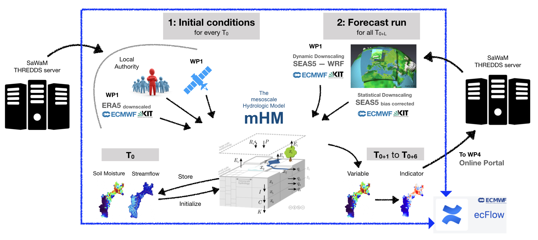
The meso-scale Hydrological Model (mHM) is applied on the project regions to quantify the water balance and availability in the river basins. This includes establishing the model and validating the simulation results via comparison of simulated state variables such as routed streamflow, soil moisture, anomalies of total water column, water levels at the lakes/ reservoirs with the help of ground observations and satellite RS (satellite altimetry input from WP1). Then the seasonal forecasting model chain is setup based on the ecFlow framework, wherein the seasonal meteorological forecasts are forced into mHM (input from WP1), batch mHM runs are made, quality of prediction quantified and the output ensemble hydrological forecast for various lead time (1 to 6 months) are obtained. The end product from this model chain for water balance modeling and seasonal forecasting is transferred into indicators. The selection of water management indicators is met in several research areas together with end users (workshop network). All results of the seasonal model chains are provided for visualization in almost real-time in the netCDF file format (input for WP4).
Semi-arid hydrology with mHM
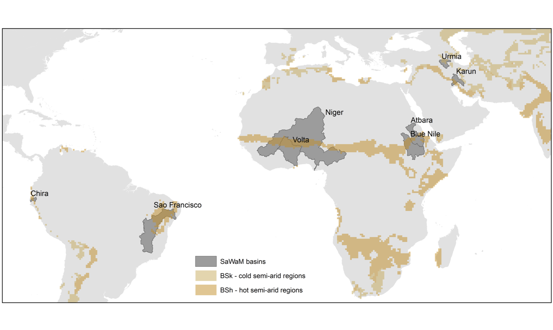
mHM is applied to simulate hydrology of semi-arid regions of the SaWaM project. This encompasses eight basins in five focus regions (Brazil, Ecuador, Iran, Sudan, West Africa) across three continents.
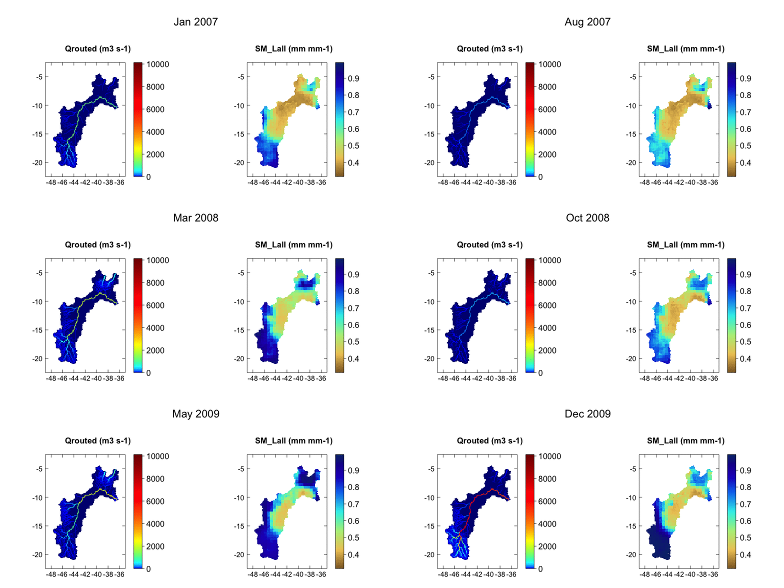
Domain size: 740,848 sq.kms., Computational size: 6583 cells.
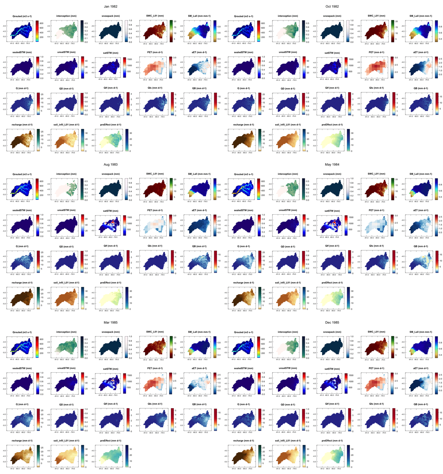
Qrouted - routed streamflow; SM_Lall - soil moisture averaged over all layers
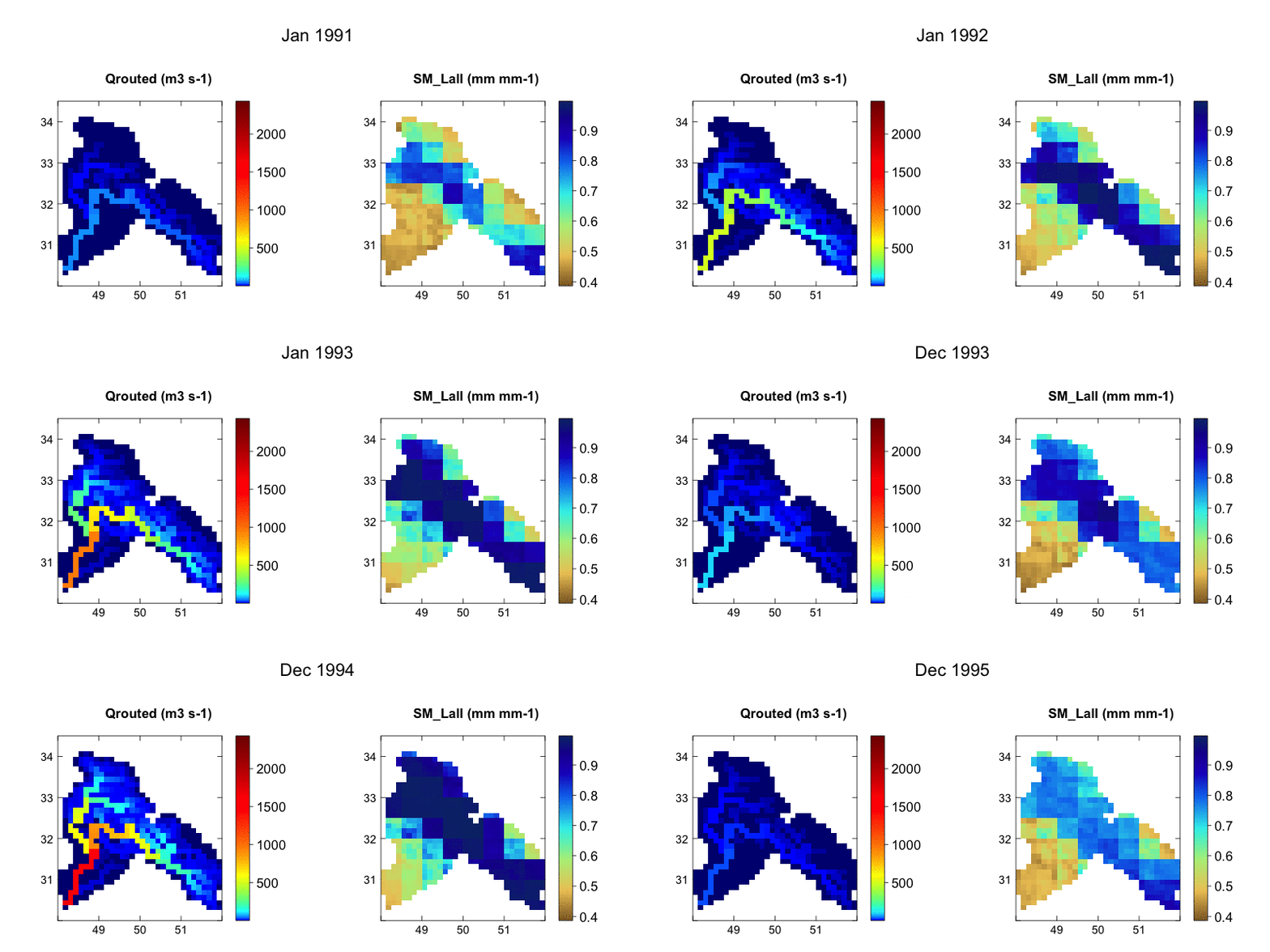
Domain size: 72,585 sq.kms., Computational size: 542 cells.
Qrouted - routed streamflow; SM_Lall - soil moisture averaged over all layers
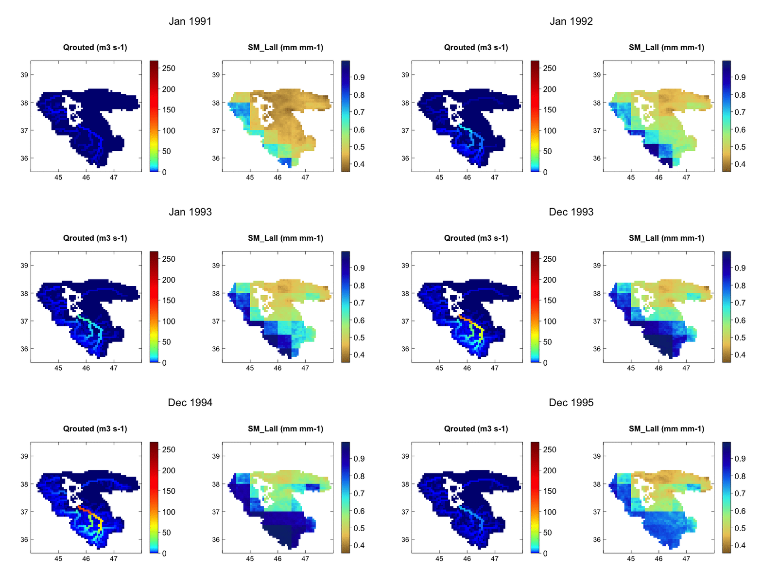
Domain size: 46,158 sq.kms., Computational size: 1404 cells.
Qrouted - routed streamflow; SM_Lall - soil moisture averaged over all layers
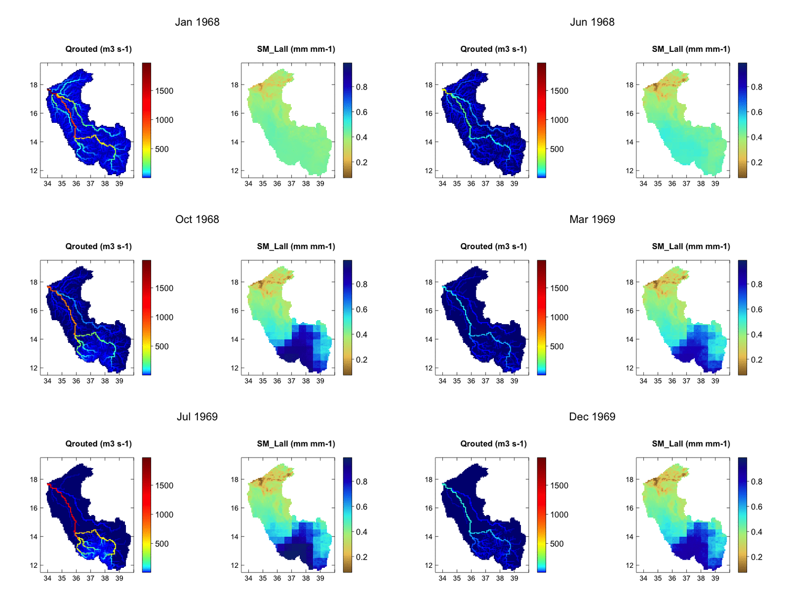
Domain size: 235,644 sq.kms., Computational size: 5330 cells.
Qrouted - routed streamflow; SM_Lall - soil moisture averaged over all layers
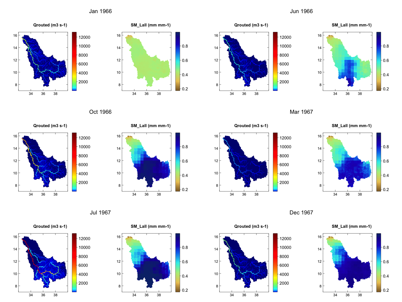
Domain size: 310,567 sq.kms., Computational size: 6907 cells.
Qrouted - routed streamflow; SM_Lall - soil moisture averaged over all layers
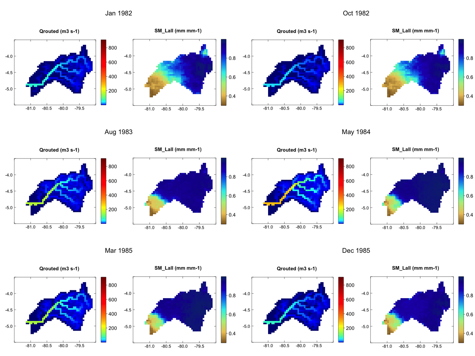
Domain size: 17,761 sq.kms., Computational size: 671 cells.
Qrouted - routed streamflow; SM_Lall - soil moisture averaged over all layers
mHM model output
mHM produces a suite of output variables. This not only enables multi-variate analysis of the results but also allows multi-variate evaluation of the model for greater reliability. Also, thanks to the multi-scale parameter regionalization (MPR) of mHM, the output is independent of model resolution. Thus, mHM gives seamless model parameter field over scales producing same outcome at all resolution.
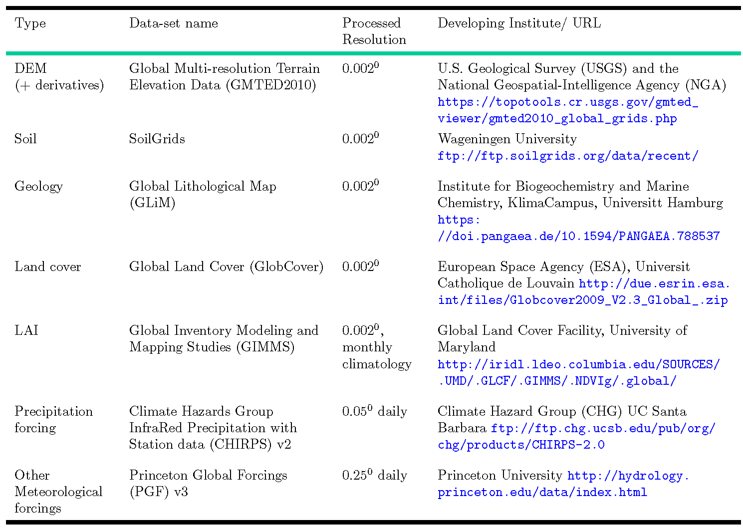
mHM Global Database at CHS
In an effort to contribute to global hydrological modeling community, we at CHS maintain a pre-processed global database for mHM. This database can be used for global setup or a specified bounding box can be set to extract the model inputs as in case with the basins of SaWaM. The database consists of all physiography and meteorology data sets needed for historical runs with mHM.
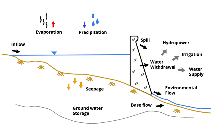
It is envisioned to develop a lake or reservoir module for mHM which is scalable with globally transferable parameters. We believe mHM with mLM would allow us to better re-animate the regulated hydrology resulting from complex water management in the semi-arid regions of SaWaM.
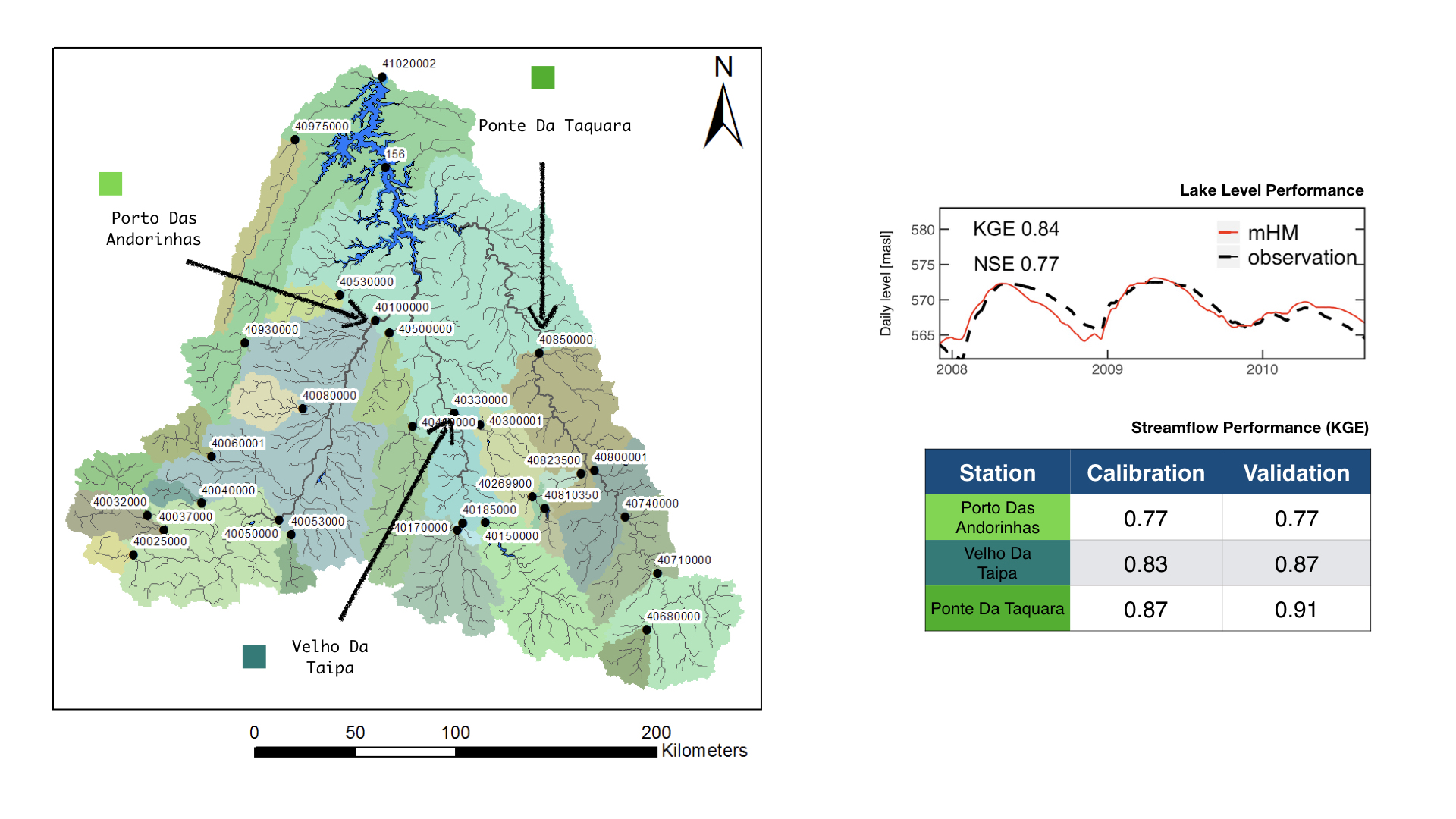
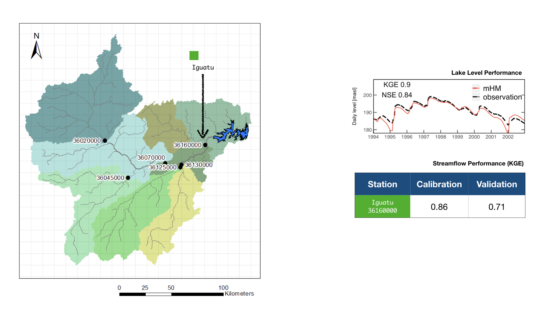
mLM in Trés Marias reservoir basin, BRAZIL
Headwater basin of São Francisco basin
mLM in Orós Reservoir basin, BRAZIL
Semi-arid basin to the North of São Francisco river basin
Initial test application of mHM for seasonal forecasting soil moisture for SaWaM was carried out for the Chira-Catamayo basin. The year 1983 was selected as it saw a major El Niño event. Dynamically downscaled SEAS5-WRF product from WP1 team is used in the pilot test. The forecast for 1, 2 and 3 months lead time from January 1983 is shown in the animation below.
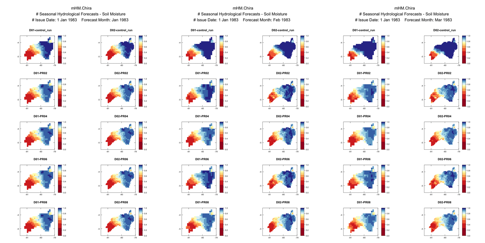
D01, D02: Two different domain covering the basin. D01 is at 0.1 degree and D02 is at 0.05 degree.
P01 - P08: Four different parameterization sets from the dynamical downscaling climate model (WRF - KIT).

