mHM in Blue Nile | Sudan-Ethiopia
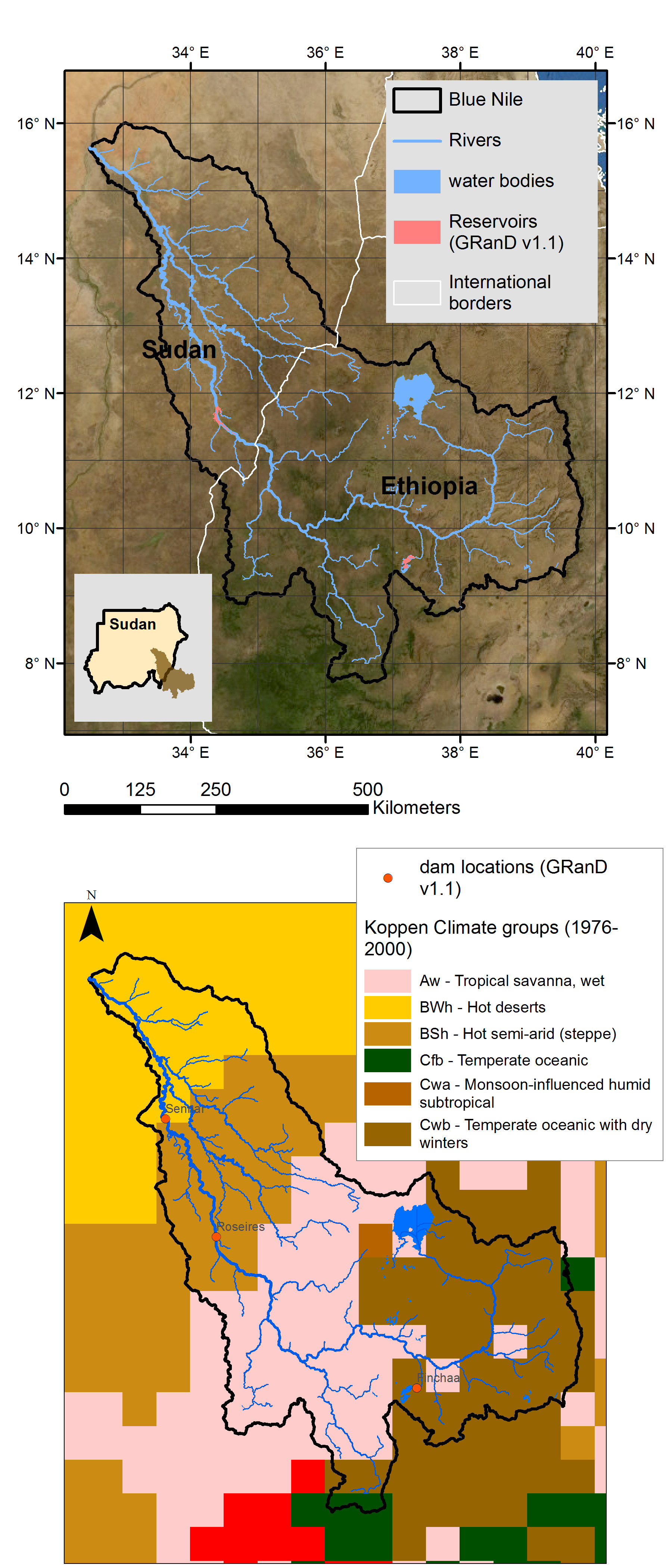
The Blue Nile river originates at Lake Tana in Ethiopia. With streamflow contribution reaching up to 80 percent during the rainy season, the Blue Nile is the second largest tributary of the Nile. The 1450 km long river drains an area of 325,000 km2 in Ethiopia and Sudan to merge with White Nile in Khartoum, the capital city of Sudan.
A key to development of Nile Countries
The water of the Blue Nile is an important resource for Sudan, where the Roseires and the Sennar Dams produce 80 percent of the country's power. These dams also help irrigate the Gezira Scheme, which is most famous for its high quality cotton. On the Ethiopian side, the construction of the Grand Ethiopian Renaissance Dam (GERD) is ongoing. GERD is a 6000-megawatt hydroelectric dam on the Blue Nile just upstream of the international border. The dam is expected to be a boost for the Ethiopian economy. Once completed, the 74 bcm (billion cubic meter) reservoir could take 5 to 15 years to fill with water depending on hydrologic conditions during the filling period.

Transboundary reservoir cascade system
In the neighboring Atbara basin, the construction of the Tekeze Dam in Ethiopia reduced flooding at Sudan's Khashm el-Girba Dam. This is because its much better to have larger impoundment of water in the deep gorges as in case of Tekeze in the northern Ethiopian Highlands. Similar effect can be achieved with the GERD. Like Atbara, the Blue Nile is also a highly seasonal river. The upstream GERD would reduce seasonal flooding of the plains surrounding the reservoirs downstream, especially the dam next door - the Roseires Dam.The effect is doubled as during the drought years, GERD would act as buffer to shortages in Sudan and Egypt. Also, as in case of any reservoir cascade system, the upstream GERD would retain silt and increase the useful lifetime of dams in Sudan (Roseires, Sennar, Merowe) and Egypt (Aswan High Dam).
However, management of such large impoundment requires close coordination and cooperation between the Nile countries, mainly Ethiopia-Sudan-Egypt. The volume of the GERD (74 bcm) is about 1.5 times the average annual flow (49 bcm) of the Blue Nile at the Sudanese-Egypt border. This loss to downstream countries could be minimized by spreading over several years, fixing suitable water elevations at downstream reservoirs during the GERD filling period and reliable hydro-meteorological seasonal forecasts.
As with any big reservoir, evaporation would be another issue with GERD. However, the extent of evaporation in highlands of Ethiopia would be comparatively lesser than from the reservoirs in the Saharan deserts downstream.
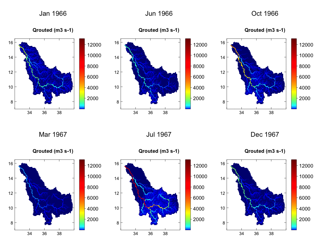
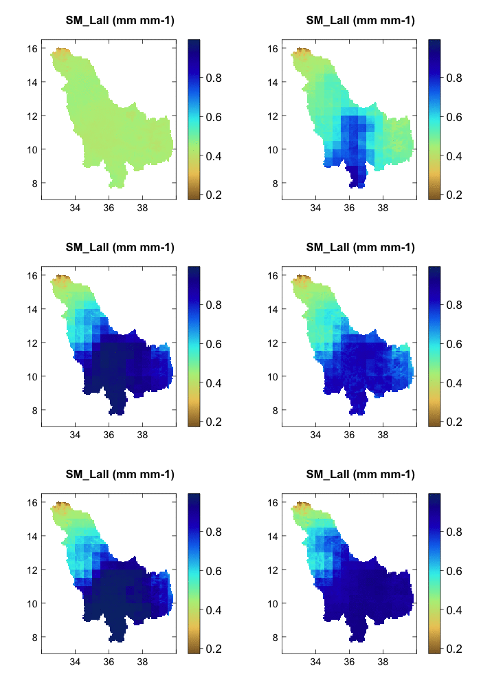
With mHM augmented with new reservoir module, we aim at providing reliable lake-hydrological simulations and thus seasonal forecasting of hydro-meteorological indices six months into the future. Such a tool would facilitate in transboundary decision making between the Nile countries and in the process foster cooperation.


