The Dep. of Computational Hydrosystems (CHS) presents:
The
mesoscale
Hydrologic Model
mHM
- Samaniego L., R. Kumar, S. Attinger (2010): Multiscale parameter regionalization of a grid-based hydrologic model at the mesoscale. Water Resour. Res., 46,W05523, doi:10.1029/2008WR007327. WRR Editors' Choice Award 2010
- Kumar, R., L. Samaniego, and S. Attinger (2013): Implications of distributed hydrologic model parameterization on water fluxes at multiple scales and locations, Water Resour. Res., 49, doi:10.1029/2012WR012195.
- Thober, S., Cuntz, M., Kelbling, M., Kumar, R., Mai, J., Samaniego, L., (2019): The multiscale routing model mRM v1.0: simple river routing at resolutions from 1 to 50 km Geosci. Model Dev. 12 (6), 2501 - 2521, doi:10.5194/gmd-12-2501-2019
Cite the code:
- mHM: Luis Samaniego et al., mesoscale Hydrologic Model. Zenodo. doi:10.5281/zenodo.1069202, https://doi.org/10.5281/zenodo.1069202
Release Notes
Information for the current release.
Code repository and list of publications
The mHM GitLab repository grants read access to the code. GitLab now allows you to report bugs or issues publicly.
Developers that contribute to the code will be incorporated into the list of authors and will appear in the DOI of the next mHM version.
Please find a list of publications in mhm/doc/mhm_papers.md.
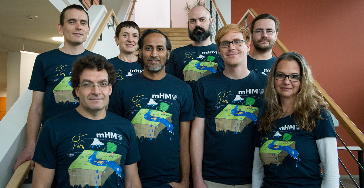
The list of collaborators behind the development of the mHM source code (Fortran), its data handling routines, pre/post-processors, git repository, the CHS Fortran/Bash/Python libraries, and the key cluster/workstation software maintenance are (listed in chronological order, starting in 2006) :
- Luis Samaniego
- Rohini Kumar
- Sabine Attinger
- Christoph Schneider
- Matthias Zink
- Stephan Thober
- Juliane Mai
- Matthias Cuntz
- John Craven
- Corinna Rebmann
- Ben Langenberg
- Thomas Schnicke
- Christian Krause
- Vladyslav Prykhodko
- Giovanni Dalmasso
- Jude Musuuza
- David Schäfer
- Robin Peters
- Oldrich Rakovec
- Diana Spieler
- Simon Stisen
- Cüneyd M. Demirel
- Miao Jing
- Falk Hesse
- Johannes Brenner
- Matthias Kelbling
- Martin Schrön
- Maren Kaluza
- Robert Schweppe
- Pallav Shrestha
- Lennart Schüler
- Sebastian Müller
- Tom Strempel
- Friedrich Boeing
- Bahareh Bahrami
- Nicola Döring
The mesoscale hydrologic model (mHM) developed by our group is a spatially explicit distributed hydrologic model that uses grid cells as a primary hydrologic unit, and accounts for the following processes: canopy interception, snow accumulation and melting, soil moisture dynamics, infiltration and surface runoff, evapotranspiration, subsurface storage and discharge generation, deep percolation and baseflow and discharge attenuation and flood routing.
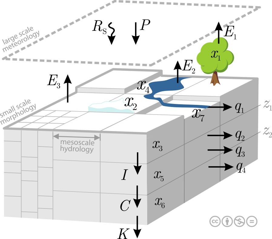
The model is driven by hourly or daily meteorological forcings (e.g., precipitation, temperature), and it utilizes observable basin physical characteristics (e.g., soil textural, vegetation, and geological properties) to infer the spatial variability of the required parameters.
The main feature of mHM is the approach to estimate parameters at the target resolution based on high resolution physiographic land surface descriptors (e.g., DEM, slope, aspect, root depth based on land cover class or plant functional types, LAI, soil texture, geological formation type) . The technique was proposed in Samaniego et al WRR 2010 and is called multiscale parameter regionalization (MPR). The MPR technique is crucial to reach flux-matching across scales and to derive seamless parameter fields (Samaniego et al HESS 2017).
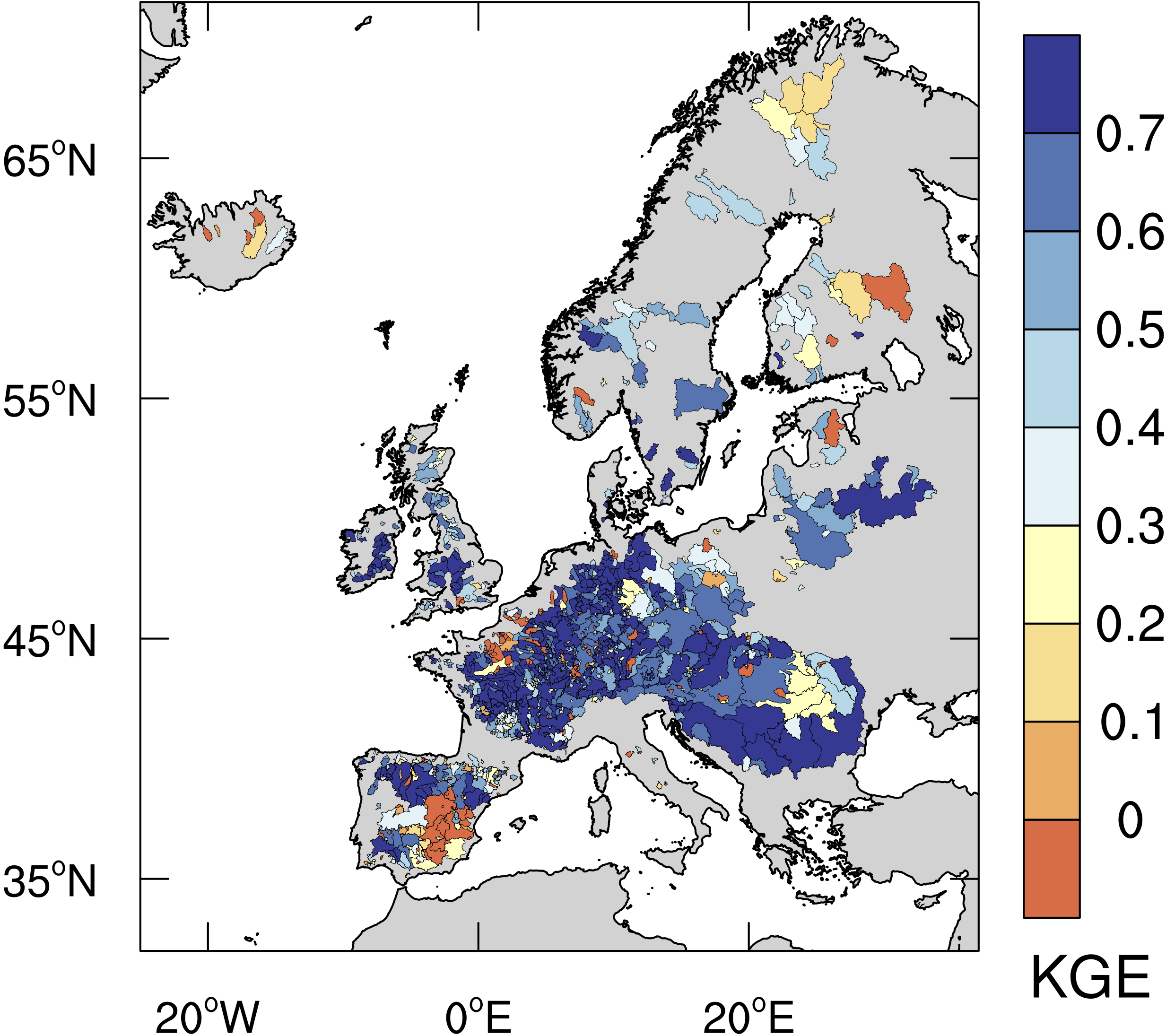
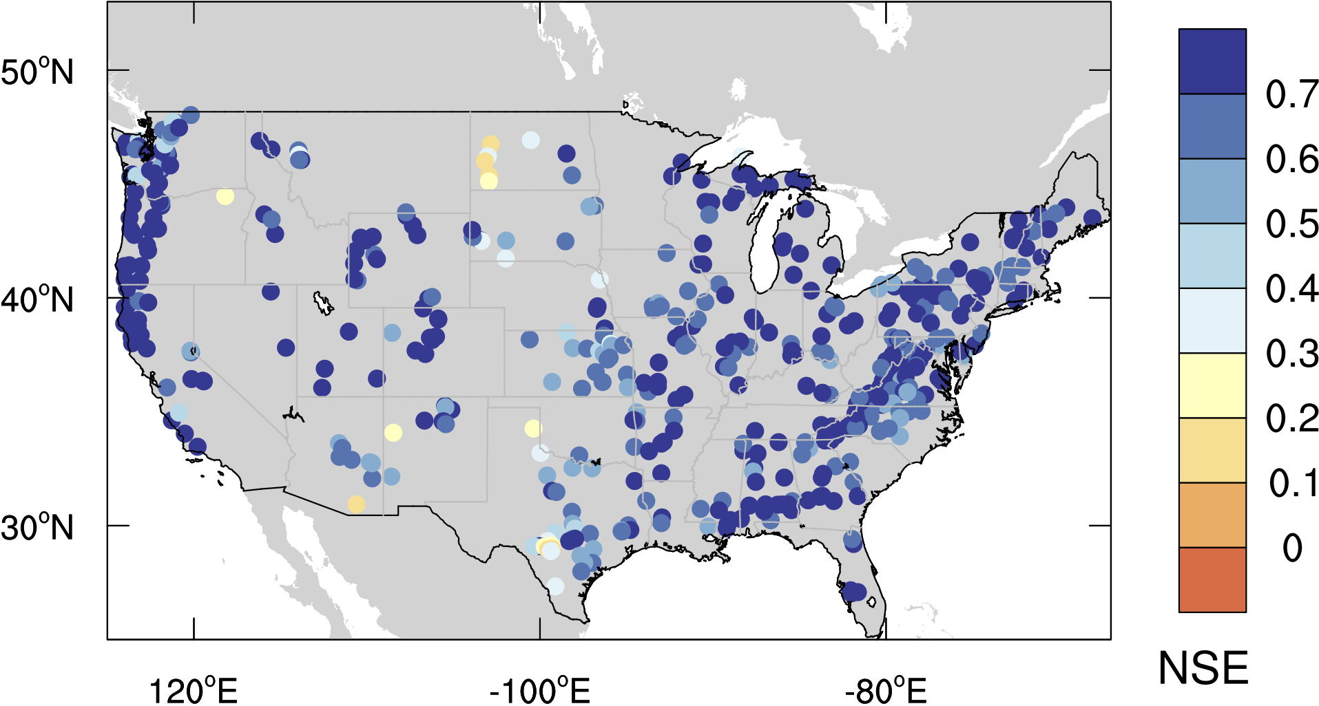
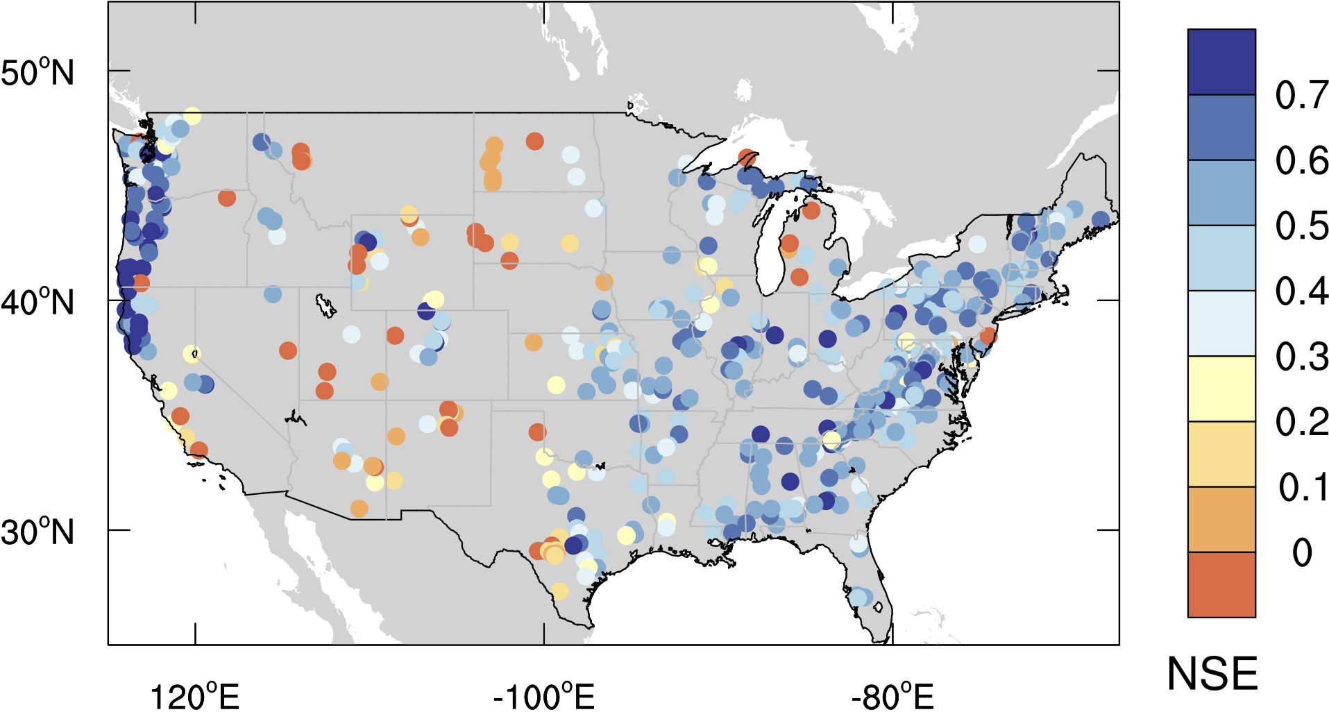
To date, the model has been successfully applied and cross-validated in more than 220 basins in Germany (Zink et al. HESS 2017), 300 Pan EU basins (Fig 2) (Samaniego et al. BAMS 2019), as well as India, and USA (Fig. 3, 4) (Rakovec et al 2019), ranging in size from 4 to 550,000 km2 at spatial resolutions (or grid size) varied between 1 km and 100 km. Shown below is the model performance for stream flow simulations over the EU basins.
Questions, Bug Report, Suggestions
If you have technical questions concerning mHM, found a bug during your operations or have any suggestions how to improve mHM, please let us know!
