mHM in São Francisco | Brazil
With a length of 2,914 kilometres São Francisco is the longest river that runs entirely in Brazilian territory, and the fourth longest in South America. Draining an area of over 630,000 square kilometres the river runs through five states of Brazil - Minas Gerais, Bahia, Pernambuco, Alagoas, Sergipe - producing an annual average streamflow of just under 3000 cubic meters per second.
Climate:
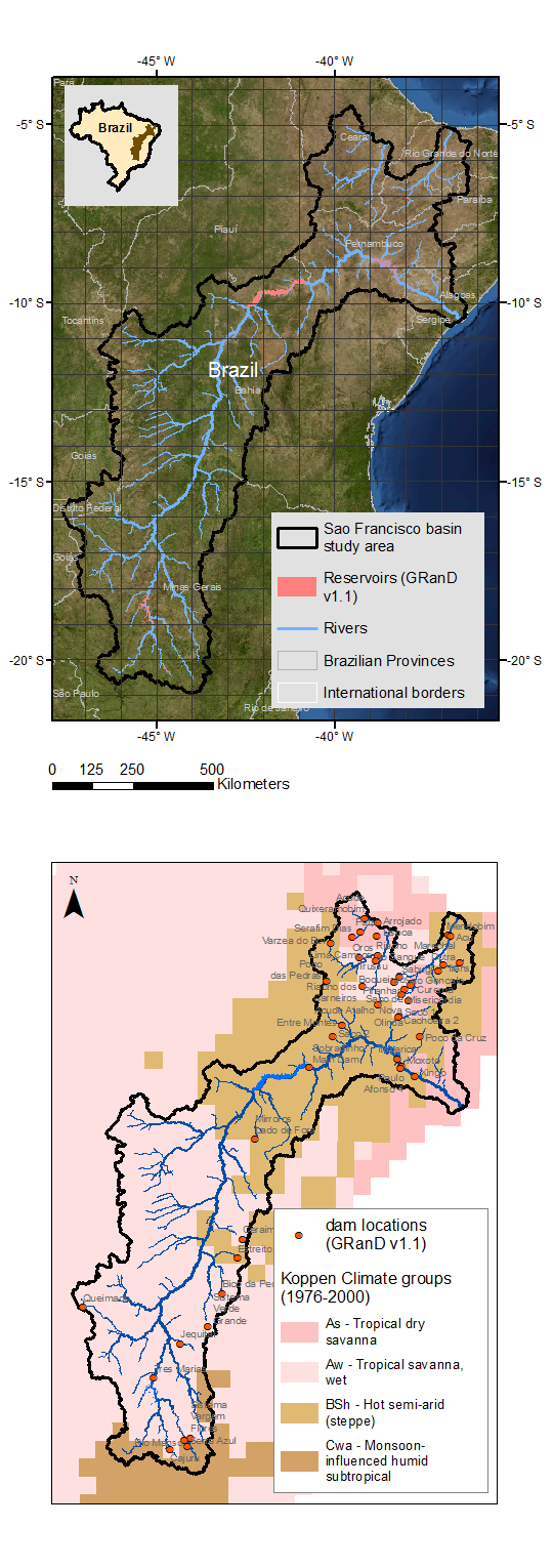
With an elongated shape, São Francisco basin runs mainly North, North-East crossing over almost 14 degrees in latitude. Understandably, this river traverses diverse climatic regions. The upstream half of the basin is tropical wet savanna which produces most of the annual streamflow. Whereas the downstream half of the basin is hot semi-arid/ steppe. Thus it unites diverse climes of the Southeast with the Northeast and is popularly as "the river of national integration" in Brazil.
Navigation alteration:
The São Francisco was regularly navigated by passenger boats. After the Sobradinho dam was built in Bahia, it formed the Sobradinho reservoir which is one of the largest artificial lakes in the world, with an area of 4,214 square kilometres. The reservoir's large size allowed for the formation of short waves which made traversing the lake difficult for the passenger boats. In addition, deforestation and excessive agricultural use of the water upstream greatly reduced the stream flow in the middle course, creating sand banks and islands that further hindered navigation.

(Top: background image source - https://visibleearth.nasa.gov/)
Hydropower busy basin:
The São Francisco consists of big hydropower generation projects. It all started with Paulo Afonso dam in 1955 which provides electric power for the whole of Northeastern Brazil. Três Marias in Minas Gerais, was built in 1961, Sobradinho in Bahia, built in 1977, Luiz Gonzaga (Itaparica), between Bahia and Pernambuco, in 1988 and the Xingó near Piranhas in 1994.
Water diversion:
In 2005, the Brazilian government proposed water diversion project to transfer water from the São Francisco river to semiarid areas of four Brazilian states further to the North - Ceará, Pernambuco, Paraíba and Rio Grande do Norte. This project is envisioned to provide the much needed water supply for the four states. The diversion project intake point is located at Cabrobó.
With the seasonal hydrological forecasts (streamflow and soil moisture) based indicators six months into future, we intend to help the water managers of São Francisco to better manage the annual streamflow volume coming to the dams. With additional mHM setup for major basins of Ceará and Rio Grande do Norte, we also aim at providing some insight into the availability of water for the diversion to these Northern semi-arid states neighboring São Francisco basin.


Domain size: 740,848 sq.kms., Computational size: 6583 cells.
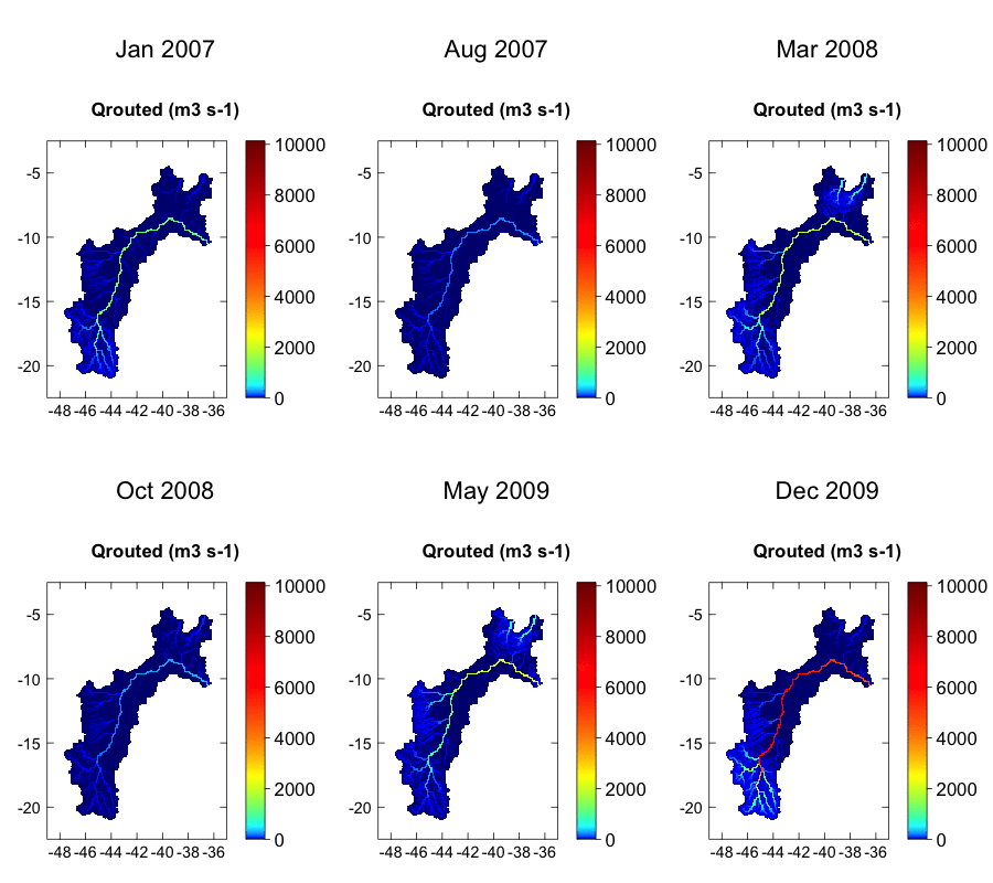
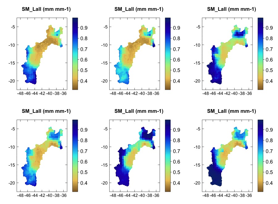
Qrouted - routed streamflow; SM_Lall - soil moisture averaged over all layers
