Head
Prof. Dr. Sabine Attinger
Department of Computational Hydrosystems
tbl-modmon@ufz.de
Deputy Head
Prof. Dr. Luis Samaniego
Department of Computational Hydrosystems
luis.samaniego@ufz.de
Assistance
Nora Pabst
Phone +49 341 6025-2367
Sindy Bleiholder
Phone +49 341 6025-1250
Susanne Gangloff
Phone +49 341 6025-2533
sekces@ufz.de
Permoserstraße 15 | 04318 Leipzig
Aug 2025
New research published in Nature Food by Batool et al. (2025) analyses the effectiveness of EU nitrogen reduction targets. Under the “Farm to Fork” (F2F) strategy of the “Green Deal”, the EU Commission aims to reduce nutrient losses by 50% by 2030 by requiring EU countries to cut chemical fertiliser use by 20%. As shown in our work such a uniform reduction in fertilizer use would not be sufficient.
May 2024
New research published in Nature Communications by Hussian et al., (2024) emphasizes the game-changing potential of near-real-time and impact-based flood prediction. Their study demonstrates a 10-meter floodplain inundation hindcast of the 2021 European Summer Flood, showcasing a 17-hour lead time for better disaster preparedness. Impact-based early warnings can empower local authorities with crucial data on citizens at-risk for targeted emergency responses.
July 30, 2023
Hitze und Dürre - Interview with climate researcher Jakob Zscheischler
in Deutschlandfunk (only in German, 10:50 min)
Link to interview
May 16, 2023
Start of ESA funded project 4DHydro
The overarching objective of 4DHydro is to foster collaborations between the Earth Observation (EO) water cycle community developing novel high-resolution EO data products, and the land surface and hydrological modelling community (LSM/HM) engaged in advancing hyperresolution modelling of the hydrological cycle at regional and continental scales. By involving several European institutions 4DHydro will assess and improve data sets of EO as well as synchronize EO products and LSM/HM models in order to improve predictions of the hydrological system. Overall, it will assist end-users and decisions-makers as well as the EU Destination Earth initiative. The project’s kick-off meeting will take place in Leipzig on 21st of June 2023.
Jan 30, 2023
The following paper received the ASCE-EWRI 2023 Award for Best Case Study in the Journal of Hydrologic Engineering.
Mai, J. , B. A. Tolson, H. Shen, É. Gaborit, V. Fortin, N. Gasset, H. Awoye, T. A. Stadnyk, L. M. Fry, E. A. Bradley, F. Seglenieks, A. G. Temgoua, D. G. Princz, S. Gharari, A. Haghnegahdar, M. E. Elshamy, S. Razavi, M. Gauch, J. Lin, X. Ni, Y. Yuan, M. McLeod, N. B. Basu, R. Kumar, O. Rakovec, L. Samaniego, S. Attinger, N. K. Shrestha, P. Daggupati, T. Roy, S. Wi, T. Hunter, J. R. Craig, and A. Pietroniro (2021):
The Great Lakes Runoff Intercomparison Project Phase 3: Lake Erie (GRIP-E)
Journal of Hydrologic Engineering, 26(9), 05021020. Accepted Feb 16, 2021.
https://ascelibrary.org/doi/10.1061/%28ASCE%29HE.1943-5584.0002097
Dec 1, 2022
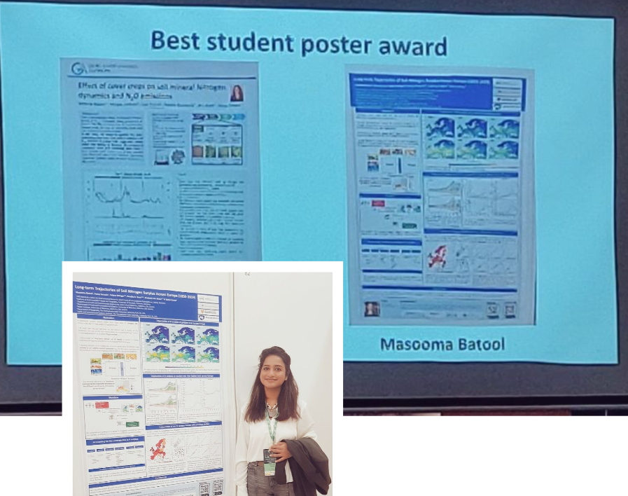
Masooma Batool won the "Best student poster award" at the XXI International Nitrogen Workshop.
This conference, hosted by ETSIAAB, Universidad Politécnica de Madrid, brought together nearly 300 papers from authors from 40 countries in Madrid, Spain, October 24-28, 2022.
At the conference, Masooma and her colleagues presented long-term trends in soil nitrogen (N) surplus across Europe (1850-2019). Excess N provides information on the trends and spatial distribution of N surplus in soil systems across Europe, highlighting agricultural areas in Central Europe as nitrogen hotspots. These areas have undergone dramatic changes over the past 150 years. Importantly, we show that estimates of N surplus are subject to large uncertainties, requiring explicit consideration of these uncertainties when analyzing past trends in N surplus.
Nov 15, 2022
Earthrise - Mission Klima
How our research contributes to climate mitigation and adaptation is demonstrated in this WELT report.
Video at www.welt.de (only in German)
05:50': Hohes Holz research station
10:40': FORMIND in the Vislab
15:45': Fragmentation of forests
43:00': FORMIND and climate scenarios
Oct 12, 2022
Dr. Husain Najafi won the UFZ Young Scientist Award for Applied Research 2022. The award goes to him for his excellence and dedication in development of the operational drought forecasting system in Germany and investigation of 2021 summer flood predictability. Hydrological forecasting systems are the fundamental component of early warning systems - disaster risk reduction.
Older news are stored in the news archive.
Sep 2, 2022
The collaborative project "Standardisiertes Monitoring von Wachstumsreaktionen wichtiger Waldbaumarten auf klimatische Extremereignisse" (MW³) with participation of the UFZ will develop a standardized monitoring system and protocol to record growth responses of important Central European forest tree species with a focus on climatic extremes. Future extreme events and their impact on forest carbon fluxes in Germany will be analyzed using smart models.
