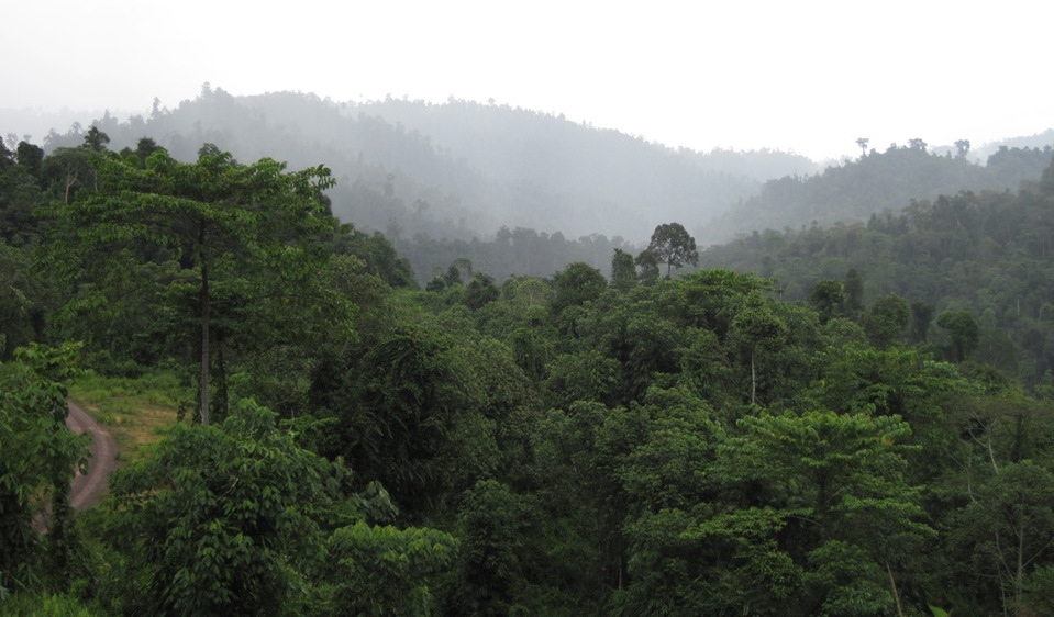
Forest Dynamics

Forests cover roughly 30% of the earth’s land surface, but land-use and climatic change are modifying and threatening these ecosystems. To protect forests a better understanding of forest dynamics is crucial.
Therefore, we have developed a family of process-based forest models: FORMIND and FORMIX. The models are used to simulate the spatio-temporal dynamics of mixed-species forests in combination with disturbances (e.g. logging, drought, storms). Both models calculate tree growth, tree mortality, the carbon balance of individual trees, competition for light, water and space, and recruitment processes by explicit seed dispersal.

In an ERC project we are analysing the coexistence of tree species in global forests. Therefore we are working in close cooperation with the
forest megaplot network FORESTGEO (from the Smithsonian Institute). Together with TU Munic and DLR Oberpfaffenhofen we have also an
own forest megaplot (Traunstein, 25 ha).
In an large AI project we use satellite data to estimate carbon fluxes and pools of global forests
(3D-ABC Hemholtz Foundation Model Initiative).
A recently developed forest packing model FPM follows a novel static approach focussing on the structure of forests. Thereby, tree crowns are randomly packed within a forest only competing for space. The simple model has so far been applied to forests in Panama and Sri Lanka. The forest packing model predicts the tree size distribution of forests as well as the spatial heterogenity of local forest structure.

If you are interested in using FORMIND, FORMIX or GRASSMIND, please contact us or visit www.formind.org for download requests.
Selected Publications
- Bauer, L., Huth, A., Bogdanowski, A., Müller, M., Fischer, R. (2024):
Edge effects in Amazon forests: Integrating remote sensing and modelling to assess changes in biomass and productivity
Remote Sens. 16 (3), art. 501 10.3390/rs16030501 - Fischer, S.M., Wang, X., Huth, A. (2024):
Distinguishing mature and immature trees allows estimating forest carbon uptake from stand structure
Biogeosciences 21 (14), 3305 - 3319 10.5194/bg-21-3305-2024 - Henniger, H., Bohn, F.J., Schmidt, K., Huth, A. (2023):
A new approach combining a multilayer radiative transfer model with an individual based forest model: Application to boreal forests in Finland
Remote Sens. 15 (12), art. 3078 10.3390/rs15123078 - Henniger, H., Huth, A., Frank, K., Bohn, F.J. (2023):
Creating virtual forests around the globe and analysing their state space
Ecol. Model. 483 , art. 110404 10.1016/j.ecolmodel.2023.110404 - Wiegand, T., Wang, X., Anderson-Teixeira, K.-J., Bourg, N.A., Cao, M., Ci, X., Davies, S.J., Hao, Z., Howe, R.W., Kress, W.J., Lian, J., Li, J., Lin, L., Lin, Y., Ma, K., McShea, W., Mi, X., Su, S.-H., Sun, I.-F., Wolf, A., Ye, W., Huth, A. (2021):
Consequences of spatial patterns for coexistence in species-rich plant communities
Nat. Ecol. Evol. 5 (7), 965 - 973 10.1038/s41559-021-01440-0 - Rödig, E., Knapp, N., Fischer, R., Bohn, F.J., Dubayah, R., Tang, H., Huth, A. (2019):
From small-scale forest structure to Amazon-wide carbon estimates
Nat. Commun. 10 , art. 5088 10.1038/s41467-019-13063-y - Rödig, E., Cuntz, M., Rammig, A., Fischer, R., Taubert, F., Huth, A. (2018):
The importance of forest structure for carbon fluxes of the Amazon rainforest
Environ. Res. Lett. 13 (5), art. 054013 10.1088/1748-9326/aabc61 - Shugart, H.H., Wang, B., Fischer, R., Ma, J., Fang, J., Yan, X., Huth, A., Armstrong, A.H. (2018):
Gap models and their individual-based relatives in the assessment of the consequences of global change
Environ. Res. Lett. 13 (3), art. 033001 10.1088/1748-9326/aaaacc
Contact
Links
- FORMIND – the forest model
- FORMIND is integrated in LandTrans "Simulator: Modular system of SMART terrestrial models"
- FORMIND is part of the LISA PhD College (coupled bidirectional to the soil model BODIUM)
- ERC Advanced Investigator Grant: Towards a Spatial Theory for Coexistence of Species-Rich Communities
- 3D-ABC: Global carbon budget for vegetation and soils
- Forest plot network FORESTGEO
