Heat Stress
Planetary Health Model for the Reduction
of Heat Stress on the Neighbourhood Level
Project staff
Department of Urban and Environmental Sociology
Prof. Dr. Sigrun Kabisch (Head)
Prof. Dr. Uwe Schlink (Head)
M. Sc. Daniel Hertel
M. A. Janine Pößneck
Project partners
Duration
1.1.2022 - 31.5.2023
Brief Description
Project Aims
Increasing weather extremes are affecting mankind to an ever greater extent. Especially in cities, the effects of climate change, land use changes and demographic change overlap like under a "burning glass" and influence human health. Due to the diverse urban built-up structures and socio-spatial characteristics, individual health risks are heterogeneously distributed. Their precise analysis requires a local approach. Therefore, in this project, heat stress is investigated at the neighbourhood level. It focuses on the interactions and interdependencies between human health and natural systems. This new approach, referred to as "Planetary Health", is highly interdisciplinary oriented. In our project, we combine micrometeorological modeling with social science analysis.
Our project picks up at this point and aims to pursue the following questions:
(1) Which adaptation scenarios towards heat stress in the neighborhood can be derived from the combination of micrometeorological simulations and social science survey results? In this context, it is also necessary to clarify which characteristics of heat stress can be identified at different urban scales, since such detailed analyses are generally lacking at the meter scale, and especially at the neighbourhood level.
(2) For heat stress, a Planetary Health Model will be developed to identify key factors, which on the one hand allow to give practical recommendations to reduce the individual exposure of the population and on the other hand ensure an easy transferability to other cities. Different groups of residents will be considered in order to be able to propose differentiated behavioral adaptations accordingly.
Main Tasks
Starting from the city perspective, the causes and effects of heat stress will be identified for different types of neighbourhoods in Leipzig. For this purpose, 2 contrasting neighbourhoods will be considered: 1. the large housing estate ‘Leipzig – Grünau’ on the western outskirts of the city and 2. an intra-urban neighbourhood. An internal differentiation is made according to different socio-demographic groups and their perception of heat stress. Various adaptation measures are simulated and evaluated with a "state-of-the-art" urban climate model.
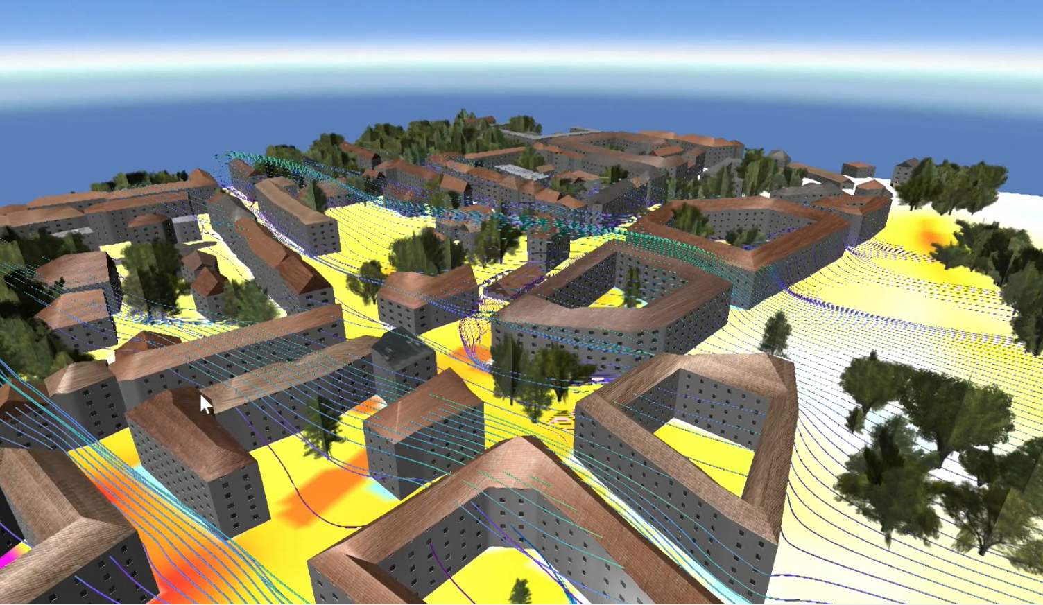
The findings will be demonstrated to municipal stakeholders and representatives of SMEs in the UFZ's visualization center (VisLab). Figure 1 shows an example of a 3D visualization for a test simulation. This method allows to test different scenarios and their fit and thus to derive practice-relevant conclusions for the further improvement of a climate-adapted neighbourhood development.

Main Results
A toolbox was developed and implemented in the form of the WebApp “MethBox heat”. The current version was created for 12.08.2022, during a pronounced heat episode, using the example of Leipzig-Grünau-Nord. It enables users to perform a high-resolution (2 x 2 m) analysis of the thermal situation in this district of Leipzig. By combining different methodological approaches (social and natural sciences), more effective and targeted adaptation measures against heat stress can be supported. For this reason, the “MethBox heat” also enables the analysis of the thermal effects of different design scenarios of an open space in the Titaniaweg area.
Details of the methodology used in the Heat Attribution tab can be found under https://doi.org/10.1016/j.envsoft.2018.11.015 and https://doi.org/10.1016/j.mex.2018.12.015. The used urban climate model PALM-4U is described in more detail under https://palm.muk.uni-hannover.de/trac/wiki/palm4u. General information on data preparation is presented under https://www.ufz.de/index.php?de=20939&pub_id=23775, p.128-131. The model setup used and background information for the creation of the scenarios can be found under https://doi.org/10.2312/envirvis.20231105. Background information on the project from which the tool emerged is presented in a book article (https://doi.org/10.1007/978-3-662-66916-7_16) and a journal article (Kabisch, S., Schlink, U., Hertel, D., Pößneck, J. (2023): Local heat stress in the neighbourhood begegnen. 3D urban climate simulations for the design of shady and inviting green spaces. In: Transforming Cities, 3-2023, pp. 56-60 (https://www.transforming-cities.de/ausgabe-3-2023-oekosystem-stadt).

