DFG project
Defining archetypal transit time distributions and their dynamics in real-world catchments
The prediction of solute export from entire catchments is complicated. Recently this topic has gained attention due to the worsening problem of nitrate pollution throughout Germany. In many places nitrate concentrations in groundwater and streamflow remain high or even increase although the input has already been decreasing for a while. This can be attributed to the fact that a certain fraction of water and pollutants can take flow paths with extremely long transit times on their way through the soil and bedrock layers and out of the catchment system which creates the so-called legacy effect. Due to this effect the hydrochemical response of a catchment can be significantly delayed which is both good and bad. It is good since it dampens and dilutes pollution events and it is bad since it leads to the long-term retention and continuing seep-out of pollutants long after the pollution input has ceased.
Our aim is to determine which physical catchment and climate characteristics control whether a certain catchment has a stronger legacy effect and is therefore prone to retain larger amounts of pollutants for a longer period of time. There are many potentially important characteristics we are going to examine in terms of how much influence they exert on catchment transit times, e.g. soil and bedrock hydraulic conductivity, soil depth, soil moisture state, annual amount of precipitation, vegetation cover.
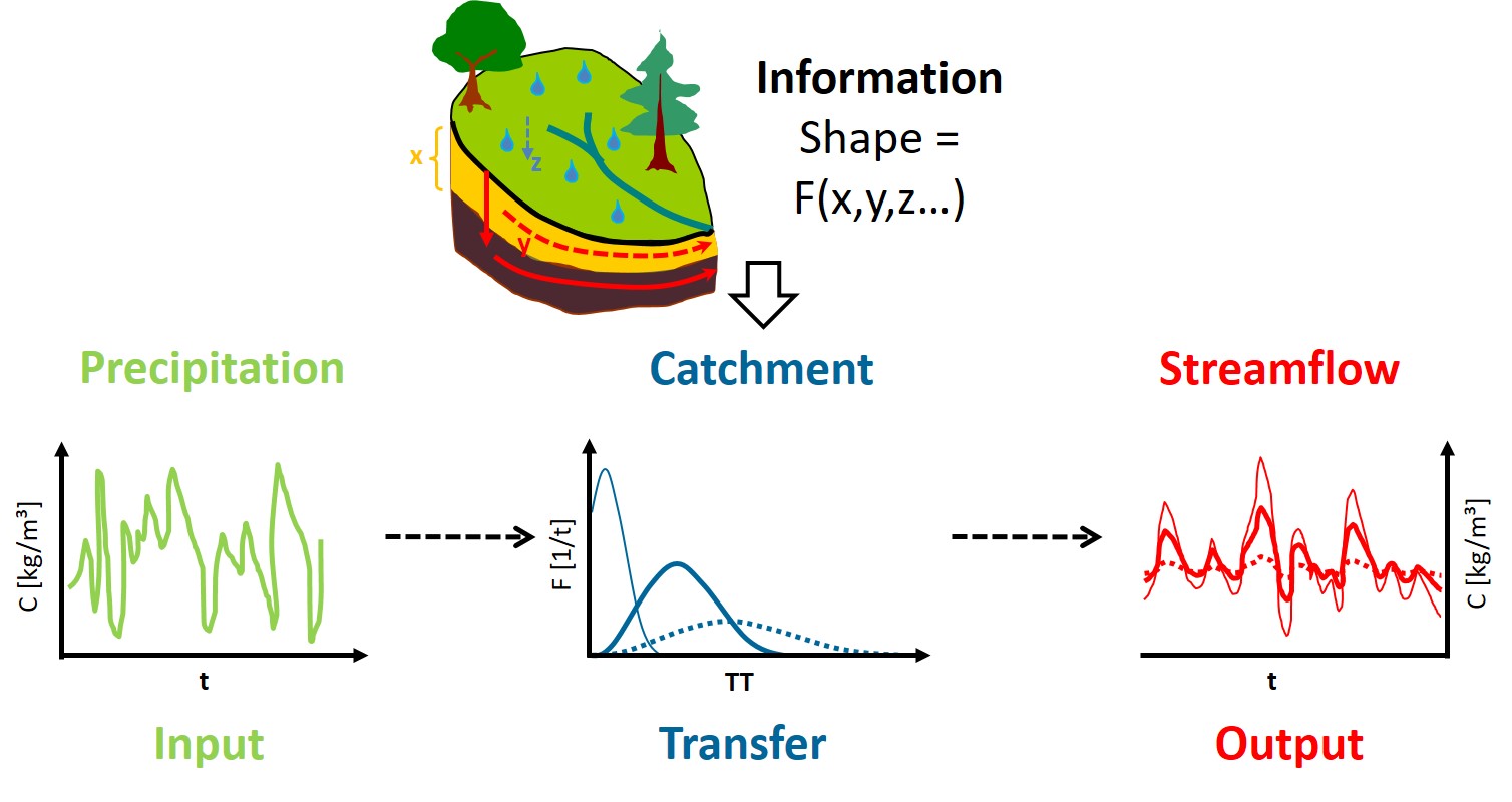
Substances that are naturally or anthropogenically introduced into the hydrologic cycle are hard to trace along their way through soil, vegetation and bedrock. Only at the catchment outlet they become more easily measureable again – as an integrated signal. One common approach to predict the export of solutes is to set up physically-based, distributed hydrologic models for specific catchments, to calibrate them with recorded time series of precipitation and discharge and thus to simulate in detail every aspect of solute transport in the catchments.
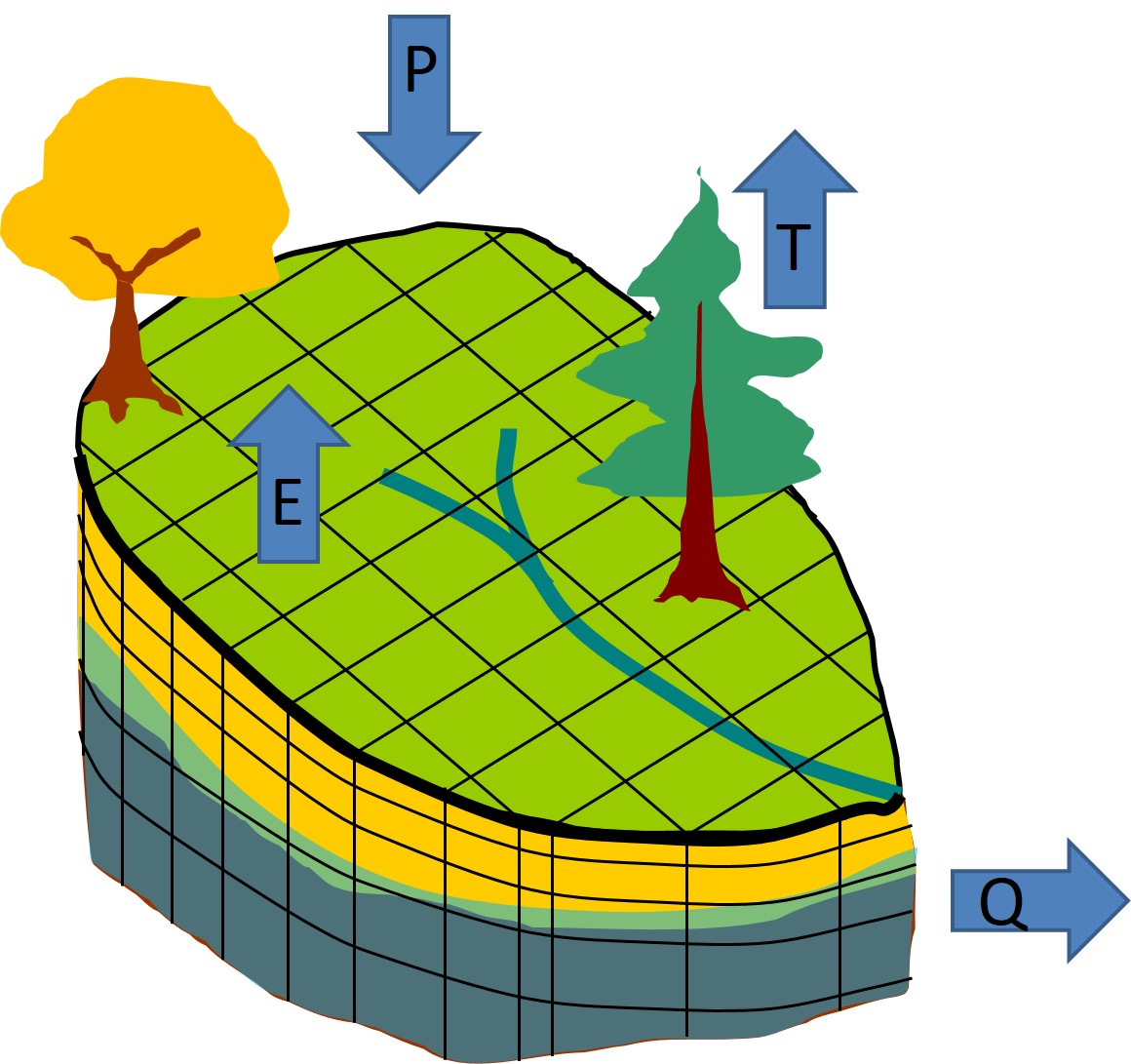
However, the setup of such models is relatively laborious and the application often computationally expensive. Also, the results are usually not directly transferable to other catchments. The goal of this project is to facilitate a simpler approach for the prediction of solute export by using physically-based models to integrate more realism into conceptual models at the catchment scale. Conceptual models do not simulate the actual physical flow processes in a catchment, instead they use, e.g., transfer functions that convert an input signal of precipitation or solutes into an output signal in the stream at the catchment outlet. These transfer functions are basically signal filters that dampen and delay the input taking into account and integrating all storage and flow processes in the catchment.

We will link the shape of transfer functions (which are used in many conceptual models to convert solute input into solute output) with physically measureable catchment and climate properties.
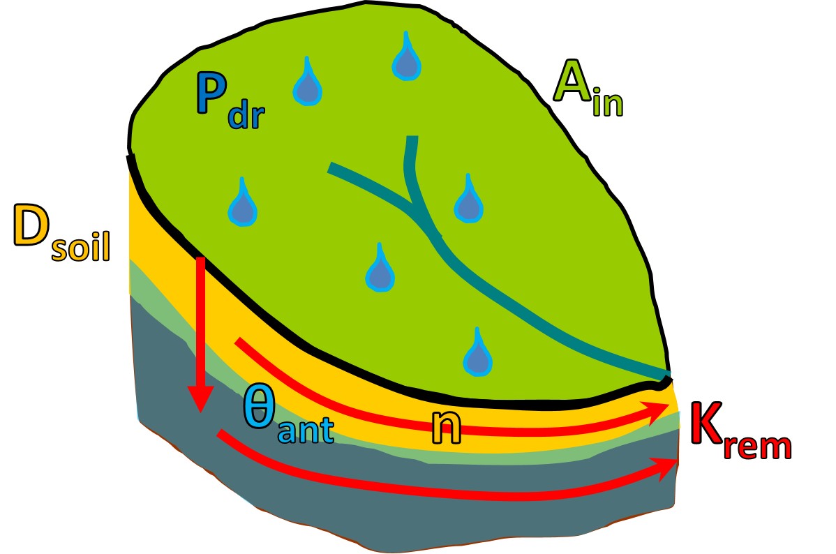
These transfer functions are forward transit time distributions that contain detailed information on how long waters and substances entering with a particular precipitation event stay inside of a catchment before they discharge. The shape of transit time distributions changes depending on which flow paths are preferentially activated during and after a precipitation event. The shape also varies spatially with specific catchment characteristics like, for example, soil depth or hydraulic conductivity.
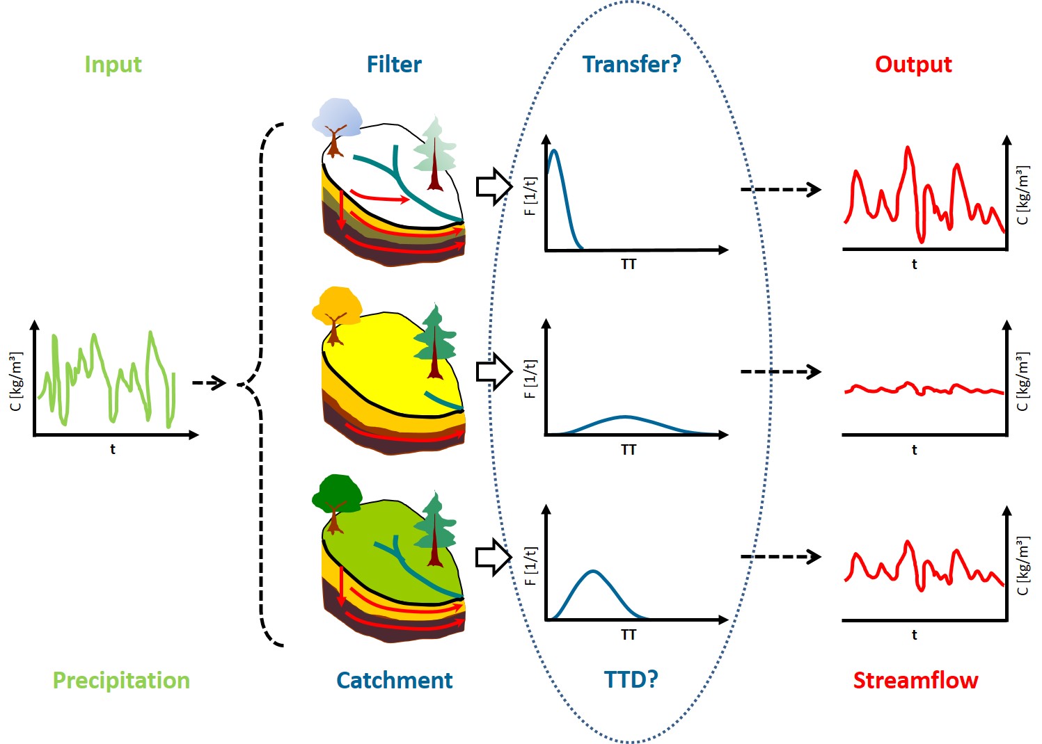
In a virtual experiment in a study that forms the basis of this project a physically-based, distributed model (HydroGeoSphere) was used to examine how the shape of transit time distributions changes spatially between catchments with different properties and how it changes temporally within one catchment with changing antecedent moisture content. To this end the catchment and climate properties as well as the catchment state were combined into a dimensionless number - the flow path number F.
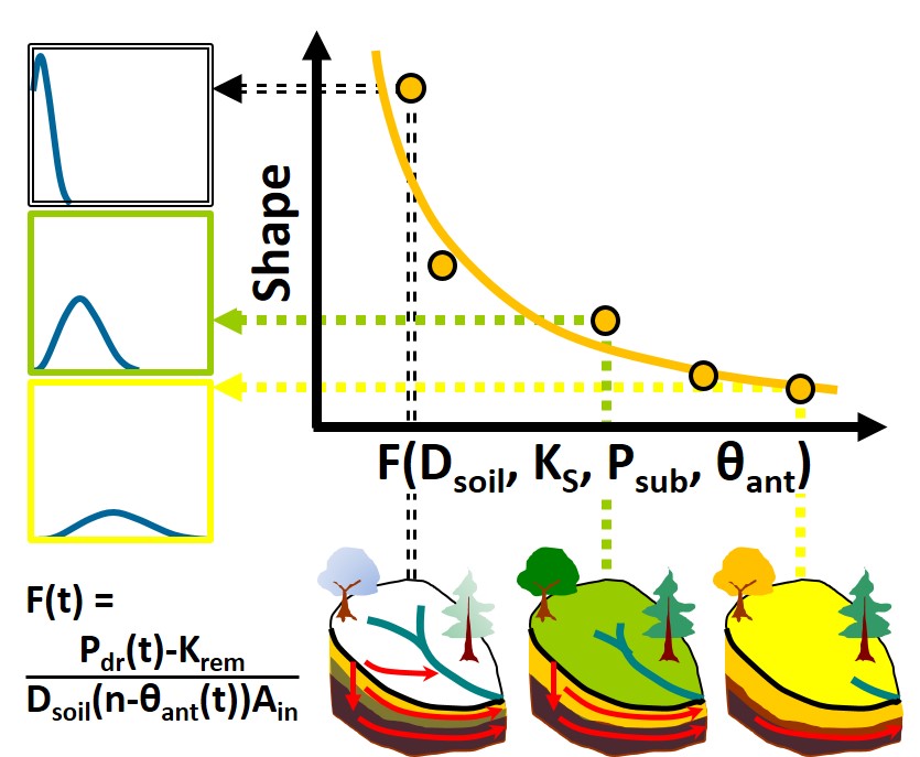
Now we aim for the verification of the results of the virtual modeling study with the help of empirical field data in real-world catchments. To this end we are using discharge and nitrate time series of the freely accessible data base Germany, select, set up and calibrate six uniquely representative (archetypal) catchments in HydroGeoSphere and compare the resulting transit time distributions with the ones that were produced with the virtual catchments.
