
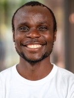
Ronald Reagan Okoth
PhD student
Department of Remote Sensing (RS)
Helmholtz Centre for Environmental Research (UFZ)
Permoserstraße 15, 04318 Leipzig
Tel.: +49 341 6025 3699
email: reagan.okoth@ufz.de
Career details
| Aug 2026 - Present | PhD Candidate, HotSOILs: Geospatial Analysis of Physical Drivers and Vegetation Impacts of Soil Hot Extremes, UFZ |
| Oct 2025 - Aug 2026 | Geospatial Analyst, Automated Environmental Mapping and Multi-Source Raster Data Integration, unique land use GmbH |
| May 2023 - Sep 2025 | Manager of Earth Observation, Spatial Feasibility Assessment and Regulatory Eligibility Verification for Carbon Projects, FORLIANCE |
| Oct 2022 - Apr 2023 | M.Sc. Thesis Student, STARFM-Based Data Fusion of MODIS-Landsat and Machine Learning-Based Continuous Mapping of Soil Temperature from In-Situ Points, UFZ |
| May 2022 - Sep 2022 | Student Assistant, Automated Acquisition and Pre-Processing of Spatial Datasets for Environmental Simulations, UFZ |
| Jan 2022 - Mar 2022 | Data Analyst Intern, Automated Geospatial Data Extraction and PDF Parsing for Locust Treatment Archives, DLR (German Aerospace Center) |
| Feb 2021 - Sep 2021 | Research Assistant, Spatiotemporal Image Classification and Arctic Ecosystem Phenology Analysis, Alfred Wegener Institute (AWI) |
| Aug 2020 - Nov 2020 | Intern, Spatiotemporal Image Classification and Arctic Ecosystem Phenology Analysis, Alfred Wegener Institute (AWI) |
| Jul 2019 - Oct 2019 | Internship Trainee, Computer Vision Data Annotation and Aerial Remote Sensing for Precision Agriculture, VITO |
Education
| Oct 2020 - May 2023 |
Master of Science in Applied Earth Observation and Geoanalysis of the Living Environment (EAGLES),Julius-Maximilians-Universität Würzburg Final grade: 1.3 (High distinction) Thesis: Fusing Remote Sensing Data: Application in Soil Temperature Prediction |
| Sep 2018 - Jun 2020 |
Master of Science in Marine and Lacustrine Science and Management,Vrije Universität Brussels, Ghent University, and University of Antwerpen Final grade: 16/20 (Distinction) Thesis: Earth Observation-Based Land Cover Analysis and Machine Learning Assessment of Coastal Dune Geomorphology and Vegetation Dynamics |
| Aug 2012 - Jun 2016 | Bachelor of Science in Coastal and Marine Resource Management, Kenyatta University, Nairobi Kenya |
Research interests
- Soil & Land Surface Temperature: Tracking when, where, and why soils reach extreme heat.Satellite Data
- Fusion: Combining different satellite datasets to get high-resolution imagery.
- Ecosystem & Vegetation Health: Measuring how extreme soil heat damages forests and grasslands.
- Mapping &Scaling Data: Using machine learning to turn local, ground-station measurements into continuous maps.
- Geospatial Data Workflows: Automating the collection, pre-processing, and visualization of large environmental datasets.
My PhD research focuses on understanding extreme soil temperatures across Europe and their impacts on ecosystems. As part of the HotSOILs project at the UFZ, I combine satellite observations, in-situ measurements, climate data and geospatial analysis to investigate how factors such as soil moisture, land cover, radiation and climate warming contribute to soil hot extremes. I am also examining whether and to what extent these extremes are linked to declines in vegetation health across European forests and grasslands. A key part of my work is developing and analysing high-resolution soil temperature datasets to better capture these events and their spatial and temporal variability.
Awards
- Awardee, VLIR-UOS ICP Connect Scholarship, Fully Funded Academic Award for International Postgraduate Studies in Belgium
- 1st Runner's Up, Global Impact Pitch Competition, Seed Funding for Index-Based Agricultural Insurance Frameworks for African Smallholder Farmers, Georgetown University 2021
Publications / Abstracts
- Lisovski S., Runge A., Shevtsova I., Landgraf N., Morgenstern A., Okoth R. R., and Heim B.: A New Habitat Map of the Lena Delta in Arctic Siberia Based on Field and Remote Sensing Datasets. Earth System Science Data. 2025, https://essd.copernicus.org/articles/17/1707/2025/
- Lisovski S., Runge A., Okoth R. R., Shevtsova I., and Heim B.: Lena Delta Land Cover Classification (2018, Sentinel-2) [dataset]. PANGAEA. 2024, https://doi.org/10.1594/PANGAEA.946407