Example Wagna
Hypothesis:
Adapted parameterisation of soil depth based on ground penetrating radar (GPR) handles heterogeneity of soil properties to improve model performance of soil water dynamics and influence of biomass production.
Investigation area:
The experimental field site Wagna in Austria (46°46′N, 15°33′O, 266 m a.s.l.) is characterised by highly heterogenic soil with fluvioglacial gravel sediments. With the help of 32 plots (each with 1000 m²) with typical crop rotations (maize, cereals and oil pumpkin) research on water movement and nutrient transport in the unsaturated zone under arable land with natural cultivation is conducted.
Methods:
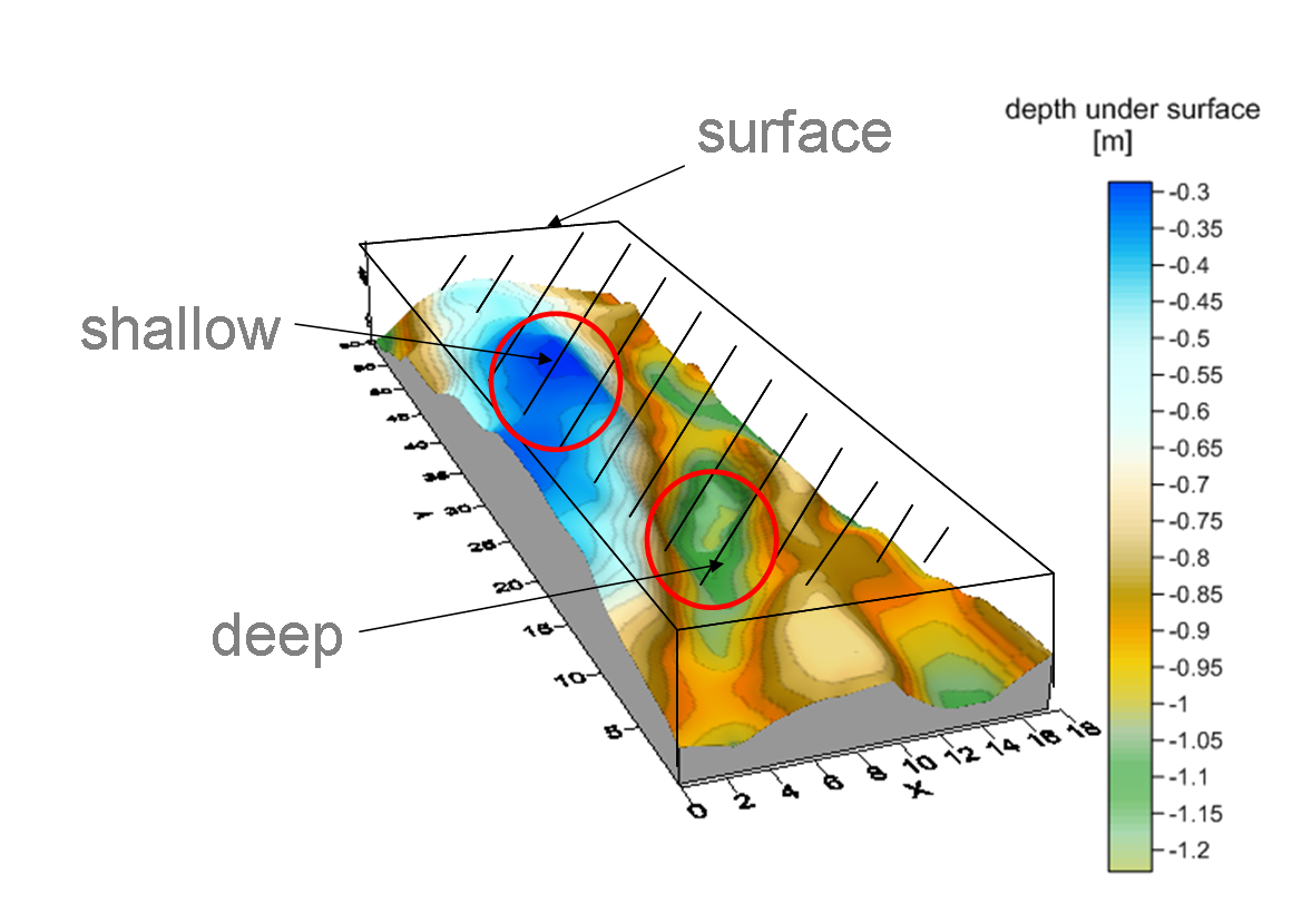
A detailed collection of ground penetrating radar (GPR) data was conducted on the field site Wagna. The analysed GPR measurements provide exact depth below surface. I.e. the boundary between top soil material and sandy subsoil with gravels is reproduced (see Fig. 1).
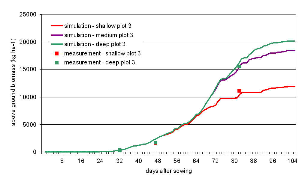
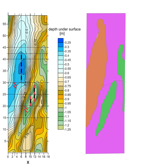
The crop yield in light soils is often depending on the precipitation during the growing period. The soils of Wagna have low water storage capacity and its value is varying with the depth of the bedrock. Those facts could result in plant water stress in dry years and consequently in reduction of their growth height and biomass. With the help of GPR maps the deepest and shallowest areas were selected in order to detect the maximum influence of soil depth to plant biomass. Repeated harvests were conducted during growing season to determine the plant biomass (red, green squares in Fig. 4). In a second appraoch already available physical soil parameters were adapted with exact depth from GPR maps (see Fig. 2) and results in soil input data with a new differentiation.
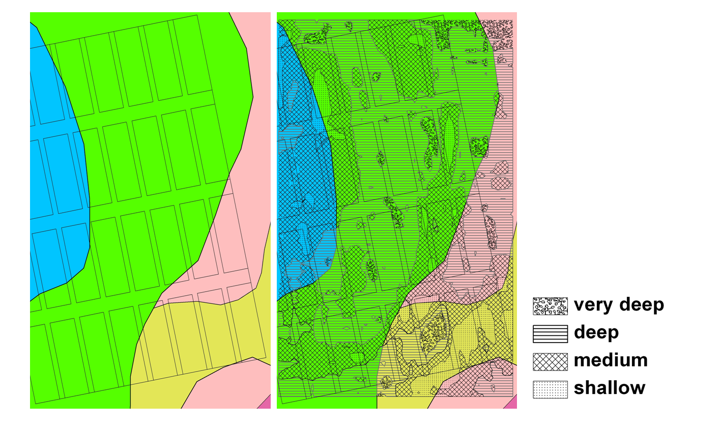
To demonstrate the principle of the adaptation a generalisation of soil depth in three depth gradations (shallow, medium and deep) was conducted (see Fig. 3 and Tab. 1).
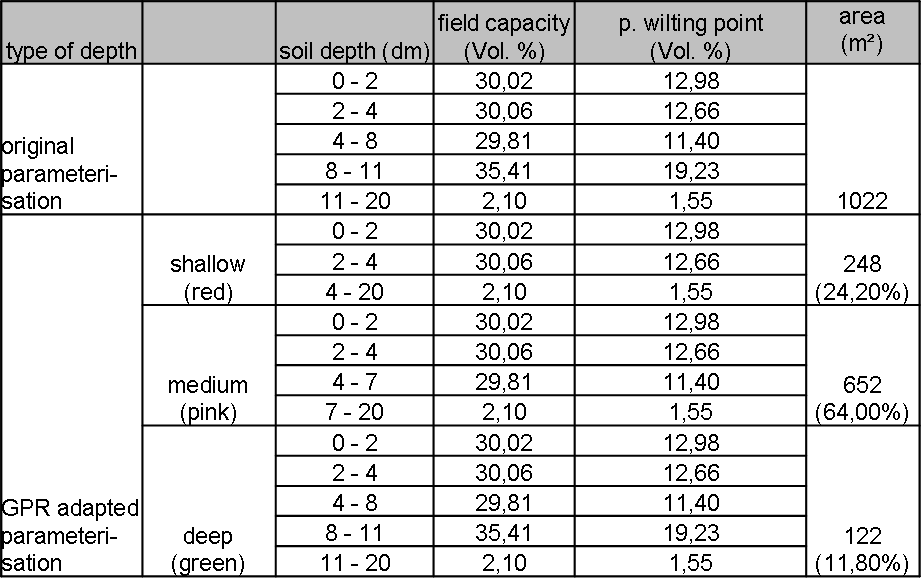
Repeated harvests were conducted during growing season to determine the plant biomass (red, green squares in Fig. 4).
Based on GPR adapted soil parameterisation CANDY extended with the new module PLUS
simulates plant biomass production based on environmental influences (Krüger et al. 2011). The biomass-results over one season indicate a good performance. Until the first and second harvest water demand is low resulting in good simulation of plant biomass in deep and shallow areas. Before 3rd harvest plant water demand increases but shallow areas have smaller storage capacities. Hence, applying the “GPR adapted” data base which accounts for shallow and deep soil differentiation results in a > 24 % better accuracy then the “original parameterisation”.
