Working group 'Water-sensitive infrastructure planning' (WaSP)

The working group ‘Water-sensitive Infrastructure Planning’ (WASP) develops spatio-economic planning methods for water-sensitive infrastructure. We work at different scales from the settlement and neighborhood level to the regional, national and international level. With the aim to develop transferrable tools and methods, the data we utilize are also cross-scale from global data sets to detailed, local data sources.
Aiming to provide climate-sensitive infrastructure planning we develop and utilize tools that provide pre-planning along decentralization and technological gradients. Along those gradients we plan water infrastructure from blue-green/ NBS to conventional or grey technologies. Spatially this includes decentral solutions close to the source or in clusters as well as centralized solutions and compare these solutions using cost estimations. The different gradients are formulated as scenarios which in turn enables optimization and scenario-based modeling.
Our planning approaches are complemented by measures to shape relevant framework conditions through strategic alliances with key institutions in a knowledge-based co-design process. In this way, we develop methods for the creation of (water) master plans for sustainable infrastructure-based water management of urban and rural systems.
Methods & approaches for water-sensitive infrastructure planning
WIthin WASP we develop and utilize different planning approaches focusing on
- Decentralization gradients – Spatio-economic planning tools
- BlueGreen infrastructure modeling & monitoring
- Stakeholder interaction and co-design
Decentralization gradients – Spatio-economic planning tools
| pySewer is a sewer generator, based on open-source, global data. | |
|
ALLOWS is a spatio-economic tool designed to identify cost-effective local wastewater management solutions at settlement scale. |
|
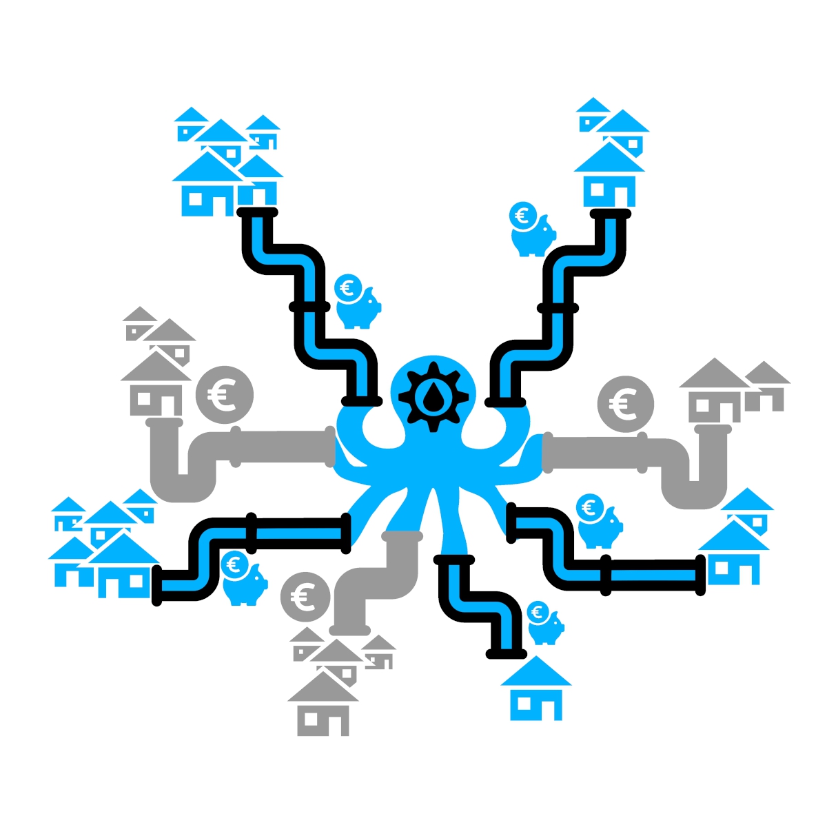
OCTOPUS identifies regional treatment plant clusters by optimising settlement networks. |

|
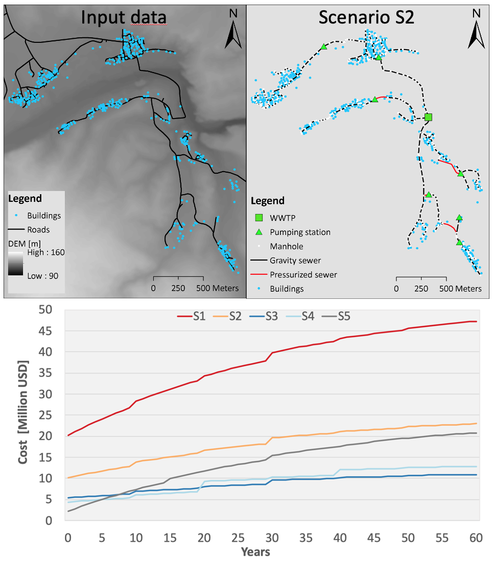
Pysewer – an open-source Python tool designed to simplify sewer layout generation. Pysewer creates gravity-prioritised layouts with minimal effort and open data while optimising hydraulic design. |
|
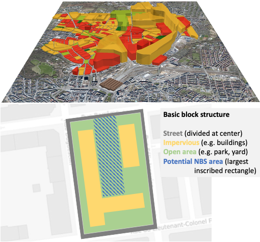
MUST-B aggregates urban data at the block scale to optimally dimension blue-green infrastructure |
|
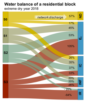
B-GRIIN builds up on the MUST-B block concept to model irrigation demand and control for blue-green infrastructure cascades |
BlueGreen infrastructure modeling & monitoring
|
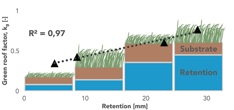
GR2L is a robust dual-layer green roof water balance to assess multifunctionality aspects under climate variability. |
|
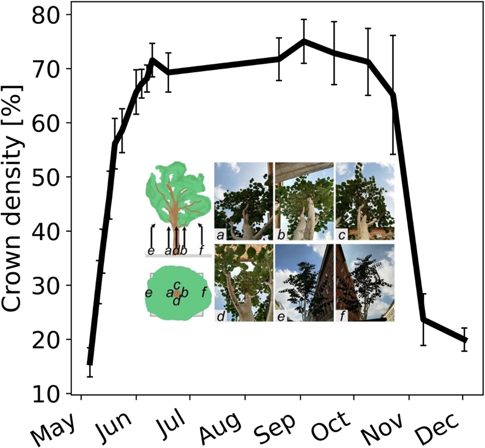
For the assessment of street trees a cost-effective method for tree crown density estimation in urban settings using image analysis was developed. |
Stakeholder interaction and co-design
| Policy Analysis |
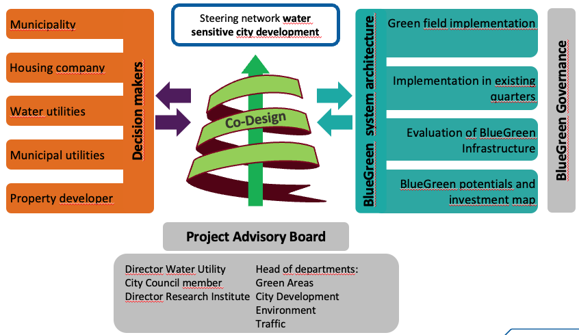
o Policy inventory and policy coherence assessment: analysis of governance systems and leverage points for policy integration and transformative change o Development of integrative policy options, policy implementation roadmaps (goals, strategies, actions, roles, responsibilities, resources |
|
Stakeholder Engagement: o Stakeholder mapping and analysis (stakeholder register, power-interest assessment, actor-linkage assessment, institutional analysis) o Development of engagement plans for trust-building and collaboration o Transdisciplinary co-creation of integrated knowledge and solutions |
| Science-Policy Interfacing (SPI) |
o Connect stakeholders from science, policy, practice and society o Science communication: transfer of scientific insights to decision-makers and translation of societal questions into research agendas |
| Transboundary Water Diplomacy | o Facilitation of dialogue amongst stakeholders: vision & goal-setting, problem analyses, deliberating solutions and reaching agreements on joint actions |
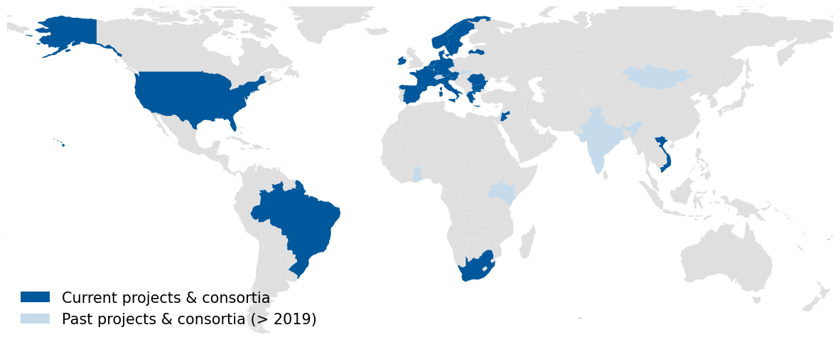
Current projects

|
MULTISOURCE (2021-2025, EU) |

|
NEXOGENESIS (2021-2025, EU) |

|
WATERUN (2022-2026, EU) |

|
Leipziger BlauGrün II (2023-2024, BMBF) |

|
UT-UBGI (2024-2027, HGF) |
| BGCC (2024-2027, BMUV) | |
| halleBG (2025-2026, HWS) |
Members
Dr Jan Friesen (WG lead)
Anton Mauersberger
Alexandria Baraza
Lucas Kersting
Antonia-Sophie Gerth
