Suspended sediment exports and impacts in natural-managed catchments
specifically: Effects of spatial distributions of natural-managed landscapes on river water quality problems associated with suspended sediments at the catchment-scale
Background
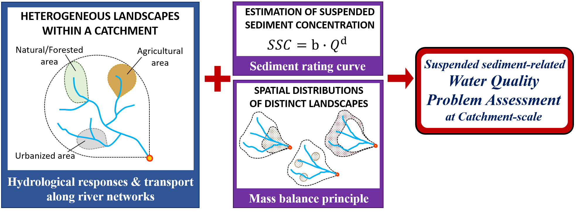
Suspended sediments in river reaches are broadly perceived as water quality pollutants. Human-altered landscapes such as agricultural and urbanized areas increasingly contribute to the environmental threats from suspended sediment loads in rivers. However, integrated effects of natural-agricultural-urbanized landscapes within a catchment on suspended sediment-related water quality problems are poorly understood. To this end, systematic differentiation for suspended sediment export regimes from different landscapes, archetypal approaches for spatial distributions of diverse landscapes in a given catchment, and a hydrological model framework at the scale of an entire river network are required.

Objective
This project aims to identify the spatial distributions of natural-agricultural-urbanized landscapes within a catchment to minimize river water quality problems related to suspended sediments.
Our focus lies on two main activities:
(1) to estimate the sediment rating curves at event scales by using dataset monitored in natural, agricultural, and urbanized catchments, and
(2) to evaluate which spatial distribution patterns of the three landscapes mitigate suspended sediments-related water quality impairments by incorporating the analyzed dataset within a hydrologic model grounded on the geomorphological theory of the hydrologic responses.
Research questions / hypotheses
1. Power-law exponents of sediment rating curves embody distinct export regimes of suspended sediment from different landscapes.
2. Suspended sediment exports from urban areas are the most sensitive to discharge dynamics.
3. Globally-found downstream clustering of human settlements is expected to exacerbate suspended sediment-related water quality problems in rivers.
Follow-up workshop 07.-11.06.2021
During a follow-up workshop in June the group focused on 5 tasks to develop their ideas and outline their collaborative paper:
(1) Specifying key research questions
(2) Updating literature reviews
(3) Conducting data analyses on the suspended sediment rating curves and the associated hysteresis patterns for diverse study catchments
(4) Simulating catchment-scale dynamics of suspended sediment concentration under synthetic scenarios which represent core patterns of land use gradients for our study areas
(5) Outlining the collaborative paper.
The group has regular research meetings to discuss the latest results of data analyses and model simulations and to update the relevant contents in the outlined manuscript.
Follow-up October 2022
The group made the following progresses through bi-monthly meetings:
- Identified German study areas with contrasting land uses on the basis of monitoring data quality such as sufficient periodity, accuracy, and reliability.
- Analyzed event-scale hysteresis patterns on the sediment rating curves for the study areas by hydrological seasons.
- Prepared for input dataset required to implement a geomorphological theory-based hydrological model.
The group is now working on the following tasks:
- Interpretation and visualization of the analyzed results
- Proof-of-concept modelling activities for the study areas to unravel salient archetypes in hysteresis patterns related to the spatial distributions of land uses.
- Manuscript drafting co-led by Karen and Jakob.
