

Parthe catchment
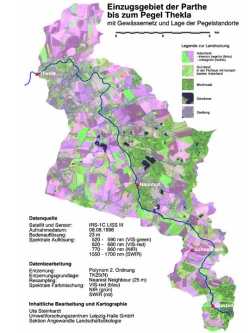
The Parthe watershed (366 km²), a subbasin of Weiße Elster river basin, is situated southeast of Leipzig (Saxony) in the Leipzig lowlands. The Parthe river flows into the Weiße Elster river at Leipzig. The gauge Thekla defines the outlet.
The Parthe watershed is part of the Saxonian Pleistocene landscape. Cambisols, Luvic Gleysol, Luvisols und Gleysol are the predominant soils, showing mainly sandy and loamy subtrates.
Annual precipitation is about 583 mm and average annual air temperature is 8,4°C. The watershed is dominated by intensive agriculture (> 60% of watershed area), urbanisation (18% of watershed area) and water abstraction.
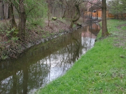
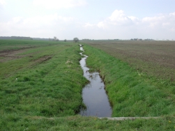
The flow conditions of the Parthe river are characterised by high water in spring and low-flow periods during the summer. During dry periods high water may occur after intense rainfall events. Some parts of the main channel and tributary channels of the system run dry in summer due to dry periods.
The studies in the Parthe catchment were carried out until the year 2010. It served several theses as study area.
Last ISI-listed paper:
Ullrich, A. & M. Volk (2010): Influence of different nitrate–N monitoring strategies on load estimation as a base for model calibration and evaluation. Environmental Monitoring and Assessment 171: 513-527
Ullrich, A. & M. Volk (2009): The use of the SWAT model to predict the impact of tillage on water quality. Agricultural Water Management 96(8): 1207-1217.
Objectives of the studies:
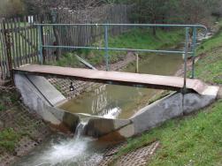
Hydrological and water quality investigations were carried out at four stations in the Parthe watershed. This was done by the UFZ in cooperation with the State Service for the Environment and Agriculture (SBUL). The measured data were used as a basis for an improved process understanding and served and still serve direct and indirect as input for models. The models are used to simulate the effects of land use and land management on hydrology and nutrient dynamics working group working group IMOP. Moreover, model sensitivity analyses are performed by using data from the Parthe watershed. Such plant- and soil physical characteristics and processes were calculated from hyperspectral data (wave lengths range between 400-1700 nm) that are of importance for the water and nutrient dynamics of the watershed. The innovative sensors that were used for these analyses show spatial resolutions of below 1 m. The sensors were carried by an ultra light aircraft.
Hydrological and water quality investigations are carried out at four stations in the Parthe watershed. This is done by the UFZ in cooperation with the State Service for the Environment and Agriculture (SBUL). The measured data are used as a basis for an improved process understanding and serve direct and indirect as input for models. The models are used to simulate the effects of land use and land management on hydrology and nutrient dynamics. Moreover, model sensitivity analyses are performed by using data from the Parthe watershed. Such plant- and soil physical characteristics and processes are calculated from hyperspectral data (wave lengths range between 400-1700 nm) that are of importance for the water and nutrient dynamics of the watershed. The innovative sensors that are used for these analyses show spatial resolutions of below 1 m. The sensors are carried by an ultra light aircraft.
Contact:
Prof. Dr. Martin Volk
Partners:
SLULG – Saxonian State Agency for the Environment, Agriculture, and Geology SLULG
SUBG – State Service for the Environment and Agriculture SUBG
StUFA Leipzig - State Agency for the Environment
