Contact
Head
Prof. Dr. Jian Peng
Department of Remote Sensing
jian.peng@ufz.de
Assistant
Catharina Reul
Department Remote Sensing and
Remote Sensing Centre for Earth System Research
catharina.reul-jimenez@ufz.de
Tel.: +49 341 6025-2335
Permoserstraße 15 | 04318 Leipzig | Germany
News / Press

The Terrestrial Water Dynamics team successfully attended the EGU General Assembly 2024 in Vienna! Presenting cutting-edge research and fostering collaborations, we're already looking forward to next year's EGU.
The UFZ Forest Condition Monitor is now live. It provides spatially explicit information about the condition of Germany's forests from 2016 to 2022.
Two of our MoDEV PhD candidates published their latest research in Remote Sensing of Environment. Antonia Ludwig assessed the spectral variation hypothesis doi and Toni Schmidt compared soil moisture products with cosmic-ray neutron sensing observations doi.
UFZ press release of a study led by Almudena García-García: Heat extremes in the soil are underestimated
The forest condition monitor from our working group LACY is part of the Environmental Photo Festival horizons zingst 2023 and publicly displayed in the city Zingst until summer 2024.
UFZ press release of a study led by Francisco José Cuesta Valero: Underestimated Heat Storage
Daniel Doktor interviewed by radioeins: presenting the forest monitor.
Congratulations to Reagan Okoth for a successful oral Master defense!
Welcome Peter Borrmann to join us as a PhD candidate in December 2022.
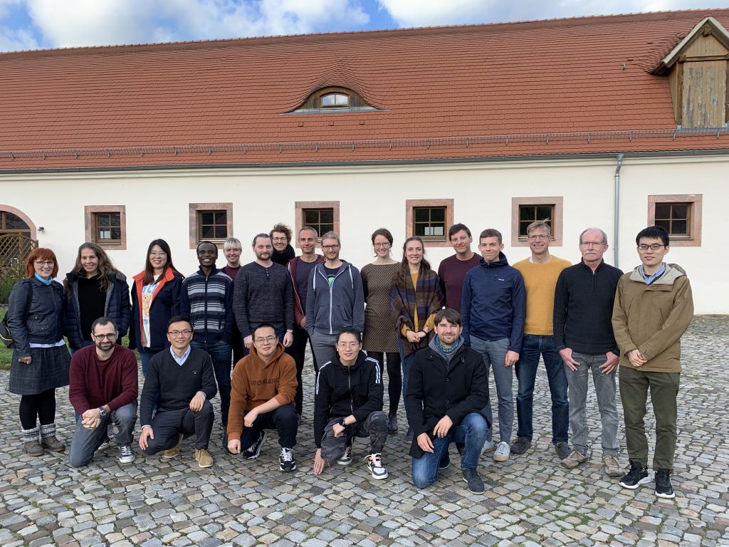
Fantastic and successful first department retreat in Grimma since the establishment of the team:

Germany-wide grassland management and land-use intensity information depicted from satellite-data (Lange et al. 2022) are now available as download and web service
Congratulations to Francisco José Cuesta Valero for being awarded the Alexander von Humboldt Research Fellowship, and we warmly welcome him to join us in October 2021.
Remote Sensing Center for Earth System Research (RSC4Earth) kicked off!
https://rsc4earth.de

New publications
García-García, A. and Peng, J.: Generation and evaluation of energy and water fluxes from the HOLAPS framework: Comparison with satellite-based products during extreme hot weather
Remote Sensing of Environment, 315, 114451, 2024 doi
Ludwig, A., Doktor, D., and Feilhauer, H.: Is spectral pixel-to-pixel variation a reliable indicator of grassland biodiversity? A systematic assessment of the spectral variation hypothesis using spatial simulation experiments, Remote Sensing of Environment, 302, 113988, 2024
doi
Schmidt, T., Schrön, M., Li, Z., Francke, T., Zacharias, S., Hildebrandt, A., and Peng, J.: Comprehensive Quality Assessment of Satellite- and Model-Based Soil Moisture Products against the COSMOS Network in Germany, Remote Sensing of Environment, 301, 113930, 2024
doi
Almudena García-García, Francisco José Cuesta-Valero, Diego G. Miralles, Miguel D. Mahecha, Johannes Quaas, Markus Reichstein, Jakob Zscheischler and Jian Peng. Soil heat extremes can outpace air temperature extremes, Nature Climate Change
(doi)
Cuesta-Valero, F.J., Beltrami, H., García-García, A., Krinner, G., Langer, M., MacDougall, A.H., Nitzbon, J., Peng, J., von Schuckmann, K., Seneviratne, S.I., Thiery, W., Vanderkelen, I., & Wu, T.: Continental heat storage: contributions from the ground, inland waters, and permafrost thawing. Earth System Dynamics, 14, 609-627, 2023.
Mahecha, M., Bastos, A., Bohn, F., Eisenhauer, N., Feilhauer, H., Hartmann, H., Hickler, T., Kalesse-Los, H., Migliavacca, M., Otto, F., Peng, J., Quaas, J., Tegen, I., Weigelt, A., Wendisch, M., Wirth, C., (2022):
Biodiversity loss and climate extremes — study the feedbacks, Nature, 612, 30-32, 2022.
Lange M, Feilhauer H, Kühn I, Doktor D (2022):
Mapping land-use intensity of grasslands in Germany with machine learning and Sentinel-2 time series.
Remote Sensing of Environment 277,112888
(doi)
Peng, J., Albergel, C., Balenzano, A., Brocca, L., Cartus, O., Cosh, M.H., Crow, W.T., Dabrowska-Zielinska, K., Dadson, S., Davidson, M.W.J., de Rosnay, P., Dorigo, W., Gruber, A., Hagemann, S., Hirschi, M., Kerr, Y.H., Lovergine, F., Mahecha, M.D., et al., (2021):
A roadmap for high-resolution satellite soil moisture applications – confronting product characteristics with user requirements.
Remote Sensing of Environment, 112162
(doi)
Balenzano, A., Mattia, F., Satalino, G., Lovergine, F.P., Palmisano, D., Peng, J., et al., (2021):
Sentinel-1 soil moisture at 1 km resolution: a validation study.
Remote Sensing of Environment, 263, 112554
full text (doi)
Huang, J., Zhang, Y., Bing, H., Peng, J., Dong, F., Gao, J., & Arhonditsis, G.B. (2021):
Characterizing the River Water Quality in China: Recent Progress and On-Going Challenges.
Water Research 201: 117309
full text (doi)
Ayalew, D.A., Deumlich, D., Šarapatka, B., Doktor, D., (2020):
Quantifying the sensitivity of NDVI-based C factor estimation and potential soil erosion prediction using spaceborne Earth observation data
Remote Sens. 12 (7), art. 1136
full text (doi)
Preidl, S., Lange, M., Doktor, D., (2020):
Introducing APiC for regionalised land cover mapping on the national scale using Sentinel-2A imagery
Remote Sens. Environ. 240 , art. 111673
full text (doi)
