

Validation and Calibration
Ground-based measurements are indispensable for calibrating and validating remote sensing products and to gain a better process understanding of the system under study. To achieve this, the aims are firstly to develop optimal exploration strategies to define a priori the number and location of measurement points in the landscape and secondly to monitor soil, atmosphere and interactions for adequate ground truth data sets. A combination of mobile geophysical near-surface methods, specially-developed sensor systems and sensor networks as well as infrared spectroscopy offering suitable technical solutions. Additionally, we develop new monitoring strategies and observation systems in cooperation with other institutes and companies and evaluate them on different test sites.
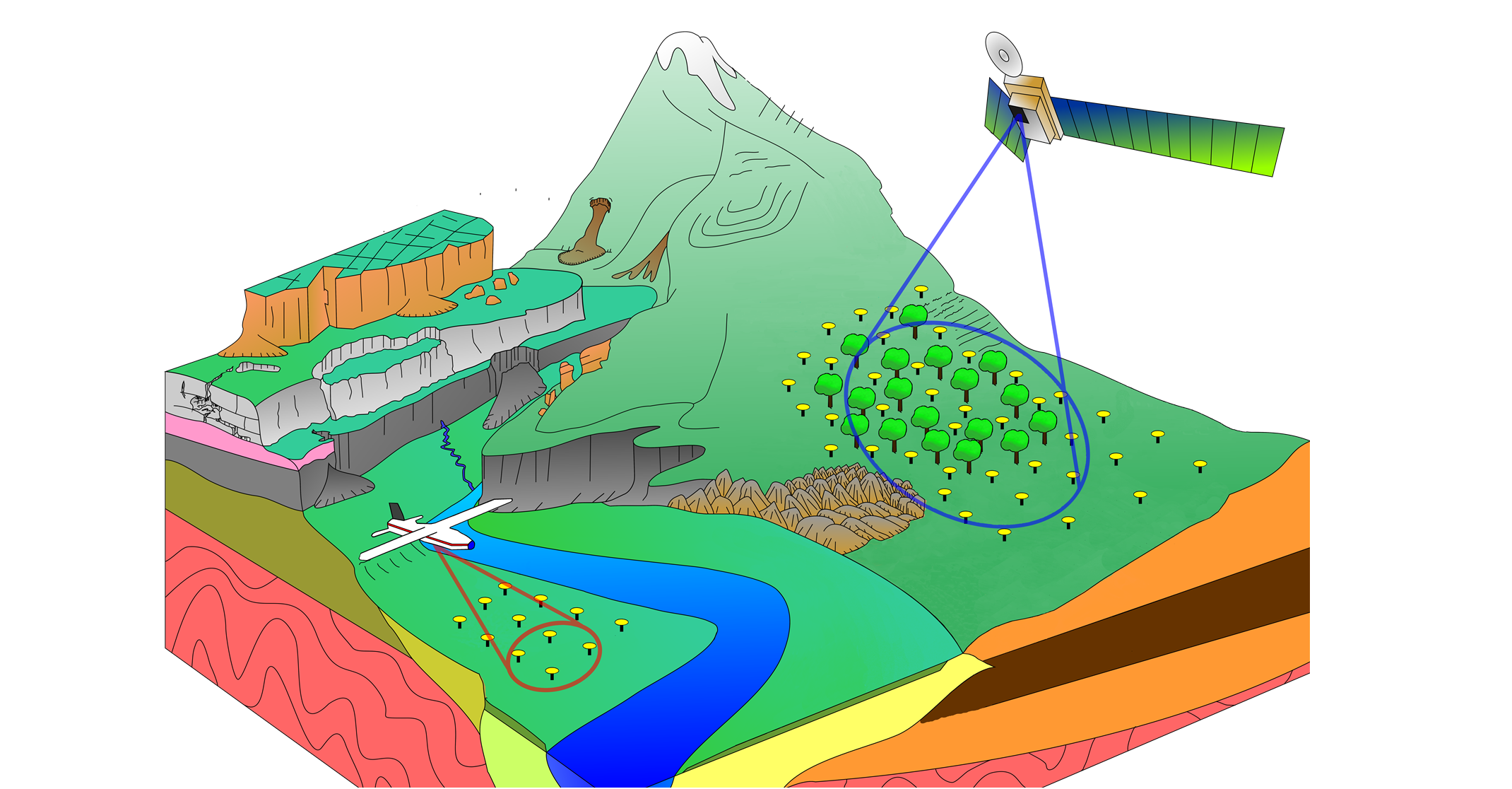
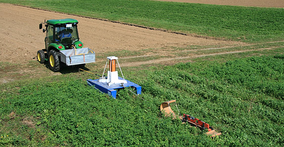
For our landscape hydrological studies, we apply a hydropedological approach to identify representative measurement locations. This encompasses the synergistic use of a variety of data such as terrain attributes based on a digital elevation model (DEM), remote sensing and data from mobile geophysical platforms equipped with electromagnetic induction instruments and gamma-ray spectrometers to account for spatially-relevant topographic features and soil structures.
Long-term and campaign-based soil moisture measurements are conducted from the hillslope to the catchment scale to infer hydrological processes. Monitoring methods vary from traditional TDR (time domain reflectometry) measurement, wireless sensor network, cosmic-ray neutron probe (CRNP) and areal-wise physical methods such as electromagnetic induction (EMI). Along with satellite (e.g., TerraSAR X) and airborne (e.g., FSAR) data acquisitions to detect surface soil moisture, additional TDR measurements are conducted to support and facilate validation.
Model Driven Site Assessment, Information and Control infrastructure is a broad research platform for model-supported, near-surface assessment and serves to connect scientists in interdisciplinary research. The basic concept of MOSAIC is based on a combination of existing, non-invasive methods in areas such as drilling, geophysical measurements and analysis. In addition to technologies such as advanced Direct Push - a borehole logging unit - a field lab and a mobile swimming unit also are employed.
Ecosystems are often characterized by their high heterogeneity, complexity and dynamic. Hence, single-point measurements are often insufficient for their complete representation. The application of wireless sensor networks in terrestrial and aquatic environmental systems offer significant benefits as a better consideration to the local test conditions due to the simple adjustment of sensor distribution, sensor types and sample rate.
Ground-based Open-Path Fourier Transform Infrared (OP-FTIR) spectroscopy is an optical remote sensing technique, which provides data about the composition of the lower atmospheric boundary layer. The detection and quantification of atmospheric gases are based on the physical behavior (emission or absorption) of target molecules within infrared spectral region (wavelengths from 2.5 – 14.5 µm). Measured IR spectra contain information about the gas concentration along the optical path – so called path integrated concentrations. The detection limit for a reliable quantification can reach the ppb-range depending on the applied measurement mode (active, passive), the length of the optical pathway (several 100 m) and the IR source used (artificial IR source, natural black bodies).
Cosmic-ray neutron probes are a novel technology used to monitor near-surface soil moisture. The biggest advantage of this method is the large footprint of the measurement that averages over 10-20 ha. This closes a critical scale gap in soil moisture monitoring and provides representative data for hydrological or agricultural models at the field scale. Besides 10 stationary sensors, the UFZ operates the Cosmic-Ray-Neutron Rover, the only mobile neutron detector for environmental research in Europe.
Satellite imagery as well as geophysical and remote sensing airborne acquisition platforms provide complimentary but physically-disparate data sets imaging the spatial variability of the ground. Integrated analysis of the mapped spatial ground variability, e.g., by means of Artificial Neural Networks or fuzzy sets, enables the identification of zones characterized by similar inter-parameter relations between the underlying input maps. Such pattern-based information can be used to guide the selection of ground-truthing locations for sample extraction or ground-borne geophysical surveys. Pattern-based optimal sampling and positioning concepts ensure efficient coverage of the ground heterogeneity present in the survey area when planning surveys with spatially-sparse data acquisition.