Press Release, 26. August 2021
Water monitoring from space
Lighthouse project BIGFE makes remote sensing data accessible for governmental water quality monitoring in lakes and rivers
As Earth observation satellites of the European Copernicus programme circle the Earth, they transmit quite a lot of data. This information from space will be used by state environmental agencies to monitor water bodies. Researchers are working on this in the joint project "Monitoring water quality and water surface expansion of inland waters by remote sensing" (BIGFE) under the leadership of the Helmholtz Centre for Environmental Research (UFZ).

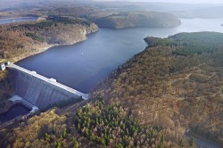
Photo: André Künzelmann / UFZ
Remote sensing data are already being used to monitor coastal areas of the North Sea and Baltic Sea. But this is not yet the case for monitoring inland waters. "We want to change that", says UFZ lake researcher Dr Karsten Rinke. "The data provided by the Sentinel satellites of the European Copernicus programme is a veritable treasure trove of data. This needs to be leveraged by the state authorities for future use in water monitoring". Rinke is head of the lighthouse project BIGFE, which started in July and is funded by the Federal Ministry of Transport and Digital Infrastructure as part of the Copernicus initiative.
The classic monitoring of inland waters in accordance with the EU Water Framework Directive has so far involved a great deal of time and personnel. However, the results from the on-site examinations and the laboratory evaluation of the sample material can only ever represent an excerpt and a brief snapshot. Variables such as turbidity, temperature, and algae occurrence can be quite different at different points in a lake and can also change quickly depending on the weather situation, type of water body, and catchment area. "This is due to the special characteristics of aquatic ecosystems, which are highly dynamic systems. Although monthly sampling is common in many places, important episodes such as cyanobacterial blooms are often overlooked. Added to this is the spatial heterogeneity, which makes it particularly difficult to assess the condition of water bodies covering more than 100 hectares if a sample is taken only once in the middle of the lake", explains Rinke. Combining remote sensing data with classical monitoring measures could significantly improve the information on the water quality status. "Data from space thus contributes up-to-date information at higher spatial and temporal resolution and enables rapid management responses. For example, in the event of a mass occurrence of cyanobacteria at bathing sites", he says. Depending on the type, satellite-based information can be provided daily to weekly and has a spatial resolution between 10 and 300 metres.
The UFZ is collaborating on the project with the Institute for Hygiene and Environment of the Hamburg Ministry for the Environment, Climate, Energy, and Agricultural Economics, the Institute for Lake Research of the Baden-Württemberg State Institute for the Environment, and the Saxony State Office for the Environment, Agriculture, and Geology. UFZ geoscientist Prof. Kurt Friese coordinates the cooperation with these project partners as well as other companies and authorities. "As practice partners for our investigations, state authorities from 12 federal states provide extensive data sets from their regular watercourse surveys. We correlate and compare these with remote sensing data from the corresponding periods", says Friese. "Thanks to the close involvement of practice partners, BIGFE is able to achieve a cross-national, harmonised approach to remote sensing of our waters".
The lake researchers are combining water quality and water surface area data from around 100 lakes, reservoirs, and the lower reaches of rivers with remote sensing data from 2016 to 2020. Together with remote sensing experts from the project partners and companies specialised in remote sensing, they analyse the data in order to answer questions that are central to implementing remote sensing in governmental water monitoring: Which properties of water bodies and which water body types can be characterised particularly well with the help of remote sensing? And which less well? What is the accuracy and reliability of remote sensing data? And what are the possible sources of error? How can the added value of remote sensing be integrated into official water monitoring practice?
"These are some of the important questions we want to answer in the project over the next three years", says Rinke. "We aim to develop practical, science-based recommendations for action that enable the use of remote sensing data for official water monitoring. With BIGFE, we hope that this treasure trove of data from space can be integrated into the established standards of water monitoring".
Further information
Dr. Karsten Rinke
Head of UFZ Department of Lake Research
karsten.rinke@ufz.de
Prof. Kurt Friese
UFZ Department of Lake Research
kurt.friese@ufz.de
UFZ press office
Susanne Hufe
Phone: +49 341 6025-1630
presse@ufz.de
In the Helmholtz Centre for Environmental Research (UFZ), scientists conduct research into the causes and consequences of far-reaching environmental changes. Their areas of study cover water resources, ecosystems of the future, environmental technologies and biotechnologies, the effects of chemicals in the environment, modelling and social-scientific issues. The UFZ employs more than 1,100 staff at its sites in Leipzig, Halle and Magdeburg. It is funded by the Federal Government, Saxony and Saxony-Anhalt.
www.ufz.deThe Helmholtz Association contributes to solving major challenges facing society, science and the economy with top scientific achievements in six research fields: Energy; Earth and Environment; Health; Key Technologies; Matter; and Aeronautics, Space and Transport. With some 39,000 employees in 19 research centres, the Helmholtz Association is Germany’s largest scientific organisation.
www.helmholtz.de