Urbanisation
Research on urban areas has been a long-lasting objective at UFZ. It focusses on sustainable urban development considering its dynamics in different cultural contexts and on different spatial and temporal scales.
At present, worldwide more than 50% of people live in urban areas. By 2050 it is projected that two-third of the world’s population will be urban dwellers (United Nations 2010; EEA 2015) for which we consider this process of urban transformation as a tremendous challenge. A core issue of this rapid urban development is the impact on land use and its changes in urban areas and their surrounding rural hinterland. Globally, the dynamics of urbanization happen in an unprecedented way and information gathering on the speed, direction and intensity of land-use changes must be observed, mapped and monitored. Remotely sensed data and techniques offer the best data availability. In our research they are exploited to understand urban land use changes and to foster sustainable urban planning and land management.
Urban areas possess highly diverse structures, and are characterized by their extreme complex patterns. Dependent on the research questions, the appropriate sensors are selected with their respective spatial and temporal resolutions. Consequently, neighbourhoods, cities or urban agglomerations can be monitored. Analyses of spatio-temporal patterns explain spatial heterogeneity and are based on multi-temporal aerial and satellite imageries. Beyond optical sensors, LiDAR data are part of the methodological tool kit to derive single objects (building, tree, etc.) as precise as possible.
We profit from remote sensing data through their different resolutions:
Spatial resolution: With different sensors urban areas can be analysed from the urban agglomeration at regional scale to the urban neighbourhood at local scale.
Temporal resolution: Urbanization proceeds at various speeds and into different directions. Using remotely sensed data supplies us with a very high temporal resolution to understand changes within one year, over years and over decades.
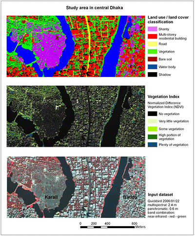
Spectral resolution: Dependent on our research goal, we can choose the appropriate satellite sensor with its specific spectral band widths to delineate land use classification schemes. Hence, we can investigate urban green spaces, urban water courses and urban sealed surfaces.
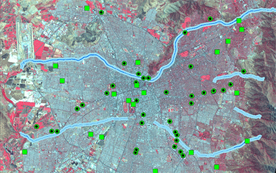
Radiometric resolution: How finely a sensor system can represent or distinguish differences of intensity helps to observe subtle differences with high accuracy and represents a poor or good reflectivity of the data. These data sets support e.g. selecting measuring points for field work in complex urban areas.
Resolution merge: Applying and further developing remote sensing techniques allows us to merge several sensors with their respective “best” resolution (e.g. Spot satellite spatial and Landsat satellite spectral). We apply these image processes when analyzing the urban spatial structure, developing highly accurate satellite maps of urban areas, and process urban structure types.
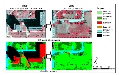
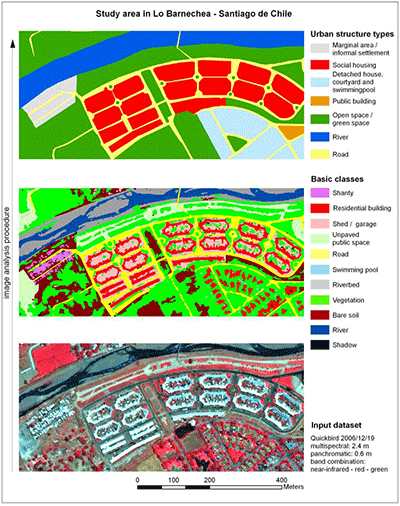
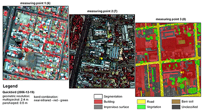
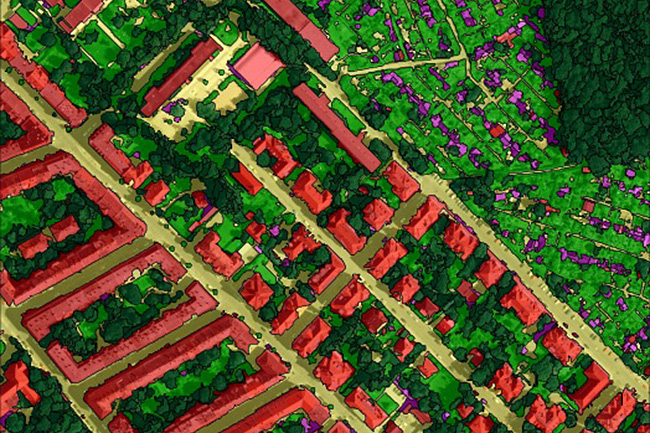
At high spatial resolution a valuable tool is the so-called object-based image analysis (OBIA). Grounded on an object-based image analysis scheme we can process a detailed mapping of single objects such as buildings, vegetation (trees and meadows) in an urbanized environment. Such data sets are then set in context to field measurements on local climate conditions.
Satellite Sensors:
Landsat 4/5/7/8
MODIS
ASTER
Sentinel 2
SPOT (HRVIR and HRG instruments)
RapidEye
Quickbird
ASTER
Aerial Sensors:
CIR (Color-Infrared) camera (3+4 bands)
Digital Orthophotos (DOP)
LiDAR
UAV Sensors:
Canon S110 (RGB and NIR)Urban agglomeration Leipzig/Halle - Germany
Santiago de Chile - South America
Different cities in Europe (contrasting growth and shrinkage in cities)
TERENO - TERrestrial ENvironmental Observatories – Urban System (ongoing)
IP UrbTrans - Integrated Project Urban Transformations (2014 – 2018)
UGALL - Urban gardens in Leipzig and Lisbon (ongoing)
EnvLifeQual - Evaluating Environmental and Life Quality to analyse Urban Vulnerability in Santiago de Chile (finished)
GreenCity - Nature-based solutions for sustainable water use in urban green spaces under climate change and water scarcity; under evaluation (binational: BMBF – WTZ, Germany, and Conicyt, Chile)
De la Barrera, F., Reyes-Paecke, S., Banzhaf, E. (envisaged in 2016). Indicators for green spaces in contrasting urban settings. Ecological Indicators, DOI 10.1016/j.ecolind.2015.10.027.
Schwarz, N., Manceur, A. (2015). Analyzing the Influence of Urban Forms on Surface Urban Heat Islands in Europe. Journal of Urban Planning and Development. http://dx.doi.org/10.1061/(ASCE)UP.1943-5444.0000263
Banzhaf, E., De la Barrera, F., Kindler, A., Reyes-Paecke, S., Schlink, U. Welz, J., Kabisch, S. (2014). A Conceptual Framework for Integrated Analysis of Environmental Quality and Quality of Life, Ecological Indicators, (45) 664-668.
Schlink, U., Kindler, A., Großmann, K., Schwarz, N., Franck, U. (2014). The temperature recorded by simulated mobile receptors is an indicator for the thermal exposure of the urban inhabitants. Ecological Indicators 36 (2014) 607-616.
Banzhaf, E., Reyes-Paecke, S., Müller, A., Kindler, A. (2013). Do demographic and land-use changes contrast urban and suburban dynamics? A sophisticated reflection on Santiago de Chile. Habitat International 39, 179-191.
Banzhaf, E., Kindler, A., Ebert, A., Metz, K., Reyes-Paecke, S. & Weiland, U. (2012): Land-use Change, Risk and Land-use Management. In: Heinrichs, D., Krellenberg, K., Hansjürgens, B. & Martínez, F. (eds.): Risk Habitat Megacity. Springer, 127-154.
Banzhaf, E. & Netzband, M. (2012): Monitoring urban land use changes with remote sensing techniques. In: Richter, M. & Weiland, U. (eds.): Applied Urban Ecology: A Global Framework. Wiley-Blackwell Publ., Chichester UK, 18-32.
Müller, A. (2012): Areas at Risk - Concept and Methods for Urban Flood Risk Assessment. A case study of Santiago de Chile. In: Kraas, F., Heintzenberg, J., Herrle, P. & Kreibich, V. (eds.): Megacities and Global Change, Vol. 3. Franz Steiner Verlag, Stuttgart, 265 pp.
Romero, H., Vásquez, A., Fuentes, C., Salgado, M., Schmidt, A. & Banzhaf, E. (2012): Assessing urban environmental segregation (UES). The case of Santiago de Chile. Ecological Indicators 23, 76-87.
Schwarz, N., Schlink, U., Franck, U. & Großmann, K. (2012): Relationship of land surface and air temperatures and its implications for quantifying urban heat island indicators - an application for the city of Leipzig (Germany). Ecological Indicators 18, 693-704.
Müller, A. (Ebert, A.), Reiter, J. & Weiland, U. (2011): Assessment of urban vulnerability towards floods using an indicator-based approach - a case study for Santiago de Chile, Nat. Hazards Earth Syst. Sci. 11, 2107-2123.
Schwarz, N., Bauer, A. & Haase, D. (2011): Assessing climate impacts of planning policies – An estimation for the urban region of Leipzig (Germany). Environmental Impact Assessment Review. http://dx.doi.org/10.1016/j.eiar.2010.02.002
Schwarz, N., Lautenbach, S. & Seppelt, R. (2011): Exploring indicators for quantifying the surface urban heat island with MODIS land surface temperatures. Remote Sensing of Environment 115 (12), 3175-3186.
Weiland, U., Kindler, A., Banzhaf, E., Ebert, A. & Reyes-Paecke, S. (2011): Indicators for Sustainable Land Use Management in Santiago de Chile. Ecological Indicators 11 (5), 1074-1083.
Land-use changes and urban structure
Urban form and Urban Heat Island
Urban Ecosystem Services
Uwe Schlink
Mobile measurements and local climate investigations


