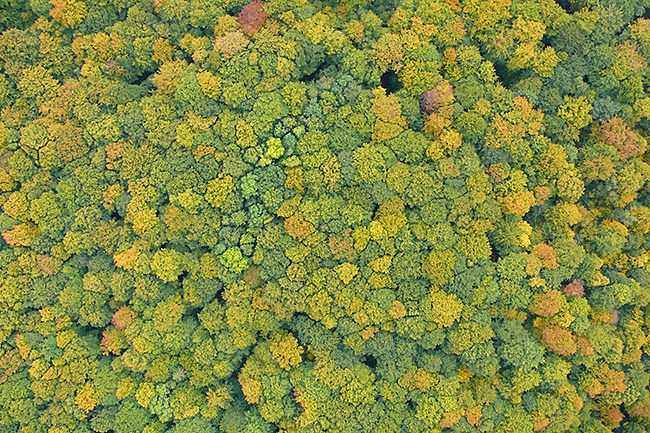
Biodiversity
By combining remotely sensed information on land use and land cover (LULC), habitat configuration and conditions, vegetation structure and data on (micro-)climate with information on the occurrence and abundance of species, ecological niches based on species-specific correlations to environmental gradients are modelled.
These models serve to predict and explain current species distribution patterns but also to estimate extinction risks from environmental change. Similar models are also used to predict and explain patterns of species richness as well as distributions of functional traits and the functional diversity of communities. The results help drawing conclusions on the influence of land use and landscape structure, but also on the impact of global environmental change on biodiversity and ecosystem services.
Satellite Sensors:
Landsat 7/8
MODIS
OMI
UAV Sensors:
Thermal Camera
RGB Camera
ALARM - Assessing Large scale Risk for biodiversity with tested Methods
SCALES
- Securing the Conservation of biodiversity across Administrative Levels and spatial, temporal, and Ecological Scales
STEP - Status and Trends of European Pollinators
ECOPOTENTIAL - Improving future ecosystem benefits through earth observations
EC21C - European Conservation for the 21st Century
CONABIO - Improving species distribution models of endangered plants in MexicoHe, K.S., Bradley, B.A., Cord, A.F., Rocchini, D., Tuanmu, M.-N., Schmidtlein, S., Turner, W., Wegmann, M. & Pettorelli, N. (2015). Will remote sensing shape the next generation of species distribution models? Remote Sensing in Ecology and Conservation, 1(1), 4-18.
Beckmann, M., Václavík, T., Manceur, A.M., Šprtová, L., von Wehrden, H., Welk, E. & Cord, A.F. (2014) glUV: A global UV-B radiation dataset for macroecological studies. Methods in Ecology and Evolution, 5(4), 372-383.
Cord, A.F., Klein, D., Gernandt, D.S., Pérez de la Rosa, J.A. & Dech, S. (2014) Remote sensing data can improve predictions of species richness by stacked species distribution models: a case study for Mexican pines, Journal of Biogeography, 41(4), 736-748.
Cord, A.F., Klein, D., Mora, F. & Dech, S. (2014) Comparing the suitability of classified land cover data and remote sensing variables for modeling distribution patterns of plants, Ecological Modelling, 272, 129-140.
Cord, A.F., Meentemeyer, R.K., Leitão, P.J., Václavík, T. (2013) Modelling species distributions with remote sensing data: bridging disciplinary perspectives, Journal of Biogeography, 40(12), 2226-2227.
Getzin, S., Wiegand, K. & Schoening, I. (2012) Assessing biodiversity in forests using very high-resolution images and unmanned aerial vehicles. Methods in Ecology and Evolution, 3, 397-404
Keil, P., Schweiger, O., Kuhn, I., Kunin, W.E., Kuussaari, M., Settele, J., Henle, K., Brotons, L., Pe'er, G., Lengyel, S., Moustakas, A., Steinicke, H. & Storch, D. (2012) Patterns of beta diversity in Europe: the role of climate, land cover and distance across scales. Journal of Biogeography, 39, 1473-1486.
Schweiger, O., Heikkinen, R.K., Harpke, A., Hickler, T., Klotz, S., Kudrna, O., Kühn, I., Pöyry, J. & Settele, J. (2012) Increasing range mismatching of interacting species under global change is related to their ecological characteristics. Global Ecology and Biogeography, 21, 88-99.
Cord, A. & Rödder, D. (2011) Inclusion of habitat availability in species distribution models through multi-temporal remote sensing data? Ecological Applications, 21(8), 3285-3298.
Hanspach, J., Kuhn, I., Schweiger, O., Pompe, S. & Klotz, S. (2011) Geographical patterns in prediction errors of species distribution models. Global Ecology and Biogeography, 20, 779-788.
Wilting, A., Cord, A., Hearn, A., Hesse, D., Mohamed, A., Traeholdt, C., Cheyne, S.M., Sunarto, S., Jayasilan, M.-A., Ross, J., Shapiro, A.C., Sebastian, A., Dech, S., Breitenmoser, C., Sanderson, J., Duckworth, J.W. & Hofer, H. (2010) Modelling the species distribution of flat-headed cats (Prionailurus planiceps), an endangered South-East Asian small felid. PLoS ONE, 5(3): e9612.
Dormann, C.F., Schweiger, O., Arens, P., et al. (2008) Prediction uncertainty of environmental change effects on temperate European biodiversity. Ecology Letters, 11, 235-244.
Liira, J., Schmidt, T., Aavik, T., et al. (2008) Plant functional group composition and large-scale species richness in European agricultural landscapes. Journal of Vegetation Science, 19, 3-14.
Bailey, D., Billeter, R., Aviron, S., Schweiger, O. & Herzog, F. (2007) The influence of thematic resolution on metric selection for biodiversity monitoring in agricultural landscapes. Landscape Ecology, 22, 461-473.
Cord, A., Conrad, C., Schmidt, M. & Dech, S. (2010) Standardized FAO-LCCS land cover mapping in heterogeneous tree savannas of West Africa. Journal of Arid Environments, 74(9), 1083-1091.
Dormann, C.F., Schweiger, O., Augenstein, I., Bailey, D., Billeter, R., de Blust, G., DeFilippi, R., Frenzel, M., Hendrickx, F., Herzog, F., Klotz, S., Liira, J., Maelfait, J.P., Schmidt, T., Speelmans, M., van Wingerden, W.K.R.E. & Zobel, M. (2007) Effects of landscape structure and land-use intensity on similarity of plant and animal communities. Global Ecology and Biogeography, 16, 774-787.
Schweiger, O., Musche, M., Bailey, D., Billeter, R., Diekotter, T., Hendrickx, F., Herzog, F., Liira, J., Maelfait, J.P., Speelmans, M. & Dziock, F. (2007) Functional richness of local hoverfly communities (Diptera, Syrphidae) in response to land use across temperate Europe. Oikos, 116, 461-472.
Schweiger, O., Dormann, C.F., Bailey, D. & Frenzel, M. (2006) Occurrence pattern of Pararge aegeria (Lepidoptera : Nymphalidae) with respect to local habitat suitability, climate and landscape structure. Landscape Ecology, 21, 989-1001.
Schweiger, O., Maelfait, J.P., van Wingerden, W., Hendrickx, F., Billeter, R., Speelmans, M., Augenstein, I., Aukema, B., Aviron, S., Bailey, D., Bukacek, R., Burel, F., Diekotter, T., Dirksen, J., Frenzel, M., Herzog, F., Liira, J., Roubalova, M. & Bugter, R. (2005) Quantifying the impact of environmental factors on arthropod communities in agricultural landscapes across organizational levels and spatial scales. Journal of Applied Ecology, 42, 1129-1139.
Schweiger, O., Frenzel, M. & Durka, W. (2004) Spatial genetic structure in a metapopulation of the land snail Cepaea nemoralis (Gastropoda : Helicidae). Molecular Ecology, 13, 3645-3655.
Models of Species Distribution, Functional Diversity, Pollination
Species distribution models, Remote sensing-based mapping of land use/land cover patterns and their changes, Potential of remote sensing data for research on biodiversity and ecosystem services
Biodiversity assessment, Detection and analysis of spatial structures of different habitats, UAV application
