Current News
The North Atlantic Waveguide, Dry Intrusion, and Downstream Impact Campaign (NAWDIC) is an international field campaign that focuses on combining detailed observations and modeling efforts to improve understanding of high-impact weather events in the North Atlantic region during winter. MOSES groups from KIT and FZJ contribute their specific expertise in boundary layer dynamics and the transport of water vapor in the upper troposphere and lower stratosphere. The observations comprise ground-based systems provided by the KITcube along the west coast of Brittany and airborne systems installed by FZJ on the research aircraft HALO during its missions over the North Atlantic. More information on NAWDIC is available here.
A new publication by Fischer et
al. (2025) based on joint work of MOSES researchers from marine and terrestrial
centers has delivered new insights how short-term temperature anomalies -
marine heat waves and cold spells - profoundly affect polar shallow water
ecosystems and how they can have a stronger and more immediate impact on marine
ecosystems than long-term trends. Traditional sampling approaches often miss
these rapid changes. By using continuous, high-resolution monitoring and
AI-supported data analysis, the researchers captured ecosystem responses in
real time. These short-term events affect the entire food web, from
microorganisms to fish, and emphasize the need for next-generation marine
observation technologies to fully understand ecosystem dynamics in a changing
climate. The results show that not only the abundance but also the composition
of species shifts in response to rapid environmental changes. This work
highlights the importance of high-resolution monitoring to understand how weather extremes shape marine ecosystems in real time.MOSES participates in NAWDIC
Effects of marine heat waves and cold spells on a polar shallow water ecosystem
More information about this publication is available here.
News Archive
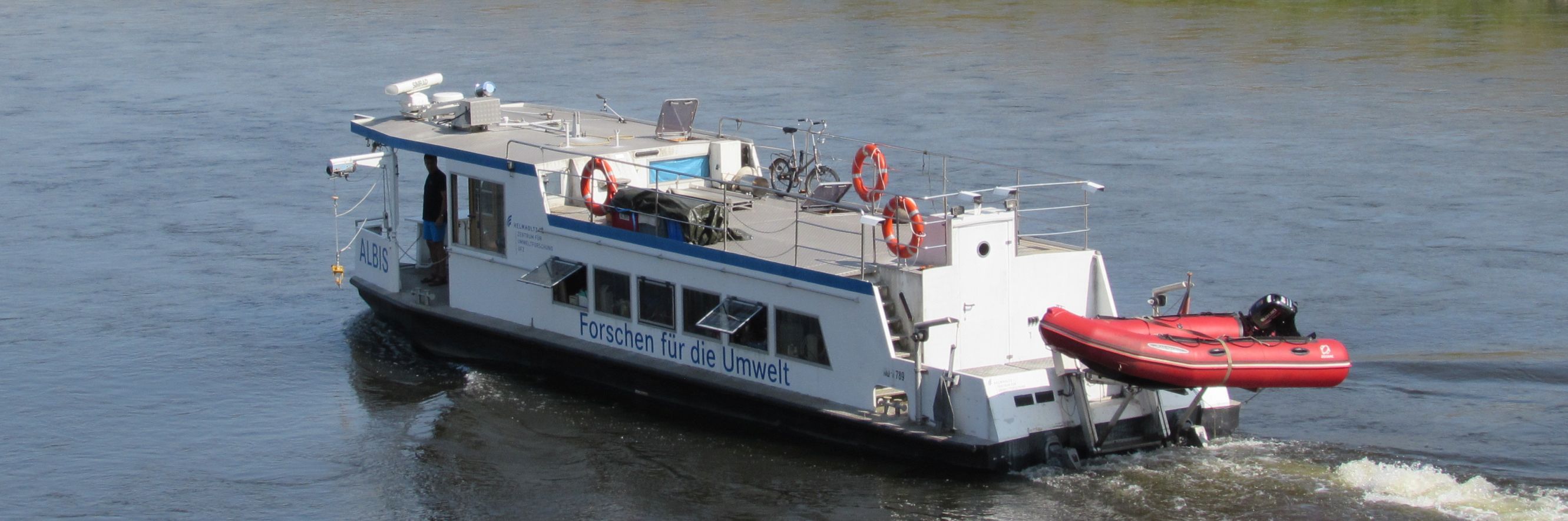
Riding the wave: MOSES ad hoc campaign collects unique data during the Elbe Flood
The Elbe River, its estuary and the coastal North Sea have been a recurrent focus of MOSES campaigns in recent years, primarily examining the impacts of the past extreme low-water events on the transport of dissolved nutrients and pollutants as well as on greenhouse gas emissions from the inland Elbe to the North Sea.
Now, scientists from UFZ, HEREON, GEOMAR and AWI have mobilised on short notice to sample the effects of the current flood along the Elbe River into the North Sea. The operational plan for such a flood event was already in the drawer for several years, but now it had to be executed rapidly during the Christmas holidays. With the onset of the flood at the end of December, scientists around Norbert Kamjunke from UFZ tracked the peak of the flood wave over a period of eight days from Bad Schandau at the German-Czech border to Lauenburg near Hamburg. Access to the river often presented them with challenges due to the extensive flooding of the surrounding land, and samples were mostly taken from bridges along the river course.
The investigations comprised measurements of conductivity and water temperature using sensor probes. Simultaneously, water samples were collected and prepared for later laboratory analyses of biogeochemical parameters such as carbon compounds, nutrients, micropollutants, metals and pigments.
 Foto: N. Kamjunke (UFZ, 2023)
From the weir in Geesthacht, colleagues from coastal Helmholtz centre HEREON took over the monitoring of the flood wave in the tidal Elbe and its entry into the German Bight. The investigations by HEREON scientists in the tidal Elbe were actively supported by the Hamburg Port Authority and the ferry line operator FRS Elbfähre Glückstadt Wischhafen. Götz Flöser (HEREON) is overwhelmed: “With this support organised at very short notice, it was possible to take targeted samples along the tidal river.”
Following the arrival of the wave in Cuxhaven, scientists from AWI and GEOMAR will start their observations. From mid-January, they will be travelling in the German Bight with the research vessels Mya II and Littorina sampling the same set of constituents as for the Elbe River, such as nutrients, organic pollutants and heavy metals that have been transported to the North Sea by the flood event. An additional focus lies on the impact of the flood on emissions of greenhouse gases such as methane and carbon dioxide in the German Bight. Furthermore, samples for eDNA will be collected to assess the flood impact on biological community structure in the coastal North Sea.
The recently funded project ElbeXtreme is dealing with the influence of extreme events in the Elbe region on aquatic ecosystems and societal use of inland and coastal waters. Ingeborg Bussmann (campaign lead at AWI) is enthusiastic: “After the previous extreme low water situations, we are now able to start our project with the collection of an unprecedented data set for flood events!”
Such flood events as well as low-water situations are likely to become more common in future as a consequence of climate change. Scientists therefore need to understand the impact of these events on nutrient and pollutant transfer, and establish the consequences for ecosystems and the local stakeholders who rely on the ecosystems. The MOSES consortium hopes to gain a deeper understanding of the influence of these rare extreme events on the state of the environment and the interplay between freshwater and coastal systems and how these events impact socio-ecological systems. Such investigations support the development of adaptation and mitigation options in the coming years in consultation with the stakeholders, which will also be a focus of ElbeXtreme.
The project ElbeXtreme, coordinated by GEOMAR, has been recently funded by BMBF and by the science ministries of the northern German states (Bremen, Hamburg, Mecklenburg-Western Pomerania, Lower Saxony, Schleswig-Holstein). It is part of the research mission mareXtreme - “Pathways to improved risk management in the field of marine extreme events and natural hazards” of the Deutsche Allianz Meeresforschung (DAM).
Link to press release GEOMAR
Link to press release AWI
Link to press release HEREON
Link to press release UFZ
Updated: 24.01.2024
How polluted is the Elbe River?
Observation campaign investigates the fate of micro pollutants, plastic particles, and nutrients over a length of more than 1000 km along the watercourse
 Sampled watercourse along the Elbe River from the Czech source to the German Bight. (Graphics: UFZ / ARTKOLCHOSE)
Researchers from several Helmholtz Centres and the Czech Academy of Science will devote June-September to the question of how environmental chemicals, nano- and microplastics, and nutrients enter the Elbe and then the North Sea, in what concentration and size, and how they are degraded and modified along the way. The aim is to determine the discharges from agriculture, sewage treatment plants, industry, and residential areas into the Elbe and their share in coastal pollution.
The campaign begins on 27 June with sampling of the 370 km section from the Elbe spring to the Czech-German border. From here to the Geesthacht barrage, the UFZ research vessel "Albis" will be deployed in the first two weeks of July followed by the Hereon research vessel “Ludwig Prandtl” from Geesthacht to Cuxhaven in August. In addition to the “Ludwig Prandtl”, the GEOMAR research vessel “Littorina” and the AWI research vessel “Uthörn” will take over the coastal area of the North Sea at the beginning of September.
Press release UFZ
Press release HEREON
Press release AWI
September, 2023
Tracking thunderstorms - Swabian MOSES 2023 started in May
Observation campaign in the Black Forest investigates weather extremes to elucidate their origin, development and consequences
 The Villingen-Schwenningen observation site is the core of a total of 30 measuring stations in the campaign. (Foto: U. Weber)
How do summer weather extremes develop? What are their effects? What damage do they cause? In the "Swabian MOSES 2023" measurement campaign, researchers are getting to the bottom of these questions. The goal is to better understand weather extremes. To do this, they are tracking the events in a coordinated manner: From the first shallow cumulus clouds to the development of a thunderstorm, the associated hail formation, heavy precipitation and flooding, to the discharge of pollutants into the affected water bodies.
The campaign is taking place from May to September 2023. In the area of the southern Black Forest, the measurements concentrate on the formation of thunderstorms. These mostly move in a north-easterly direction, so that in the area between Rottenburg and Kirchheim particularly many weather extremes show their damaging effects such as hail storms and flash floods.
Press release KIT
Press release UFZ
June, 2023
Research under the midnight sun - Polar MOSES is underway in Svalbard
The expedition 2023 investigates the impacts of rapidly thawing permafrost in subarctic and Arctic environments
 In front of the AWIPEV “Blue House”: Peter Dietrich (UFZ), Uta Ködel (UFZ), Solveig Landmark (UFZ), Claudia Schütze (UFZ), Lasse Hertle (UFZ), Steffen Zacharias (UFZ), Inge Grünberg (AWI), Marie Rolf (AWI), Julia Boike (AWI) (f.l.t.r.)
In July, a joint team of the AWI and UFZ Helmholtz Centres started fieldwork in Ny- Ålesund, Svalbard. This year's campaign targets the region around the BAYELVA long-term permafrost monitoring station, which has been under observation since 1998. The MOSES team is researching environmental changes caused by rapidly thawing permafrost. To this end, they installed the world's northernmost Cosmic Ray Neutron Sensor Station, which will provide important data on soil moisture dynamics and snow cover. A mobile Infrared Spectrometer System is employed to measure greenhouse gas emissions in terms of their spatial variability, while the Electromagnetic Induction Method helps to identify near-surface structures and processes that drive emission dynamics. Land subsidence is monitored by GNSS Surveys that cover both the tundra on the Broegger Peninsula and critical infrastructure in Ny-Ålesund. They complement previous surveys and provide in-situ data for NASA’s ICESat satellite mission.
The campaign runs until mid-August and will be continued and expanded next year in further collaboration with KIT, HEREON and GEOMAR.
BAYELVA Site
AWIPEV Station
August, 2023
 The UFZ research vessel ALBIS brings equipment to the Elbe river shore (Foto: C. Schütze / UFZ).
As in previous years, 2022 is again a year with record low water levels and extreme drought periods. And as in previous years, in August a team of the Hydrological Extremes working group from AWI and UFZ has taken the MOSES toolbox to investigate the effects of these droughts on the Elbe River near Tangermünde in more detail. The investigations were especially focused on the emissions of greenhouse gases such as carbon dioxide and methane from water and adjacent dry fallen floodplain sediments. The campaign was performed to collect detailed data of temporal and spatial heterogeneity of the potential emission drivers and patterns due to the extreme low water situation.

Weather extremes are also occurring more frequently in Germany. A stakeholder-workshop with participants from science and practice was therefore dedicated to the topic »Weather Extremes: Perspectives in Monitoring and Prediction«. From 31 Mai to 1 June 2022 scientists and representatives of environmental authorities meet in Leipzig to intensify exchange and stakeholder involvement. The reason for the workshop was the start of the MOSES operational phase in January 2022.
Getting a better understanding of the influence of eddies in the ocean
Last of three ship expeditions launched in upwelling area off West Africa
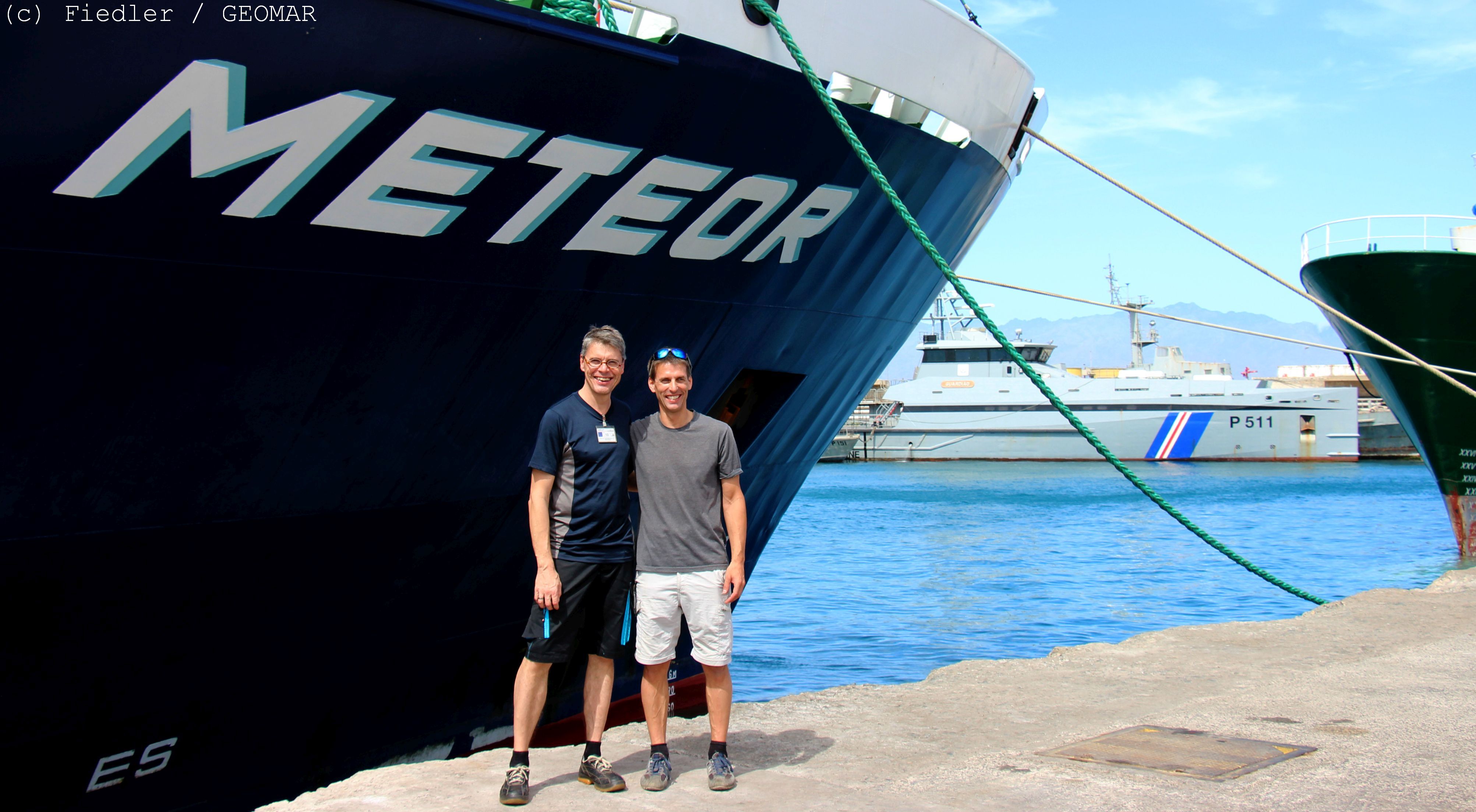
Oceanic eddies play an important role in the mixing and transport of nutrients or of physical properties, such as heat. In this way, they influence the flow of substances to the seafloor or the occurrence of species. Scientists of the today launched expedition M182 – MOSES Eddy Study III, the last of a series of three research cruises of the Helmholtz initiative MOSES to the upwelling area off Mauritania, are now investigating the effects of ocean eddies in more detail. Their focus is on carbon transport from the sea surface to the seafloor, the mechanisms of the biological carbon pump, and the export of carbon to the deep sea. These processes affect carbon dioxide uptake in the ocean and are directly linked to climate change.
 Retrieval of an autonomous underwater vehicle (AUV). Photo: GEOMAR
Upwelling areas are among the most productive marine areas in the world. They are not only significant for biodiversity, but also play a major role in the global food supply and economy as high-yield fishing grounds. Oceanic eddies influence the biological, biogeochemical, and physical properties of these regions and are therefore highly significant to their function. A good understanding of these processes in relation to human-induced climate change is important to assess potential profound impacts on the dynamics of upwelling systems in the research region.
With the ship expedition M182 starting today, under the title “MOSES Eddy Study III”, scientists led by Professor Dr. Jens Greinert from GEOMAR Helmholtz Centre for Ocean Research Kiel aim to deepen the understanding of eddy-related processes.
During the research cruise, four working areas will be visited at different water depths and distances from the Mauritanian coast off West Africa and investigations will be carried out before, during and after a passage of an eddy. In doing so, the M182 cruise complements the investigations of the previous two cruises, M156 and M160.
Essential to the M182 is the deployment of an entire fleet of autonomous survey vehicles and landers, a type of measurement platform. A total of seven Autonomous Underwater Vehicles (AUVs) and a novel rover will explore the water column and seafloor alongside three deep-sea lander systems. “We have a load of high-tech instruments on board that has never been deployed to the extent by GEOMAR before” says Jens Greinert “It is technically complex but the necessary next step to collect even better research data.” Optical, acoustic and chemical sensors on the platforms are complemented by chemical, biological and genetic analyses in the laboratories of the M182 research vessel METEOR.
The expedition is part of the project “Role of eddies in the carbon pump of eastern upwelling systems” (REEBUS), funded by the German Federal Ministry of Education and Research, and the Helmholtz initiative “Modular Observation Solutions for Earth Systems” (MOSES). In this initiative, coordinated by the Helmholtz Centre for Environmental Research (UFZ), nine research centers of the Helmholtz Association are jointly building mobile and modularly deployable observation systems between 2017 and 2022 to study the effects of temporally and spatially limited dynamic events, such as extreme precipitation and runoff events, on the long-term development of Earth and environmental systems.
For more information, click here.
June, 2022
The Quadroin: innovative and autonomous sensor system dives into the ocean eddies
 Burkard Baschek with the artificial penguin: Quadroin. (Foto: F. Büttner /Hereon)
Autonomous and flexibly deployable sensor systems are of great importance to capture and monitor event dynamics. The ‘Quadroin’ is one example of the technical innovations created as part of MOSES within the event working group ‘Ocean Eddies’ in cooperation between Helmholtz-Zentrum Hereon and companies. Inspired by the shape of the penguin, it swims with a speed of up to five meters per second, recording temperature, pressure, oxygen, conductivity and fluorescence on its way. Prof. Burkard Baschek (Hereon): ‘It's ideal for moving autonomously and without cables in ocean eddies and providing us with fast data.’ In the future, several artificial penguins will be operating simultaneously, forming a swarm and communicating with each other.
More information and pictures of the system:
Gewitter, Hagel, Starkregen und Hitzewellen: MOSES startet die Untersuchung von Extremwetterereignissen in Süddeutschland
Extreme Wetterereignisse wie starke Gewitter oder Hitze- und Dürreperioden haben in den letzten Jahren auch in Deutschland zugenommen und verursachen dabei teils große wirtschaftliche und infrastrukturelle Schäden. Die Schwäbische Alb ist aufgrund ihrer komplexen Topographie und geographischen Lage besonders häufig von schweren Gewitterereignissen und ihren Begleiterscheinungen wie z.B. Hagel, Sturmböen und Starkregen betroffen. Ein prominentes Beispiel ist der Hagelsturm von Reutlingen am 28. Juli 2013, der Hagelkörner mit einem Durchmesser von bis zu 10 cm hervorbrachte und Schäden von ca. 1 Milliarde Euro verursachte. Die mit den Gewittern einhergehenden kleinräumigen Starkniederschläge können zudem lokale Sturzfluten sowohl in Gebirgsregionen als auch in flächenversiegelten urbanen Bereichen verursachen, die nicht nur zu erheblichen Schäden an der Infrastruktur, sondern auch zu einem massiven Sediment- und Schadstofftransport in Gewässern führen.
Gleichzeitig war die gesamte Region von der Alb bis ins Neckartal aufgrund der extremen Dürreperioden in den Jahren 2018 bis 2020 von historischen Niedrigständen im Grundwasserpegel betroffen. Viele Flüsse zeigten in den Sommermonaten der vergangenen Jahre ein ausgeprägtes Niedrigwasser – Einschränkungen der Schifffahrt und der Wasserentnahme, z.B. zur Bewässerung von Feldern oder zur Kraftwerkskühlung, waren die Folge.
„Deshalb haben wir uns die Region als nächsten Standort für eine umfangreiche MOSES-Kampagne der Arbeitsgruppen Hydrologische Extreme und Hitze / Dürren ausgewählt“, sagt Andreas Wieser vom KIT. Erste Erfahrungen zu derartigen Wetterextrem-Kampagnen konnten die Teams bereits 2019 und 2020 sammeln (MOSES-Blogs).
 Verteilte Standorte am Rande der Schwäbischen Alb: das weithin sichtbare Regenradar am Standort bei Nürtingen (oben) und Geräteaufbauten am Hauptstandort bei Rottenburg am Neckar (unten).
Passend zum jetzigen Kampagnenstart kommt das erste Extremwetter in Form eines für Anfang Mai ungewöhnlichen Sturmtiefs „Eugen“ angezogen. Mit verschiedenen Messsystemen sind neben dem federführenden Institut für Meteorologie und Klimaforschung (IMK) des KIT auch das Helmholtz Zentrum für Umweltforschung (UFZ) aus Leipzig, das Forschungszentrum Jülich (FZJ), die Universität Hohenheim, die Eberhard Karls Universität Tübingen, die Technische Universität Braunschweig, das Helmholtz Zentrum Potsdam – Deutsches GeoForschungsZentrum (GFZ), das Deutsche Zentrum für Luft- und Raumfahrt (DLR) sowie der Deutsche Wetterdienst (DWD) beteiligt. Die vom KIT koordinierte Messkampagne läuft bis Mitte September 2021. Das Ziel: Ein besseres Verständnis, wie sich solche Extremwetter entwickeln und welche Folgen sie für die betroffenen Umweltbereiche wie Agrargebiete oder Flüsse haben.
 Energiebilanzmessungen mit dem MoLEAF-Turm.
Text: Jannik Wilhelm (KIT), Mai 2021
Fotos: Claudia Schütze (UFZ), Mai 2021
weitere Informationen:
- Kampagnen-Webseite: www.swabianmoses.de
- Pressemitteilung KIT
- Press release KIT
Permafrost test campaign at AWIPEV Research Base under corona conditions (March 2021)
 Group photo front of AWIPEV - from left to right: Julia Martin, Frederieke Miesner, Julia Boike, Christian Rasmussen, Esther Horvarth, Bill Cable (Photo: Esther Horvath, AWI).
Our AWI team (Julia Boike, Bill Cable, Frederieke Miesner, Julia Martin, Christian Rasmussen, Esther Horvath) left Berlin and Bremen on March 3 bound for Svalbard. After arrival in the Oslo airport, serious interrogations by the police, and yet another Covid test, we were accepted for a 10-day stay in a quarantine hotel. Our American collaborative team (10 people in total) had already arrived and were staying in the same hotel.
Our days in quarantine were spent by preparing for field work, including sensor testing in the hotel room, regular office work (video conferences) and daily walks. Further negative Covid tests allowed us to board the plane to Longyearbyen on March 14, with continuation to Ny-Ålesund on March 15. Some of us traveled from Longyearbyen by boat (the “Farm”) which was organized by our American collaborators, also taking all of our heavy freight.
We were some of the first people to arrive in Ny-Ålesund und after a longer period of no visits or projects! As a result of the pandemic, some stations are still closed since last year. After the Kings Bay shooting training for everybody, and further safety and station rules, we started working at Bayelva on March 17.
") Bill Cable and Frederieke Miesner from AWI-team test the MOSES temperature lance, developed by Bill to measure sediments temperature under frozen lakes (Photo: Esther Horvath, AWI).
Bill Cable and Frederieke Miesner from AWI-team test the MOSES temperature lance, developed by Bill to measure sediments temperature under frozen lakes (Photo: Esther Horvath, AWI).
Maintenance of the long-term permafrost observational site
The Bayelva long term permafrost monitoring site (since 1998) received some maintenance, upgrades, and new equipment. Two new automated cameras and lights were installed to take hourly time-lapse photos of the site and instruments. The cameras and lights replace an older camera installed in 2013 and provide higher resolution images. A new temperature chain was installed in the existing borehole (9m) at the site and runs parallel to the existing temperature chain. The new temperature chain is connected to a data logger which provides the data in near-real-time. As part of a running Svalbard Integrated Arctic Earth Observing System (SIOS) project, we measured snow water equivalent (SWE) and snow depth at many sites in the footprint of the automated gamma sensor. The gamma sensor was installed in 2019 and provides automated measurements of SWE. These data will help further evaluation and calibration of the automated measurements.
") Snow measurements. Julia Martin (r) measures the weight of the snow in her snow pit at Bayelva site to calculate the snow water equivalent. Snow can act as an insulating layer and hence influences the permafrost thermal regime. Julia Boike (l) stands in the snow pit for further snow measurements (Photo: Esther Horvath, AWI).
Snow measurements. Julia Martin (r) measures the weight of the snow in her snow pit at Bayelva site to calculate the snow water equivalent. Snow can act as an insulating layer and hence influences the permafrost thermal regime. Julia Boike (l) stands in the snow pit for further snow measurements (Photo: Esther Horvath, AWI).
Testing MOSES sensors
As part of the Helmholtz project Modular Observation Solutions for Earth Systems (MOSES), we tested new instruments developed specifically for permafrost thaw events. This included an automated magnetic probe for snow depth measurements and a thermal lance, both developed by Bill Cable. The thermal lance is a custom-built (AWI) 1.5 m stainless steel probe with 30 digital temperature sensors and 2 accelerometers used to measure the temperature profile of lake sediments. The data is recorded automatically at a specified interval along with GPS position and time.
The only problem was that we could not “find” any water on the Broegger peninsula- all “lakes” and lagoons were frozen to the lake bed. Apparently, last year was very dry and water levels were low. Finally, after drilling at many lake locations and without finding water, we were successful at the Brandal Lagoon. Furthermore, the local drinking water lake (Tvilingvatten) was the second test site for which we were granted permission by the local authorities (Kings Bay).
Additionally, the Bayelva site received a new GPS-IR (GPS Interferometric Reflectometry) system built by Bill Cable for MOSES. The system uses the reflected GPS signals to measure the height of the antenna above the ground, giving us information on snow depth and subsidence. The Bayelva site it a great place to test such a system because it is online and can be controlled remotely.
.") Frederieke Miesner uses a CTD to measure the water depth, temperature, and salinity of the drinking water lake. We had just enough extensions to push the temperature lance all the way into the soft sediment at the bottom of the lake (Photo: Bill Cable, AWI).
Frederieke Miesner uses a CTD to measure the water depth, temperature, and salinity of the drinking water lake. We had just enough extensions to push the temperature lance all the way into the soft sediment at the bottom of the lake (Photo: Bill Cable, AWI).
(Text: Julia Boike, April 2021)
So leidet der Wald - Auswirkungen der Trockenheit auf Vegetation und Böden in der Eifel
.") Die anhaltende Trockenheit und der Borkenkäfer bedrohen den Nadelwald in der Eifel. (Foto: C. Montzka / FZJ).
Die anhaltende Trockenheit und der Borkenkäfer bedrohen den Nadelwald in der Eifel. (Foto: C. Montzka / FZJ).
Trockenheit, Borkenkäfer – insbesondere die Fichten leiden, auch in der Eifel. Seit der extremen Dürre im Jahr 2018 gibt es zu wenig Niederschlag. Die Trockenheit reicht bis in tiefere Bodenschichten. Milde Winter begünstigen das Überleben von Schädlingen. Experten warnen vor einem massiven Baumsterben.
Wissenschaftler aus dem Forschungszentrum Jülich erforschen seit Jahren – nicht nur in der Eifel – sowohl die Langzeitfolgen des Klimawandels als auch Auswirkungen von Extremereignissen wie etwa Dürre. Sie beobachten, wie sich zum Beispiel Hitze und Trockenheit auf die lokalen Fichtenbestände auswirken, aber auch Wiederaufforstungen mit anderen Baumarten. Der Standort Kleinhau wird etwa zur Holzwirtschaft genutzt. 2018 und 2020 wurden dort zahlreiche beschädigte und abgestorbene Fichten abgeholzt und anschließend nordamerikanische Roteichen gepflanzt.
So führen die Jülicher Forscher und ihre Kollegen von anderen Helmholtz-Zentren (UFZ, GFZ und KIT) seit Mai 2020 im Rahmen der "Heat and Drought 2020"-Kampagne umfangreiche Messungen für das Helmholtz-Projekt MOSES durch (siehe MOSES-Blog). Gemessen werden unter anderem Bodenfeuchte, Niederschlag und der Austausch von Gasen wie Wasserdampf und Kohlendioxid (CO2). Gerade Wälder spielen eine wichtige Rolle im CO2-Kreislauf. Infolge der Trockenheit nehmen sie jedoch zum Teil weniger CO2 auf als sonst üblich.
Mehr Informationen gibt es hier.
Update: 23.09.2020
.jpg "ALBIS") The research vessel ALBIS on the river Elbe (Foto: UFZ / Schütze).
The research vessel ALBIS on the river Elbe (Foto: UFZ / Schütze).
Am am 4. August startete unter Federführung des UFZ die Testkampagne "Elbe 2020". Sie führt von Schmilka an der tschechischen Grenze bis in die Nordsee. Trotz Corona-bedingter Einschränkungen wollen die Wissenschaftlerinnen und Wissenschaftler mehrerer Helmholtz-Zentren das Zusammenspiel ihrer Mess- und Sensorsysteme testen, um die Auswirkungen von Nähr- und Schadstofffrachten auf die Wasserqualität und die Ökosysteme der Elbe und der angrenzenden Nordseeküste abschätzen zu können.
Ursprünglich sollte die Messkampagne "Elbe 2020" als Generalprobe für das Funktionieren des MOSES-Messsystems bereits im Mai dieses Jahres beginnen. Geplant war, die gesamte Wirkungskette hydro-meteorologischer Extremereignisse zu testen - von den Flusseinzugsgebieten der Müglitz im Erzgebirge und der Bode im Harz über deren Abflüsse in die Elbe, die Elbe entlang bis hin zu deren Mündung in die Nordsee. Denn sowohl Starkregen als auch zu geringe Niederschläge haben nicht nur regionale Folgen, sondern wirken überregional auf Flüsse, Böden, Grundwasser und den Küstenbereich.
Doch die Corona-Pandemie machte an der einen oder anderen Stelle einen Strich durch die Rechnung. Die ursprünglichen Einsatzpläne mussten mit Beginn des Lockdowns im März immer wieder an die aktuelle Lage angepasst werden. Auf der ersten Etappe der Kampagne wird die Albis von Schmilka bis Geesthacht fahren und dabei aufeinander abgestimmte Sensor- und Probenahme-Systeme mitnehmen. Ein Teil der Geräte wird dann in Geesthacht wie ein Staffelstab an die nächste Etappe in der Tide-Elbe ab Geesthacht weitergereicht und auch auf der letzten Etappe in der Deutschen Bucht auf den Forschungsschiffen des HZG, GEOMAR und AWI zum Einsatz kommen. „Auf diese Weise kann der Transport von im Wasser gelösten Nähr- und Schadstoffen aber auch von Algen vom Binnenland ins Meer nahezu lückenlos und in Echtzeit verfolgt werden“, sagt Projektleiterin Ute Weber.
Aktuelle Informationen unter #Elbe_2020 und im MOSES-Blog!
Update: 28.08.2020
Actually, the permafrost team wanted to go to Siberia this year. However, due to the corona pandemic, all activities planned for the Lena Delta had to be postponed until next year. Instead, the scientists took the opportunity to test their equipment at Lake Stechlinsee and to get it ready for next year's mission.
The MOSES permafrost thaw Neuglobsow campaign took place from 17. – 20. August at Stechlinsee using the LakeLab facilities of the Leibniz-Institute of Freshwater Ecology and Inland Fisheries (IGB) with cosy 23°C water temperature.
Included were 16 participants from three research institutes and one university: AWI Potsdam, AWI Helgoland, GFZ, IGB and the University of Applied Science Brandenburg (THB). We tested some of the instruments that are being developed as part of the MOSES project for use in icy Arctic waters in regions affected by rapid permafrost thaw:
- a semi-autonomous boat with ambient noise sensor,
- a CTD (conductivity, temperature and pressure sensor) and methane analyzer,
- an autonomous bathymetry boat,
- an echo sounder boat,
- a sediment sampler,
- a newly developed temperature lance
- and thermal conductivity probes.
For more information abaout the campain, please click
here (1.5 MB)
.

Heat and drought campaign is in progress
As part of the activities of the MOSES “Heat and Drought” working group, the effects of past drought years on different ecosystems will be investigated this summer in two German regions, which were particularly affected: the TERENO- and ICOS-sites in the Harz and in the Eifel regions. Coordinated by the Helmholtz Centre for Environmental Research in Leipzig (UFZ), scientists from Helmholtz Centres in Potsdam, Jülich, Munich and Karlsruhe are participating in this "Heat & Drought Campaign 2020”.
The recent droughts of 2018 and 2019 had devastating effects on the functioning of ecosystems and led to damage beyond the duration of the summer heat waves, such as soil degradation, reduced carbon uptake by vegetation, or increased susceptibility of plants to pests and diseases. This trend continued in spring 2020 after an above-average warm winter (see e.g. UFZ drought monitor). Monitoring of the lasting, complex effects on ecosystems is essential for a better understanding of the causes, development and consequences of heat waves and droughts and is thus crucial for developing and improving adaptation and protection measures.
For some of the investigations, the MOSES teams of the “Heat and Drought” working group will now take off to investigate the consequences of the two consecutive years of drought impacts on agriculture and forestry. In accordance with the new Corona distancing rules, the forest-climate station "Hohes Holz" in the TERENO Harz region as well as surrounding agricultural areas are investigated with remote sensing methods.
The remote sensing campaigns around the "Hohes Holz" site are a central component of the MOSES campaign 2020 and will take place regularly throughout this year’s growing season, starting in May. The site, which runs as a forest-climate observatory since 2014, provides unique sensor equipment for evaluating ecosystem processes and is part of the European Research Infrastructure Integrated Carbon Observation System (ICOS-RI). As remote sensing results, hyperspectral images as well as thermal and optical images of the study area will be available to assess evapotranspiration, soil moisture and the vegetation status at the regional scale. One of the flight campaigns will be carried out simultaneously with the Helmholtz Centre Potsdam (GFZ) and the “Anhalt University of Applied Sciences” to enable comparability for data acquisition and processing of the different sensors and platforms as well as transferability of acquired data in the future.
Students of the UFZ-PhD College MOMENT (Model Monitoring EveNTs) closely work with the MOSES teams. The PhD students investigate the interactions between the carbon and water cycles by examining three biomes: forests, grasslands and agriculture, with special emphasis on the effects of extreme hydrological and climatic events and their long-term impacts. Their work will directly incorporate the multi-sensor data from the flight campaigns both for modelling and for improving the process understanding of coupled matter and energy cycles.
See also our MOSES Blog!
Update: 28.08.2020
Eigentlich war eine umfassende Kampagne zur Beobachtung der Entstehung von Starkregenereignissen im Müglitztal südlich von Dresden in Kooperation mit dem KIT, der Uni Hohenheim, dem FZ Jülich und dem GFZ Potsdam von Mai bis Juli geplant. Doch aufgrund der Corona-Pandemie musste eine Vielzahl der Experimente abgesagt oder gemäß den aktuellen Verordnungen angepasst werden. Trotzdem liegt nun ein weiterer interessanter Datensatz aus dem Müglitztal vor.
 Der Cosmic Ray Neutron Rover unterwegs im Müglitztal (Foto: U. Ködel / UFZ).
Schon 2019 beteiligten sich die genannten Helmholtz-Zentren an einer MOSES-Kampagne, um die Entstehung von Starkregenereignissen und deren Einfluss auf den Wasserhaushalt eines Mittelgebirgs-Einzugsgebietes zu untersuchen. Zahlreiche Daten liegen nun vor und die beteiligten Wissenschaftler arbeiten an der Auswertung und Veröffentlichung der Ergebnisse. Auch für dieses Jahr standen umfangreiche Messungen zur Erweiterung der Datenlage und zum Training der Abläufe derartiger Ereignis-getriebener Beobachtungen auf dem Plan. Die Aktivitäten mussten dann aber Corona-bedingt auf die Ermittlung des Niederschlags, der Bodenfeuchte, dem oberflächlichen Abfluss und der Wasserspeicherung im Untergrund an ausgewählten Standorten beschränkt werden.
So war das „Digital Earth“-Team am UFZ um Uta Ködel und Erik Nixdorf und ihre MOSES-Kollegen über den eigentlichen Kampagnenzeitraum hinaus im Einsatz, um mit angepasster Messtechnik kontinuierlich an festen Stationen bzw. mit mobilen Geräten event-getriggert Daten zu erheben.
Mehr Informationen dazu gibt es im MOSES-Blog!
Update: 28.08.2020
MOSES hunts Ocean Eddies
Marine and coastal scientists investigate mobile oxygen minimum zones
As part of the
Helmholtz observation initiative MOSES, researchers from the GEOMAR Helmholtz
Centre for Ocean Research Kiel and the Helmholtz-Zentrum Geesthacht are now on
their way to investigate extremely low-oxygen eddies in the tropical Atlantic
until Christmas. Autonomous devices are already scouting the ocean around the
Cape Verde Islands for eddies suitable for study. On 23 November, the research
vessel METEOR left the port of Mindelo / Cape Verde for the detected eddies. A
research aircraft will support the search from the air. With the help of
researchers from MARUM (Bremen) and
the University of Kaiserslautern experts from HZG and GEOMAR will locate and observe
the eddies from the air and measure their interaction with the atmosphere.
Prof.
Dr. Burkard Baschek, head of the Institute of Coastal Research at the HZG explains
the main aims of the campaign: “The small ocean eddies bring nutrients from
deeper levels of the water column upwards to the surface. When they enter the
sunlit surface layer, they provide ideal conditions for algae growth and thus are
decisive for the beginning of the food chain and life in the sea. Now we want
to measure and understand the interaction of the small eddies with the large
ones.” Furthermore, "the more the research deals with eddies in the ocean,
the more we realize that they play an important role in the distribution of
energy, oxygen or nutrients, which has so far been insufficiently understood,
and that they can also influence the physics and biogeochemistry of entire
ocean basins," says Prof. Dr. Arne Körtzinger of GEOMAR, chief scientific
of the METEOR expedition.
If you want to follow the eddy hunt you can do so on Twitter, Facebook or Instagram (hashtag: #MOSESeddyhunt). The autonomous devices used can be followed live on here. In the Cape Verde Blog researchers regularly report on their activities.
.JPG)
Further Links:
www.ebus-climate-change.de The REEBUS Project
www.oscm.cv The Ocean Science Centre Mindelo
https://www.hzg.de/public_relations_media/news/083559/index.php.de HZG Press Release
https://www.geomar.de/index.php?id=4&no_cache=1&tx_ttnews%5btt_news%5d=6783&tx_ttnews%5bbackPid%5d=185 GEOMAR Press Release
https://youtu.be/yEOdMKFBSyk Video with impressions of Ocean Eddy campaign
Der aktuelle Bericht der Permafrost-Testkampagne 2018 im Mackenzie Delta / Canada ist jetzt verfügbar:
- Online Geological Survey of Canada Open File Report (Suchbegriff: Open file 8640)
- direkter Download GEOLOGICAL SURVEY OF CANADA / OPEN FILE 8640 (56.1 MB)
Auf mehr als 580 Kilometer zieht sich die Elbe von der deutsch-tschechischen Grenze bei Schmilka bis nach Geesthacht kurz vor Hamburg. Wie sich das extreme Niedrigwasser auf die Wasserqualität auswirkt, ist eine der zentralen Fragen, auf die Wissenschaftler des Helmholtz-Zentrums für Umweltforschung (UFZ) Antworten finden wollen. Mit dem UFZ-Forschungsschiff Albis starteten sie am 29. August von Schmilka aus ihre Forschungsfahrt auf der Elbe und erreichten am 07. September das Geesthachter Wehr.
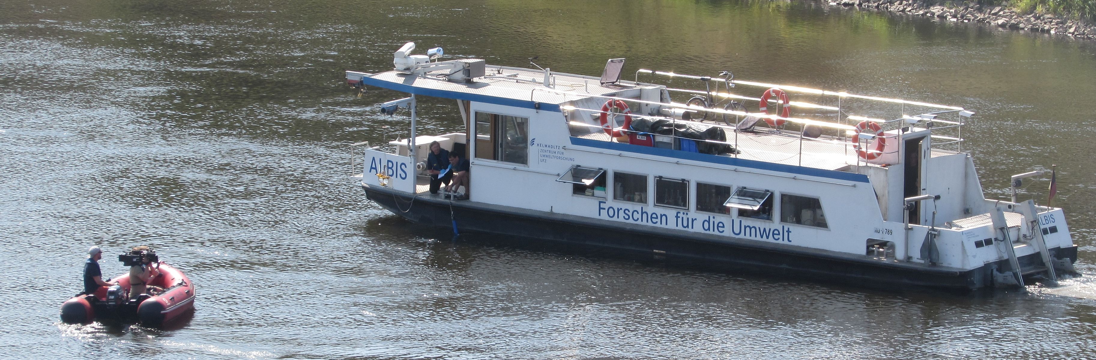
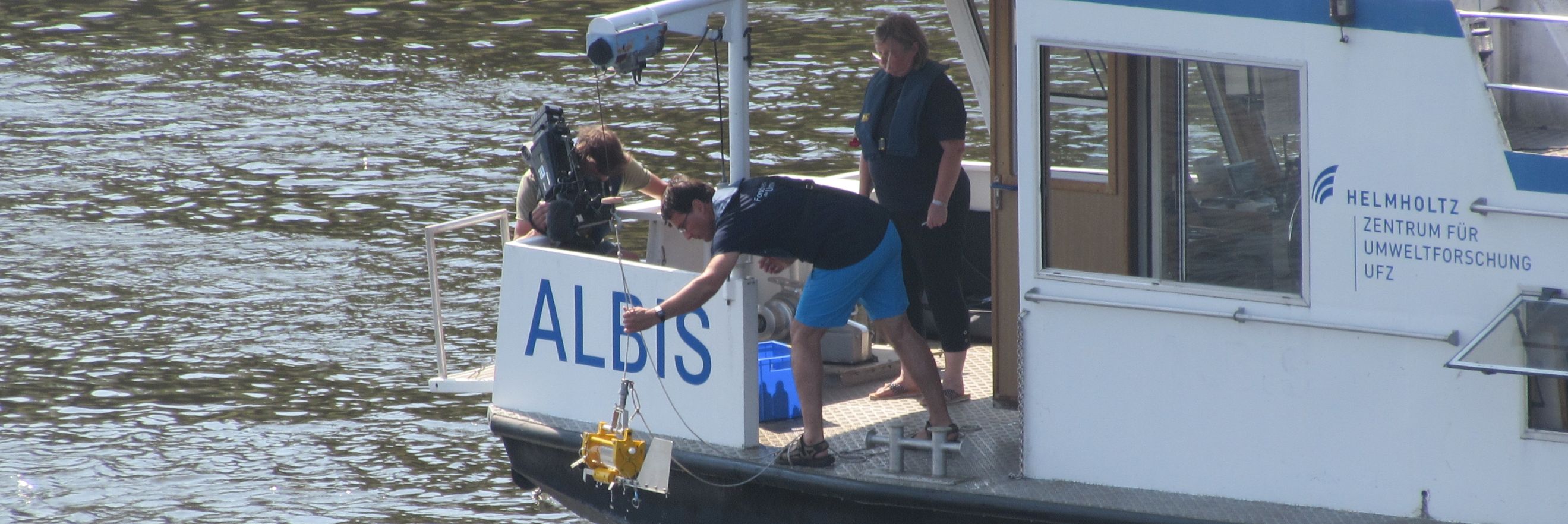
Probenahme am Messpunkt Torgau (Fotos: C. Schütze).
An 24 Standorten entlang der Elbe, jeweils links- und rechtsseitig sowie mittig im Fluss, erfassen die Wissenschaftler*innen Messdaten und entnehmen Wasserproben. In Absprache mit den Landesbehörden in Sachsen und Sachsen-Anhalt messen sie mit einer Multiparametersonde Temperatur, Sauerstoff, die Konzentrationen schwebender Algen oder die Trübung des Fließgewässers sowie chemische Parameter von Wasserproben wie partikuläre und gelöste Nährstoffe, Schwermetalle, seltene Erden und Mikroschadstoffe.
Siehe auch MOSES-Blog und UFZ-Pressemitteilung.
MOSES Testfahrt 2: Mit Forschungsschiffen und Online-Modellen zu Strömungssimulationen "Hydrologische Extreme" überprüfen.
Zwischen Überflutung und Dürre: Wetter-Extremereignisse gelten als Vorboten des Klimawandels. Heute treten diese Wetterextreme mit ihren schädigenden Auswirkungen für Mensch und Umwelt immer häufiger auf. Auch Deutschland und Europa werden verstärkt mit den Folgen des Klimawandels konfrontiert. Aktuelle internationale Prognosen rechnen mit einem Anstieg der Häufigkeit und Intensität von Sturmereignissen mit starken Regenfällen und Überschwemmungen um zehn bis 20 Prozent in Mittel- und Nordeuropa bis zum Ende des Jahrhunderts.
Nach einem ersten erfolgreichen Test neuer Sensorik im Rahmen der ersten MOSES-Testkampagne im April 2019 fahren die Forscher der vier Helmholtz Zentren Alfred-Wegener-Institut (AWI), (Helmholtz-Zentrum Geesthacht (HZG), Helmholtz-Zentrum für Ozeanforschung Kiel (GEOMAR) und Helmholtz-Zentrum für Umweltforschung (UFZ) erneut auf die Nordsee, um einen MOSES-Einsatz unter möglichst realen Bedingungen zu üben. Am 25. und 26. Juni 2016 wollen die Wissenschaftler mit zwei Forschungsschiffen von AWI und HZG einen zuvor bestimmten Wasserkörper in der südlichen Nordsee lokalisieren. Dieser wäre im Falle eines extremen Hochwassers aus der Elbe geflossen und hätte Schadstoffe und Klimagase in erhöhter Konzentration mitgeführt. Unterstützt werden die Forscher auf See von Kollegen der beteiligten Institute sowie durch das zentrale MOSES-Datenmanagement am Helmholtz-Zentrum Potsdam Deutsches Geoforschungszentrum (GFZ). more

Kurzfristiger Wechsel: MOSES-Testkampagne „Hitze & Dürre“ misst Extremniederschläge in Süddeutschland
Montagmorgen am 20. Mai startete die MOSES-Arbeitsgruppe „Hitzewellen/Dürren“ ihre Testkampagne im Untersuchungsgebiet nahe Fendt in Oberbayern – am Nachmittag stand sie im Zentrum von Tief "Axel". Bis Mittwoch fiel in der Region so viel Niederschlag wie sonst in einem Monat, die Ammer trat über die Ufer, Felder standen unter Wasser. Nach einer kurzen Pause geht seit Montag dem 27. Mai erneut Dauerregen in der Region nieder, damit steigt die Gefahr weiterer Überflutungen.
Die Mess-Systeme, die eigentlich aufgebaut waren, um einen Einsatz bei Hitzewellen oder Trockenheit zu proben, erfassen stattdessen Extremniederschläge. Das Beobachtungskonzept wurde deshalb kurzfristig der neuen Situation angepasst: Im Fokus der Messkampagne stehen nun die Auswirkungen des Starkregens und die Prozesse, die vor, während und nach einem solchen Extremereignis ablaufen. Dank des flexiblen Sensor- und Einsatzkonzepts von MOSES sind solche kurzfristigen Änderungen auch vor Ort noch möglich. Gemeinsam mit der laufenden Testkampagne der Arbeitsgruppe „Hydrologische Extreme“ im Müglitztal (Erzgebirge, Sachsen) werden nun Extremniederschläge an zwei Standorten gleichzeitig erfasst. Im Müglitztal konzentrieren sich die Untersuchungen auf die Entstehung von Starkregen und Hochwasser, bei Fendt vorrangig auf die Folgeprozesse. more

Das Team um Andreas Wieser vom Karlsruher Institut für Technologie (KIT) ist im Rahmen der MOSES-Arbeitsgruppe „Hydrologische Extreme“ der Entstehung von Starkregen- und Hochwasserereignissen auf der Spur. An den Untersuchungen sind auch Wissenschafter*innen aus dem Forschungszentrum Jülich, dem Helmholtz-Zentrum für Umweltforschung und dem Deutschen Geoforschungszentrum beteiligt.
Ausgesucht hat sich das Team dafür ein besonderes Messgebiet im Süden von Sachsen – das Müglitztal. Während der Flutkatastrophe 2002 wurde aus der ruhigen Müglitz ein reißender Fluss – bedingt durch die entsprechende Wetterlage und die Topographie des Tales.
Genau diese Randbedingungen sind die Einflussfaktoren, aus denen Hochwasserereignisse entstehen können. Seit Anfang Mai werden nun über den erzgebirgischen Höhen des Müglitztals und im Talgrund MOSES-Geräte installiert. more

Sturmereignisse mit starken Regenfällen und Überschwemmungen wird es laut globaler Prognosen bis zum Ende dieses Jahrhunderts 10 bis 20 Prozent häufiger geben als bisher. Diese verursachen, ebenso wie extreme Niedrigwasserphasen, erhebliche Schäden und haben somit sozioökonomische aber auch ökologische Auswirkungen. Um diese besser zu verstehen, unternehmen drei Forschungsschiffe des Helmholtz-Programms MOSES am 16. und 17. April 2019 eine gemeinsame Forschungsfahrt von der Elbemündung bis nach Helgoland. more

Ausgerechnet die Feuchtigkeit irdischer Böden stört Astrophysiker bei der Erforschung des Weltalls. Der Physiker Martin Schrön (UFZ) beschreibt, wie aus der Not eine Tugend wurde und wie Sternenexplosionen Bauern bei Trockenheit helfen können.
Für die derzeit laufende Aufbauphase von MOSES wurde die Elbe als Untersuchungsgebiet für die Arbeitsgruppe der "Hydrologischen Extreme" ausgewählt. Erste Messkampagnen, bei denen das Zusammenspiel der Messgeräte sowie der schnelle Datenaustausch zwischen den Partnern im Vordergrund stehen, finden in den Jahren 2019 und 2020 jeweils von April bis Juli statt. Der KITcube wird dabei im Müglitztal im Osterzgebirge eingesetzt, einem Gebiet in dem es häufig zu extremen Niederschlagsereignissen und Überschwemmungen kommt.
Katrin Kohnert ist Doktorandin in der GFZ-Sektion Fernerkundung. Sie forscht vor allem im Norden von Alaska und im kanadischen Flussdelta des Mackenzie zur Freisetzung von Treibhausgasen aus Permafrostböden unter dem Einfluss des Klimawandels. Vor wenigen Wochen kehrte sie von ihrer jüngsten Expedition aus dem Mackenzie-Delta zurück.
Das gesamte Interview mit Katrin Kohnert finden Sie hier.
UFZ untersucht Auswirkungen auf Wasserqualität und Ökologie im Rahmen des Sondermess-Programms Niedrigwasser der Flussgebietsgemeinschaft Elbe
Die derzeitige Hitze- und Dürreperiode hat auch gravierende Auswirkungen auf Bäche und Flüsse in Deutschland: Viele sind zu schmalen, langsam fließenden, stark erwärmten Rinnsalen geworden. In Magdeburg lag der Pegel der Elbe am 23. Juli nur noch sieben Zentimeter über dem historischen Tiefststand vom 22. Juli 1934 – man kann also bereits jetzt von einem extremen Niedrigwasser sprechen. Magdeburger Gewässerforscher des Helmholtz-Zentrums für Umweltforschung (UFZ) beteiligen sich am Sondermessprogramm Niedrigwasser der Flussgebietsgemeinschaft Elbe im Bereich der Mittelelbe. Mit Multiparameter-Messsonden, die Teil des Helmholtz-Beobachtungssystem MOSES sind, wollen sie die Auswirkungen auf die Wasserqualität, die Ökologie und viele damit zusammen hängende Nutzungen der Gewässer im Elbe-Einzugsgebiet erfassen.
Die vollständige Pressemitteilung finden Sie hier.
Jeder weiß: Das Sommerwetter mit zum Teil über 30 Grad Celsius hat nicht nur positive Seiten.
Wie sich Hitzewellen auf die Umwelt und das Klima auswirken, untersuchen derzeit Jülicher Klima- und Bodenforscher und ihre Kollegen aus Potsdam, Leipzig und Garmisch-Partenkirchen auf einem Versuchsfeld in der Nähe von Jülich. Bodenforscher Prof. Nicolas Brüggemann und Atmosphärenforscher Dr. Ralf Tillmann erklären im Interview, warum die Forschung so wichtig ist.
Die vollständige Pressemitteilung mit dem Interview, Bildmaterial und Zusatzinformationen finden Sie hier.
MOSES-Auftakt mit über 100 Vertreterinnen und Vertretern aus Forschung, Politik und Praxis
Das neue Beobachtungssystem MOSES wurde am 21. Juni in Berlin Vertretern aus Forschung, Politik und Praxis vorgestellt: Von 2017 bis 2021 entwickeln die Helmholtz-Zentren des Forschungsbereichs „Erde und Umwelt“ das mobil und flexibel einsatzfähige Mess-System, das darauf ausgerichtet ist, hochdynamische Ereignisse wie beispielsweise Starkregen und Hochwässer oder Hitzewellen und Dürren zu erfassen. Ab 2022 soll MOSES dann für den regulären Einsatz bereit stehen. In den Aufbau der Forschungsinfrastruktur investiert die Helmholtz-Gemeinschaft ca. 28 Millionen Euro.
Im Zentrum der Veranstaltung standen die
Forschungsziele der Initiative sowie die technische Innovation und
Einsatzmöglichkeiten des modular konzipierten Beobachtungssystems. Dabei
ging es auch darum, bereits zu Beginn der 5-jährigen Entwicklungsphase
Anknüpfungspunkte für Kooperationen mit Interessenten aus Forschung und
Praxis vorzustellen und zu diskutieren.

Die Präsentationen der Redner können über die folgenden Links abgerufen werden:
Prof. Reinhard F. Hüttl (Forschungsbereichskoordinator und Vizepräsident der Helmholtz-Gemeinschaft, GFZ) stellt die Mission und Kennzahlen der laufenden Programmperiode sowie die strukturelle Weiterentwicklung des Forschungsbereichs „Erde und Umwelt“ vor: Die sieben beteiligten Zentren bündeln ihre Kompetenzen zukünftig in einem gemeinsamen Programm „The Changing Earth – Sustaining our Future“. Zur Präsentation (1.7 MB) (PDF)
Prof. Georg Teutsch (Wissenschaftlicher Geschäftsführer des UFZ, federführendes Zentrum für MOSES) zeigt neue Wege der Erdbeobachtung: Technischer Fortschritt in der Sensorentwicklung und die internationale Vernetzung von Observatorien erlauben zunehmend die Verwirklichung von systemorientierten Beobachtungskonzepten, mit zeit- wie raumübergreifenden Komponenten. Zur Präsentation (2.1 MB) (PDF)
Dr. Ute Weber (Projektleiterin von MOSES, UFZ) fasst die Ziele und das Einrichtungskonzept von MOSES zusammen: Beobachtungsdaten und Forschungsergebnisse zeigen, dass Ereignisse wie Hochwasser oder Hitzewellen das Potenzial haben, Erde und Umwelt langfristig zu verändern. Und es ist davon auszugehen, dass solche Wetterextreme in Zukunft häufiger auftreten. Mit dem neuen Beobachtungssystem sollen die direkten Auswirkungen mit einem systemorientierten Ansatz erfasst und die langfristigen Folgen untersucht werden. Für den Erfolg von MOSES sind Kooperationen mit der Forschungsgemeinschaft und Praxis maßgeblich; Interessenten sind eingeladen, sich an der Planung und Durchführungen von Testkampagnen zu beteiligen. Zur Präsentation (1.6 MB) (PDF)
Prof. Hans Peter Schmid (Leiter des Instituts für Meteorologie und Klimaforschung - Atmosphärische Umweltforschung am KIT, Mitglied der MOSES-AG Hitzewellen) veranschaulicht am Beispiel der Hitzewelle 2003 in Europa die Forschungsthemen, die im Rahmen von MOSES-Kampagnen für Hitzewellen und Dürren untersucht werden: Einfluss auf die Leistungsfähigkeit aquatischer und terrestrischer Ökosysteme, Beeinträchtigung von Luft- und Wasserqualität, Verbesserung der Vorhersagbarkeit von Hitzewellen. Erste Testkampagnen werden im Sommer 2018 und von Frühjahr bis Sommer 2019 durchgeführt. Zur Präsentation (3.1 MB) (PDF)
PD Julia Boike (Leiterin der AG Energie- und Wasserbilanz Permafrostforschung am AWI, Koordinatorin der MOSES-AG Permafrost) führt aus, dass mit der Klimaerwärmung große Bereiche des arktischen Permafrosts auftauen. Dieses Auftauen verläuft aber nicht gleichförmig, sondern man beobachtet plötzliche und begrenzte „Hot Spots“, die einen bedeutenden Teil der prognostizierten arktischen Treibhausgas-Emission ausmachen können. Ab Sommer 2018 werden solche „Hot Spots“ mit MOSES-Testkampagnen erforscht. Zur Präsentation (2.6 MB) (PDF)
Prof. Dietrich Borchardt (Leiter des Themenbereichs Wasserressourcen und Umwelt am UFZ, Koordinator der MOSES-AG Hydrologische Extreme) zeigt anhand des unterschiedlichen Verlaufs von Hoch- und Niedrigwassersituationen an der Elbe die direkten Auswirkungen auf die Wasserqualität vom Oberlauf bis zur Küste. So wurden im Mai/Juni 2013 während des Elbehochwassers 5 – 50fach erhöhte Flussfrachten gemessen. Ein beträchtlicher Teil der Jahresfrachten an Düngern und Schadstoffen gelangte in die Elbe und das Mündungsgebiet. Als Folge entwickelte sich Sommer 2013 eine Algenblüte an der Nordseeküste. Im Rahmen von MOSES-Testkampagnen werden ab Frühjahr 2019 die Entstehung von Hydrologischen Extremen (Starkregen und Hochwasser, Niedrigwasser) sowie deren Auswirkungen untersucht. Zur Präsentation (1.9 MB) (PDF)
Prof. Burkard Baschek (Leiter am Institut für Küstenforschung des HZG – Bereich Operationelle Systeme, Koordinator der MOSES-AG Ozeanwirbel) stellt aktuelle Forschungsergebnisse zur Bedeutung von Ozeanwirbeln für den Energie- und Nährstoffkreislaufs der Weltmeere vor: Während die großen Wirbel mit über 100 km Durchmesser an der Meeresoberfläche gut beobachtet werden können, ist über kleinere Wirbel bislang wenig bekannt. Es gibt aber zunehmend Hinweise, dass sie den marinen Nähstofftransport und damit die Primärproduktion, die Entwicklung von Nahrungsnetzen und so auch die Kohlendioxid-Aufnahme der Meere maßgeblich steuern. Ab Herbst 2019 sollen diese kleinen, hochdynamischen Wirbel mit MOSES-Testkampagnen erforscht werden. Zur Präsentation (2.2 MB) (PDF)
Ute Weber, 5. Juli 2018