Robust Pictures of the Future
(IP RobustPics):
Assuring sustainable development paths in landscapes under climate change
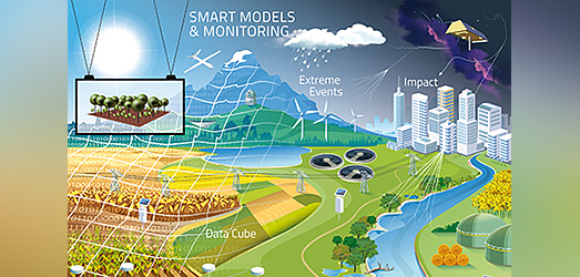
Keeping landscapes multifunctional is crucial for human well-being. In face of climate change, this is challenging and requires adaptation in all sectors of landscape management. Prerequisites of informed decision-making are robust predictions of the functional effects of considered development paths. This requires advancements in modeling, observation, and data science. This is the goal of the Integration Platform “Robust Pictures of the Future” (IP RobustPics).
There is a multitude of landscape functions of particular importance for human well-being: primary production, storage of water and carbon, cycling of nutrients, attenuation of pollutants, pollination and biocontrol, or the provision of habitat for preserving biodiversity. All of them are sensitive to the anticipated climate change, esp. the increasing extremes like heat waves, droughts, or heavy rainfalls, but also to the implemented landscape management, esp. in sectors like agriculture, forestry, or water resource management. Thus, strategies are needed for a short- or/and long-term adaptation of management practices. This demonstrates the importance of seasonal to decadal predictions at large spatial extents (national and larger).
The required large-scale predictions come along with challenges: (i) mechanistic soundness; (ii) adequate consideration of heterogeneity in environmental conditions at a resolution which matches the operational needs of the targeted decision-makers; (iii) complex interplay of hydrological, ecological, and socio-economic processes which are traditionally modeled in isolation; (iv) incorporation of scenarios of climate change and altered landscape management. This requires a new generation of terrestrial environmental models which are more integrated and allow large-scale simulations at an operationally relevant resolution. Parameterizing and validating these models is another challenge. It can be overcome by linking these models to novel geo-referenced data from earth observation (esp. remote sensing) and applying data science. The development of appropriate concepts, methods, tools, and workflows is the core of the IP-research. They are applied in close collaboration with other, more content-oriented IPs to provide the desired “pictures of the future” for various use cases.
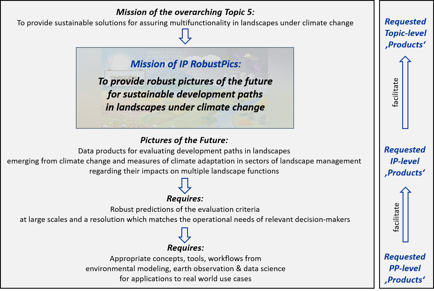
The Integration Platform RobustPics follows a mission and product oriented approach. As the entire Topic 5 (‘Future Landscapes’) of the overall Helmholtz Program, IP RobustPics aims to contribute to the provision of sustainable solutions for assuring multifunctionality in landscapes under climate change.
All activities of IP RobustPics (research and exchange) are dedicated to the fulfilment of its mission: the provision of data products required for the evaluation of development paths in landscapes which emerge from climate change and measures of climate adaptation in sectors of landscape management through the lens of multiple landscape functions (‘robust pictures of the future’). They are seen as main ‘IP-level Product’ requested. Its provision requires a number of methodological advancements in modeling, observation and data science in form of appropriate concepts, tools, and workflows. The delivery of these ‘PP-level Products’ is the main purpose of the various Platform Projects (PPs) of IP RobustPics.

The IP RobustPics is closely linked to a variety of vibrant national and international scientific networks with expertise in relevant fields of research, and its Members are involved in various responsible roles. According to its policy, IP RobustPics intends to make use of these networks by assuring rapid transfer of knowledge between the IP and these networks, but also specific measures of capacity building.

Remote Sensing Centre for Earth Systems Research (RSC4EARTH), a collaborative activity of the University of Leipzig and UFZ. IP RobustPics Members are co-affiliated to RSC4EARTH .

Modular Observation Solutions for Earth Systems (MOSES), a novel observation system for unraveling the interplay of long-term trends and extreme events jointly operated by several Helmholtz centres and coordinated by UFZ / IP RobustPics.

Integrated European Long-Term Ecosystem, critical zone and socio- ecological Research Infrastructure (eLTER), a pan-European network of observatories hosted at the UFZ; IP RobustPics Members are involved in the coordination.

German Centre for Integrative Biodiversity Research (iDiv), a national research centre with the UFZ belonging to the iDiv consortium. Eight IP RobustPics Members are also Full iDiv Members strengthening the position of modeling and observation in iDiv.

The Science Center CASUS (Center for Advanced Systems Understanding) in Görlitz, Saxony pursues the vision to develop a systematic understanding of the complex phenomena of our environment with new digital methods.

National Earth System Modeling Strategy (natESM), Initiative within the Deutsches Klima-Konsortium (DKK) to which the UFZ belongs and IP RobstPics Members are involved.

Analysis, Integration, and Modeling of Earth Systems (AIMES), an international network of scientists within Future Earth. IP RobustPics Members have responsible roles in AIMES Working Groups:
Large-scale Behavioral Models of Land use ChangeOpen Modeling Foundation (OMF)

TERENO (TERrestrial ENviromental Observatories) is a network hosting four observatories for an integrated environmental monitoring of German regions with high vulnerability with respect to climate change. IP RobustPics Members are involved in the coordination of TERENO.
TERENO
The Helmholtz Incubator promotes pioneering research through innovative projects and initiatives. Members of the IP RobustPics and other experts from all the Hemholtz Centres come together in this think tank.
