Lighthouse project
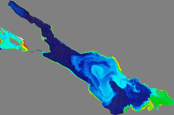
"BIGFE - Recording water quality and water area extent of inland waters by remote sensing".
National Copernicus integration measure of the
Federal Ministry for Digital and Transport (BMDV)
Duration: 01.07.2021 - 31.12.2024
The principles developed for the informative value, uncertainty and reliability of the remote sensing products provide the basis for an appropriate implementation of remote sensing in official monitoring. In addition to this characterisation of the applicability, targeted training workshops and adapted practical tools are also necessary for the implementation. For this purpose, a close cooperation with SMEs from the remote sensing sector is integrated in the project.
BIGFE is a research network of four project partners and 12 associated state authorities in Germany, coordinated by the Helmholtz Centre for Environmental Research GmbH - UFZ and accompanied by a project advisory board.

Associated Partners
.png)
Helmholtz-Centre for Environmental Research (UFZ)
Department Lake Research
Brückstr. 3a
39104 Magdeburg
UFZ Department Lake Research
Project Management:
Dr. Karsten Rinke (Tel. +49 391 810-9499)
karsten.rinke@ufz.de
Project Coordination:
Prof. Dr. Kurt Friese (Tel. +49 391 810-9200)
kurt.friese@ufz.de
Scientist:
Dr. Susanne I. Schmidt (TEl.: +49 391 810-9127)
susanne.i.schmidt@ufz.de
Institut für Hygiene und Umwelt
Marckmannstrasse 129 a
20539 Hamburg
Institut für Hygiene und Umwelt
Scientists:
Werner Blohm (Tel. +49 40 42845-3870)
werner.blohm@hu.hamburg.de
Pia Laue (Tel. +49 40 42845-3777)
bigfe-hamburg@hu.hamburg.de
Institut für Seenforschung (ISF) der Landesanstalt für Umwelt Baden-Württemberg
Argenweg 50/1
D-88085 Langenargen
LUBW Institut für Seenforschung
Contact:
Dr. Thomas Wolf (Tel. + 49 7543 304-215)
Thomas.Wolf@lubw.bwl.de
Sächsisches Landesamt für Umwelt, Landwirtschaft und Geologie (LfULG)
Referat 45 | Landeshochwasserzentrum, Gewässerkunde
Postanschrift: Postfach 540137
01311 Dresden
LfULG
Scientist:
Dr. Stefanie Weißbach
Stefanie.Weissbach@smekul.sachsen.de

