
Methodology: Linking SMART models to data
Platform Project - PP5.3
Large-scale predictions of landscape functions and their response to climate change and management interventions at an operationally relevant resolution do not only require a new generation (i.e. SMART) terrestrial environmental models and appropriate (esp. earth observational) data, but also a sound methodology for their linkage. PP5.3 aims at providing respective concepts, tools, workflows, and a catalogue of good practice examples which are rooted in theories and long-lasting experience with various modelling strategies in the consortium and make use of cutting-edge methods from data science.
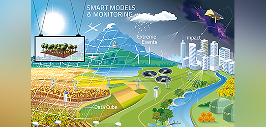
Developing robust pictures of the future of landscapes fulfilling multiple functions requires a new generation of models. They need to have a high resolution to capture key mechanisms at the local scale, but nevertheless need to be applicable to entire regions, up to the national and European level to be able to support policy development and management at these levels. The type of model will also need new kinds of data and monitoring schemes.
The requirements of the general modelling strategy that we need are summarized in the acronym SMART, which stands for models that are Scalable, Mechanistic, of Adapted complexity, Robust, and Transferable. SMART will have implications for monitoring as it will help to focus on environmental factors and resolutions that are crucial for parameterizing the SMART models.
For developing SMART models, a new strategy of terrestrial modelling is needed. It has to be based on general principles of systems theory to allow us to link models, data and monitoring schemes across different disciplines and environmental compartments. PP5.3 aims at identifying such general principles and is therefore focussed on development of theory and methodology that supports modelling and monitoring of multifunctional landscapes at all relevant scales. We will derive relevant concepts, tools, workflows, and a catalogue of good practice examples for modelling and monitoring. Our theory development will be based on UFZ’s long-lasting experience in the development and application of modelling, monitoring and data science for water resources, geoenergy and vegetation at various spatial and temporal scales.

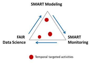
PP5.3 comprises the three core themes: “SMART Modelling”, “SMART Monitoring”, and “FAIR Data Science”. Sub-projects of PP5.3 will produce insights and products supporting the missions of the PP and the overarching IP. While they can focus on one of the core themes, they will always also link to the other themes (see Figure). Designated first sub-projects will address, for example, “Aggregation and upscaling” (theoretical foundation, concepts, examples, synthesis paper), “Addressing effect chains of extreme events” (disturbance-theoretical foundation, workflows, examples), and “Synergetics for complexity reduction” (platform-wide seminar series).
