
Hydrosystems
MOSES-Müglitz: Monitoring and Modelling Campaign
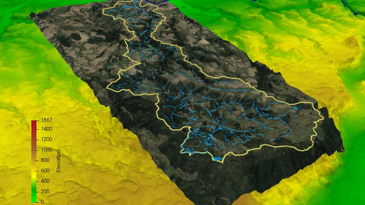
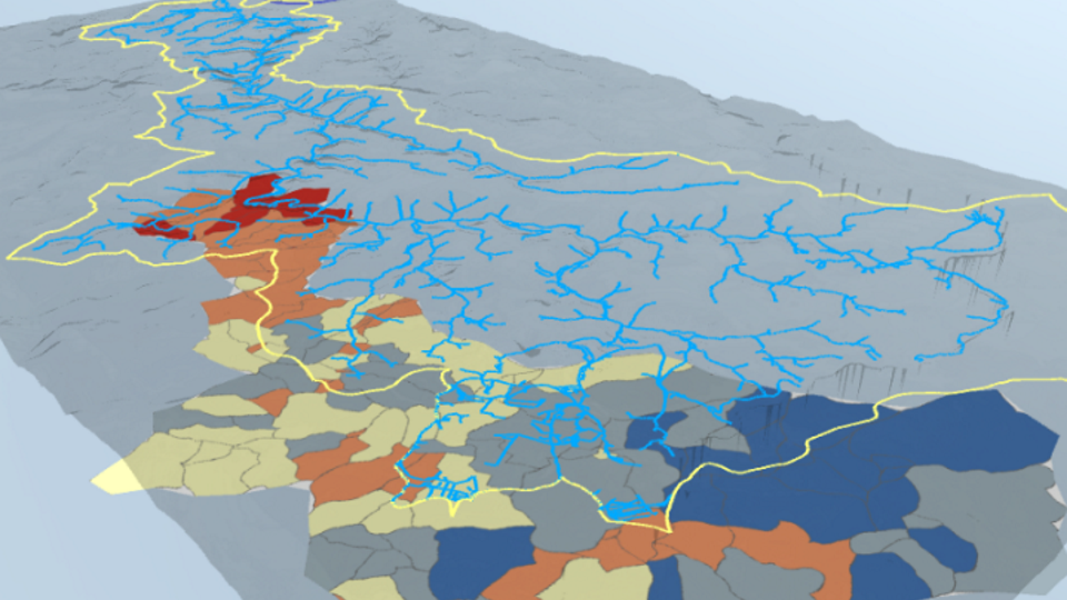
The hydrological study in the Müglitz catchment is part of the MOSES initiative (Modular Observation Solutions for Earth Systems, www.ufz.de/moses, coordinated by UFZ) investigating the impact extreme meteorological events on local hydrological processes. The presented visualization study is also a result of a close collaboration of the ESM and Digital Earth initiatives combining the expertise in monitoring and modelling environmental processes in a Virtual Reality framework.
| Project links: | MOSES ESM Digital Earth |
| Video: | Virtual Environment Presentation |
| Publications: |
|
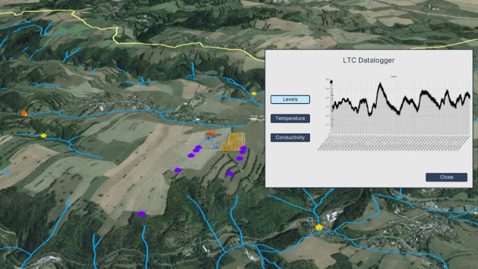
Monitoring and Modelling in Large River-Lake Systems
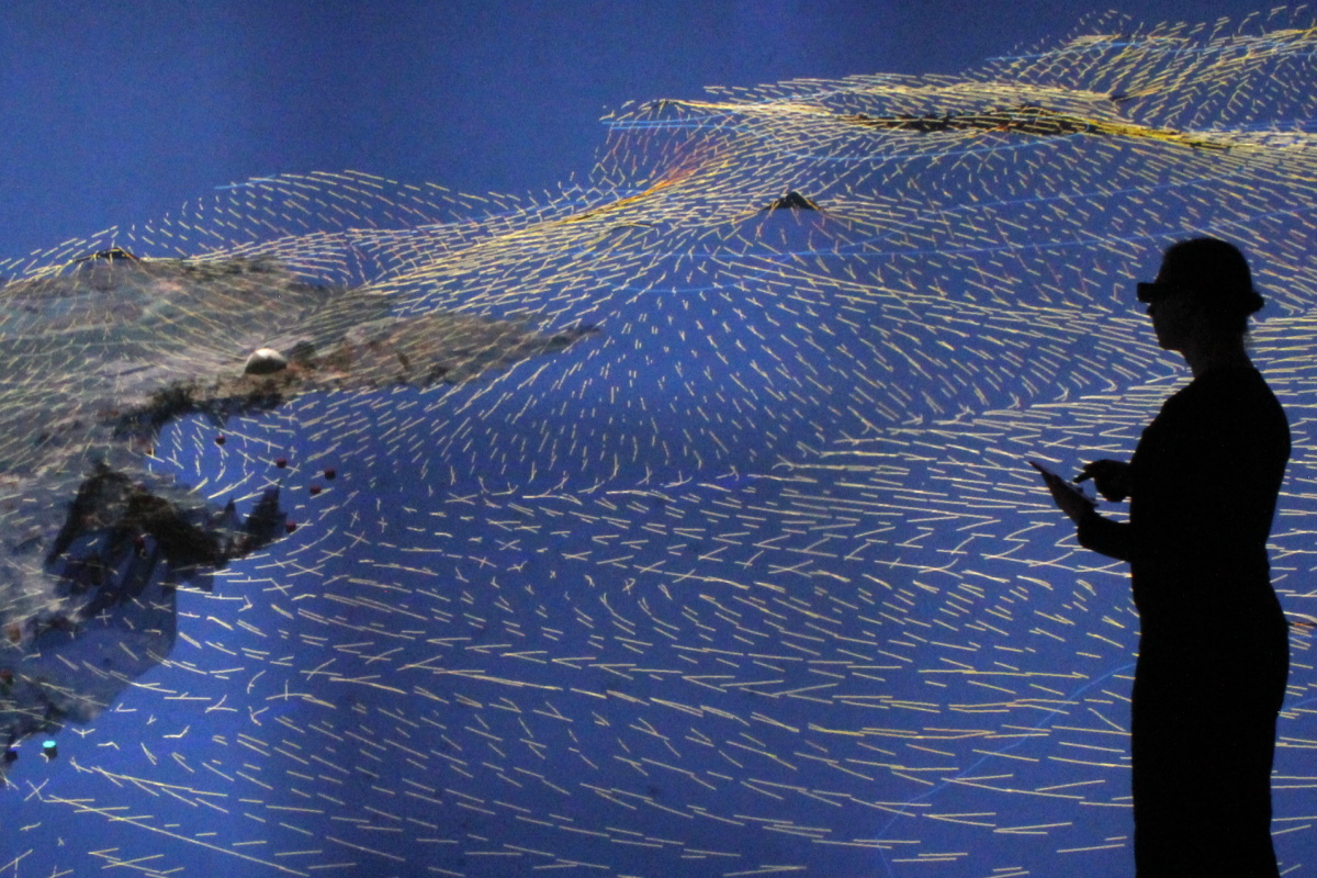
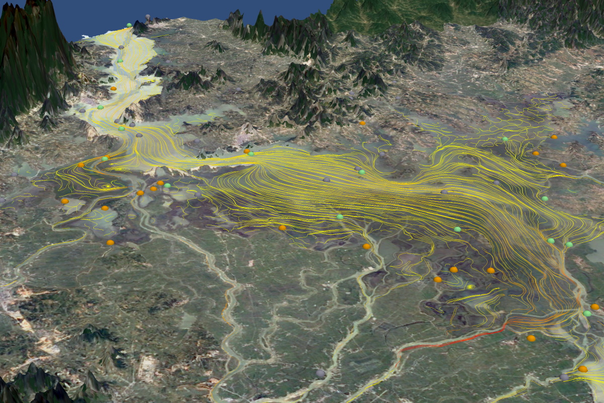
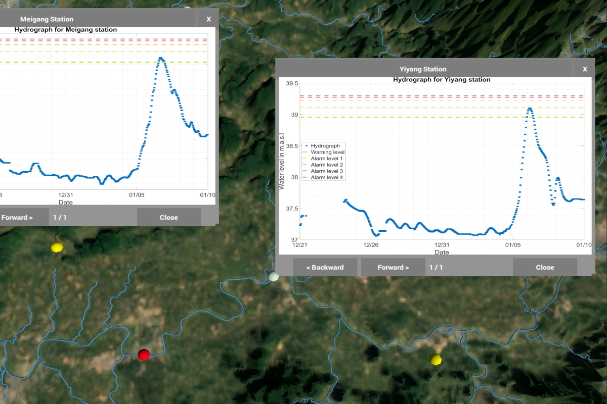
Virtual geographic environments for catchments of rivers or lakes, combining a wide range of 2D and 3D observation data sets with simulation resultsa for holistic analysis of water and solute dynamics.
| Project link: | A modelling platform prototype for environmental systems |
| Video: | https://www.youtube.com/watch?v=7r282lIGsHk |
| Publications: |
|
Coastal Water Management

Salt water intrusion due to overexploitation in coastal areas is deteriorating groundwater resources and heavily affects urban areas: Visualisation of subsurface flow systems helps with the design of protection measures.
| Project link: | IWAS-Oman |
| Video: | https://www.youtube.com/watch?v=-xBQJ9WWPJY |
| Publications: |
|
Groundwater Balance in Arid Regions

Simulating the water balance for the Dead Sea, showing the decrease in the natural replenishment rate of groundwater due to water used for agriculture and lowered precipitation due to climate change.
| Project link: | Sustainable Management of Water Resources (Quantity and Quality) in the Dead Sea Area (SUMAR) |
| Video: | https://www.youtube.com/watch?v=bj6lticy6jA |
| Publications: |
|
Recharge and Discharge Controls on Groundwater Travel Times

Travel times and flow paths of groundwater from its recharge area to drinking-water production wells will govern how the quality of pumped groundwater responds to contaminations. Simulating different recharge scenarios and fitting to observed water levels allows understanding the groundwater regime in the area and to estimate water quality for production.
| Project link: | Water and Earth System Science (WESS) |
| Video: | https://www.youtube.com/watch?v=bKxT-w0FCEQ |
| Publications: |
|
Completed Projects
Mixed 2D/3D visualizationUncertainty visualization