
Simulator: Modular system of SMART terrestrial models
Platform Project - PP5.1
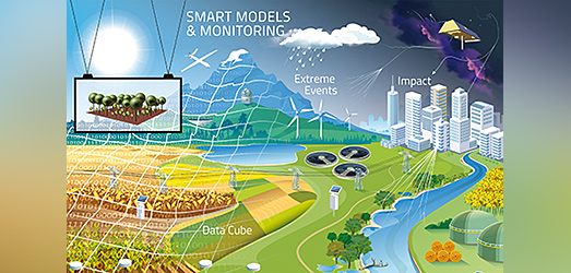
Pre-requisite for investigating the multifunctionality of cultural landscapes under global change are land models for evaluating the way how landscapes and all their functions are impacted by global change in general but also how they are impacted locally by specific management actions. The project provides an open-source system of next-generation high-resolution models which enables large scale simulations of landscapes under climate and land use change as well as management interventions and providing robust predictions at scales relevant to stakeholders.
Establishing high resolution land simulators (digital twins of our landscapes) and drive them with climate and land use projections allows to thoroughly analyze and reliably project possible futures of landscapes under climate and land-use change. Moreover, they are necessary to provide input to decision making. Consequently, the goal of this PP is to provide a set of seamlessly coupled landscape simulation modules for Germany, Europe and later globally which are able to adequately simulate multiple, interlinked ecosystem services and environmental functions under changing conditions.
Existing landscape models are either regional and simulate specific landscapes or regions and are not transferable to other regions OR they are global, cover whole continents but are missing important landscape features in sufficient detail. The landscape model envisioned here will combine the best of these two modelling worlds (see SMART modelling approach, PP5.3 ).
The new landscape model is developed in a truly interdisciplinary effort and explicitly considers the multifunctionality of landscapes. Scientists, software developers and data managers are establishing the new simulation tool by preparing the necessary input data, creating new software, adapting and coupling various modules ranging from a hydrological module comprising the land surface hydrology of mHM and the groundwater hydrology of OGS , via a water quality module (mQM) , a forest module (FORMIND) , a grass module (GRASSMIND) and an agricultural module (BODIUM) . Besides the core code developers, scientists from other PPs are involved as stakeholders into the model development.
