TERENO - Harz/Central German Lowland Observatory
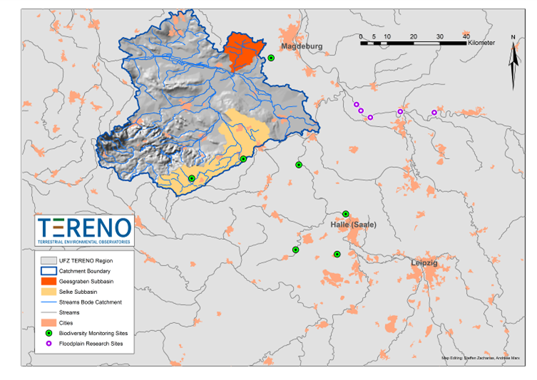
The UFZ observatory Harz/Central German Lowland covers an area of approx. 25.700 km². The region is characterized by pronounced gradients of temperature, precipitation, land use and urbanity. The monitoring, observation, and research activities within the Harz/Central German Lowland Observatory are organized in four main platforms:
- Hydrological Platform: catchment of the river Bode (shape on the map)

 Hydrological Platform
 - Biodiversity Platform (green dots on the map)

 Biodiversity Platform
 - Floodplain Platform (pink dots on the map)

 Floodplain Platform
 - Urban Platform: the city of Leipzig as focus area

Map of UFZ Observatory Harz / Central German Lowland
Information for the public
![]()
![]() Broschure - Mit Landwirtschaft Lebensraume schaffen (German)
Broschure - Mit Landwirtschaft Lebensraume schaffen (German)