WebGIS 2.0
http://www.ufz.de/webgis-daisy
The WebGIs is designed to give you a cartographic environment to develop informative maps including spatial point- and areal data. The functionality of the WebGIS is in dependence of GIS-environments with full informal and basic analytical functions.
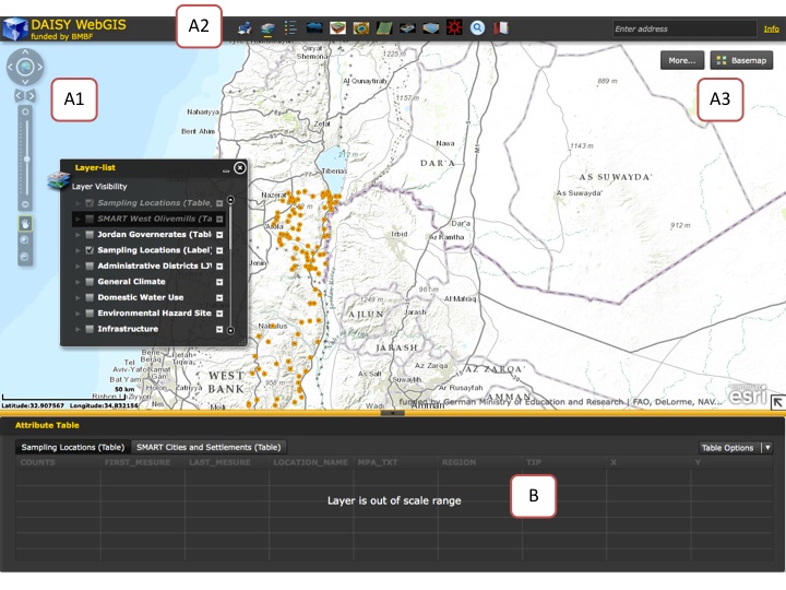
After approaching the DAISY-webgis page, you will get welcomed and see the following screen, which is generally divided into 2 parts.
The upper part as Map Window (A) and the lower part representing the attribute table (B) of point sources within the visible map frame.

more content is coming soon...
